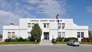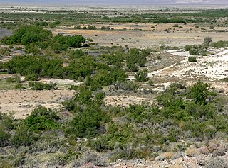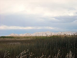
Lincoln County is a county in the U.S. state of Nevada. As of the 2020 census, the population was 4,499, making it the fourth-least populous county in Nevada. Its county seat is Pioche. Like many counties in Nevada, it is dry and sparsely populated, though notable for containing the Area 51 government Air Force base.

The Desert National Wildlife Refuge is a protected wildlife refuge, administered by the U.S. Fish and Wildlife Service, located north of Las Vegas, Nevada, in northwestern Clark and southwestern Lincoln counties, with much of its land area lying within the southeastern section of the Nevada Test and Training Range. The Desert NWR, created on May 20, 1936, is the largest wildlife refuge in the lower 48 states of the United States, encompassing 1.615 million acres (6,540 km2) of the Mojave Desert in the southern part of Nevada. The refuge was originally established at 2.25 million acres. In 1940 840,000 acres were transferred to the Department of Defense.

Alamo is an unincorporated town in Lincoln County, Nevada, United States, about 90 miles (140 km) north of Las Vegas along U.S. Route 93. Its elevation is 3,449 feet (1,051 m). As of the 2010 census it had a population of 1,080.

The Pahranagat Valley is a Tonopah Basin landform in Lincoln County, Nevada.

The Baca National Wildlife Refuge is a 78,697-acre (31,848 ha) United States National Wildlife Refuge located in southern Colorado. It is within the Sangre de Cristo National Heritage Area.

The Wallkill River, a tributary of the Hudson, drains Lake Mohawk in Sparta, New Jersey, flowing from there generally northeasterly 88.3 miles (142.1 km) to Rondout Creek in New York, just downstream of Sturgeon Pool, near Rosendale, with the combined flows reaching the Hudson at Kingston.

The Ash Meadows National Wildlife Refuge is a protected wildlife refuge located in the Amargosa Valley of southern Nye County, in southwestern Nevada. It is directly east of Death Valley National Park, and is 90 mi (140 km) west-northwest of Las Vegas.

The Moapa Valley National Wildlife Refuge (MVNWR) is a protected wildlife refuge administered by the U.S. Fish and Wildlife Service, located in the Warm Springs Natural Area in the Moapa Valley of Clark County, Nevada. The refuge is east of Death Valley and 60 miles (97 km) northeast of Las Vegas, Nevada.

The Pahranagat National Wildlife Refuge is a protected wildlife refuge, at the southern end of the Pahranagat Valley and administered by the U.S. Fish and Wildlife Service. It is 90 miles (140 km) north of Las Vegas, Nevada, in Lincoln County, Nevada. The 5,380-acre (21.8 km2) refuge was created on August 16, 1963, and is part of the larger Desert National Wildlife Refuge Complex, which also includes the Ash Meadows National Wildlife Refuge, the Desert National Wildlife Refuge, and the Moapa Valley National Wildlife Refuge.

The Upper Mississippi River National Wildlife and Fish Refuge is a 240,000-acre (970 km2), 261-mile long (420 km) National Wildlife Refuge located in and along the Upper Mississippi River. It runs from Wabasha, Minnesota in the north to Rock Island, Illinois in the south.

Malheur National Wildlife Refuge is a National Wildlife Refuge located roughly 30 miles (48 km) south of the city of Burns in Oregon's Harney Basin. Administered by the United States Fish and Wildlife Service, the refuge area is roughly T-shaped with the southernmost base at Frenchglen, the northeast section at Malheur Lake and the northwest section at Harney Lake.

The Tualatin River National Wildlife Refuge is a 1,856 acres (751 ha) wetlands and lowlands sanctuary in the northwestern part of the U.S. state of Oregon. Established in 1992 and opened to the public in 2006, it is managed by the United States Fish and Wildlife Service. Located in southeastern Washington County, 15 miles (24 km) southwest of Portland, the refuge is bordered by Sherwood, Tualatin and Tigard. A newer area, extending into northern Yamhill County, is located further west near the city of Gaston surrounding the former Wapato Lake.

New York State Wildlife Management Areas (WMAs) are conservation areas managed by the New York State Department of Environmental Conservation (NYSDEC) primarily for the benefit of wildlife, and used extensively by the public for hunting, fishing, and trapping. As of 2016, the NYSDEC owns and maintains 113 WMAs, with a total area of approximately 197,000 acres. The Wildlife Management Areas program is administered by the Division of Fish, Wildlife and Marine Resources of the NYSDEC.

Wapato Lake is a restored historic lake located in what became parts of Washington County and Yamhill County in the U.S. state of Oregon. The area was sometimes known as Wapato Lake Bed and Wapato Flat. The lake is located about a half mile east of Gaston at 55 metres (180 ft) elevation. The lake bed soils contain a layer of organic peat that once supported a wetland community dominated by the wapato plant, Sagittaria latifolia, particularly in the upper marsh areas. Wapato plants were reintroduced to the restored lake by tribal people from the Grand Ronde Reservation in preparation for the opening of the Wapato Lake National Wildlife Refuge in March 2023.

Fish Springs National Wildlife Refuge is at the southern end of the Great Salt Lake Desert, part of the Great Basin in Juab County, Utah, United States. The Refuge is managed by the United States Fish and Wildlife Service. As an oasis in the Great Basin Desert in western Utah, Fish Springs serves a variety of species including fish, migratory birds, deer, coyotes, pronghorn, cougars and other native species. The reserve can be reached by paved road from Lynndyl to Topaz Mountain and then by improved dirt road to the Pony Express Road/Lincoln Highway improved dirt road which runs through the Refuge. The Refuge also is a recreational area for permitted outdoor activities. The Fish Springs Range runs north to south and is immediately west of the Wildlife Refuge.

The Nellis Air Force Base Complex is the southern Nevada military region of federal facilities and lands, e.g., currently and formerly used for military and associated testing and training such as Atomic Energy Commission atmospheric nuclear detonations of the Cold War. The largest land area of the complex is the Nevada Test and Training Range, and numerous Formerly Used Defense Sites remain federal lands of the complex. Most of the facilities are controlled by the United States Air Force and/or the Bureau of Land Management, and many of the controlling units are based at Creech and Nellis Air Force Bases. Initiated by a 1939 military reconnaissance for a bombing range, federal acquisition began in 1940, and McCarran Field became the World War II training area's 1st of 3 Nevada World War II Army Airfields and 10 auxiliary fields. The area's first military unit was initially headquartered in the Las Vegas Federal Building while the WWII Las Vegas Army Airfield buildings were constructed.
San Felipe Creek is a stream in Imperial and San Diego Counties of California. It arises in the Volcan Mountains of San Diego County 33°11′57″N116°37′35″W, and runs eastward, gathering the waters of most of the eastern slope of the mountains and desert of the county in the San Sebastian Marsh before it empties into the Salton Sea. It is probably the last remaining perennial natural desert stream in the Colorado Desert region. In 1974, the San Felipe Creek Area was designated as a National Natural Landmark by the National Park Service.

Upper Pahranagat Lake is a lake located in Pahranagat National Wildlife Refuge, within the Pahranagat Valley south of Alamo, Nevada. The lake is a popular fishing spot and campsite.

Lower Pahranagat Lake is a lake located in Pahranagat National Wildlife Refuge, within the Pahranagat Valley south of Alamo, Nevada. The lake is a popular fishing spot and campsite.


