Perungudi is a neighbourhood of Chennai in the state of Tamil Nadu, India. It is situated about 10 kilometres (6.2 mi) south of Adyar. It is bordered on two sides by the Old Mahabalipuram Road and the Perungudi lake. It is situated on the Old Mahabalipuram IT Expressway right in middle of an Information Technology (IT) Estate. It is between Taramani and Thoraipakkam and parallel to Kottivakkam and Palavakkam in the East Coast Road.
Allapuram is a part of Vellore city in the state of Tamil Nadu in southern India.It is located on vellore's arterial road "Officer's lane" and also this locality is near to Vellore Central Prison.
Chettithangal is a census town in Vellore district in the state of Tamil Nadu, India.
Dharapadavedu is a locality and zone headquarters (katpadi) in Vellore Municipal Corporation in the state of Tamil Nadu, India. Vellore-Katpadi Railway junction is located here. It is also a part of Katpadi locality. But Vellore corporation zonal office (zone-1) is located here.
Gandhinagar is locality in Vellore, located on the northern bank of the Palar River.It is divided into Gandhi Nagar East and Gandhi Nagar West, it is the one of the posh residential and commercial localities in Vellore city.
Kalinjur is a locality in Vellore City in the Indian state of Tamil Nadu.It comes under the zone-2 of Vellore Municipal Corporation
Kannamangalam, previously referred as Mangalam is a panchayat town in Tiruvanamalai district in the Indian state of Tamil Nadu. It is located around 21 km from Vellore. Places with the suffix "mangalam" were believed to have been given as charity by the Kings of a particular reign, "Kannamangalam" was thus named by the same criteria. The Naganathi River, which passes through locality serve the water needs of the town during seasonal periods. Mudaliars and Muslims form the majority of the population in Kannamangalam town. Where as, Vanniyars are abundant in neighbouring villages.
Konavattam is a part of Vellore Municipal Corporation, located at the western end of the city. Konal in Tamil means the zig zag; Vattam means the circle. Hence the original name of the place seems the zig zag circle. Its in Vellore district in the Indian state of Tamil Nadu. For the city of Vellore, Konavattam is the gateway to NH-46 highway. This area houses major automobiles dealerships and is close to the idle Vellore airport at Abdullapuram. It has 2 depots of tnstc-vpm.
Odugathur is a panchayat town in the Vellore district in the Indian state of Tamil Nadu.
Pennathur is a panchayat town in Vellore district in the Indian state of Tamil Nadu.
Polur is a scenic town, divisional headquarters and a market center in Tiruvannamalai district of Tamil Nadu in India. Located at the foothills of Javvadhi hills, a popular section of Eastern Ghats, Polur is often regarded as Gateway of Eastern ghats. Polur was once a eminent center of Tamil Jainism. The town is home to Dharani sugars, chemicals and fertiliser Pvt., Ltd, and number of agro based industries including coir industries. The famous Chittor - Cuddalore road passes through the town. The town is located 29 Kilometres north of city of Tiruvannamalai and 45 kilometres south of Vellore Metropolis.
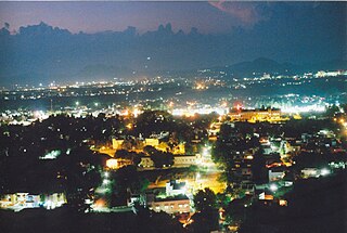
Sathuvachari is an area and Zone-II headquarters of Vellore Municipal Corporation. It is located in the east of Vellore city. It is situated in the bank of Palaar River.
Seevoor or Sevoor is a rural suburb of vellore city in the Indian state of Tamil Nadu.
Shenbakkam is a small locality adjoining with Konavattam locality and also zone-4 headquarters of Vellore Municipal Corporation in the Indian state of Tamil Nadu. Famous Swayambu Vinayagar Temple is located here.
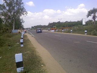
Thiruvalam also known as Thiruvallam, an ancient Temple Town built around Sri Dhanurmadhyambigai Sametha Sri Vilavanadeeswarar Temple, is part of Vellore City.
Thimiri is a panchayat town in Ranipet district in the Indian state of Tamil Nadu.The Town Panchayat was originally a religious centre with the presence of large number of temples, Mosque. The town has gained importance especially by the cultivation of paddy, Ragi. Ground nut and Sugar Cane.The Somanatha Pashana Lingeswarar Temple a Hindu temple dedicated to Lord Shiva and Kumaragiri Murugan Temple is a Hindu Temple dedicated to Lord Murugan located in Kumaragiri Hills are famous temple in Timiri. The present the area of the Town Panchayat is 6.47 km2. The town is divided into 15 election wards. Thimiri is a Town Panchayat coming under the administrative territory of Ranipet district and Arcot Taulk. This Town is located on 22 km away from Arani, 31 km at away from Vellore city and 125 km away from State capital Chennai. Thimiri is on State Highway 4 or SH4 between Arcot and Arani. This is on the main route from Arani to Chennai Highway. The State Roads connect Thimiri Town Panchayat with surrounding towns and other urban centers in the district.
Uthayendram is a town in Vellore district in the Indian state of Tamil Nadu.
Vilapakkam is a panchayat town in Ranipet district in the Indian state of Tamil Nadu.

Athani is a panchayat town located about 13 km from Gobichettipalayam in Anthiyur taluk of Erode district in the state of Tamil Nadu, India.
Jaffrabad is a census town in Vellore district in the Indian state of Tamil Nadu.

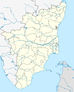

 India
India 