
Cheepurupalli is a census town in Vizianagaram district of the Indian state of Andhra Pradesh. The town is located 30 km to the north of Vizianagaram.The town covers an area of 348 hectares with a population of 78,000 according to the 2011 census.

Pathapatnam is a town in Srikakulam district of the Indian state of Andhra Pradesh. It is located in Pathapatnam mandal of Palakonda revenue division. Pathapatnam is located on the border of Srikakulam district of Andhra Pradesh and Gajapati district of Odisha. Parlakhemundi, the headquarters of Gajapati District, can be considered as twin town of Pathapatnam because of its close proximity. It is located around 65 km from srikakulam. It was the old capital of Paralakhemundi Gajapati Maharajah of his erstwhile kingdom. Hence it was named as Puruna Patana Odia that Means Patha Patnam in Telugu.
Bommanahal is a village in Anantapur district of the Indian state of Andhra Pradesh. It is the headquarters of Bommanahal mandal in Kalyandurg revenue division.
Rompicherla is a village in Chittoor district of the Indian state of Andhra Pradesh. It is the mandal headquarters of Rompicherla mandal. Adorned with bamboo girders, and wood thatch, the shacks of Rompicherla villages are just as comfortable as those in Phalsampatti. The men usually occupy one or two rooms. There is usually a well with toilet in every house.
Krosuru is a village in Palnadu district of the Indian state of Andhra Pradesh. It is the mandal headquarters of Krosuru mandal in Sattenapalli revenue division.
Pedanandipadu is a village in the Guntur district of the Indian state of Andhra Pradesh. It is located in Pedanandipadu mandal of Guntur revenue division.

Tadikonda is a village in Guntur district of the Indian state of Andhra Pradesh. It is located in Tadikonda mandal of Guntur revenue division. It forms a part of Andhra Pradesh Capital Region.
Kondapi is a village in Prakasam district of the Indian state of Andhra Pradesh. It is the mandal headquarters of Kondapi mandal in Kandukur revenue division.
Chintalapudi is a town municipality and mandal headquarters in Eluru District of the Indian state of Andhra Pradesh.

Kollur mandal is one of the 25 mandals in Bapatla district of the Indian state of Andhra Pradesh. It is under the administration of Tenali revenue division and the headquarters are located at Kollur.
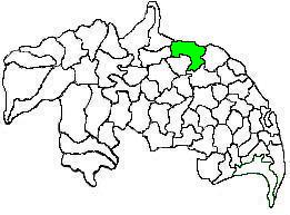
Amaravathi mandal is one of the 28 mandals in Palnadu district of the Indian state of Andhra Pradesh. It is under the administration of Sattenapalli revenue division and the headquarters are located at Amaravathi. The mandal is located on the banks of Krishna River, at a distance 27 km from the district headquarters. It is bounded by Atchampet, Krosuru, Pedakurapadu, Tadikonda and Thullur mandals.

Thullur mandal is one of the 57 mandals in Guntur district of the Indian state of Andhra Pradesh. It is under the administration of Guntur Revenue Division and the headquarters are located at Thullur. The mandal is situated on the banks of Krishna River, bounded by Amaravathi, Tadikonda, Tadepalle and Mangalagiri mandals. The mandal is also a part of the new capital city of Andhra Pradesh to be developed. 18 villages from the mandal fall under the jurisdiction of Andhra Pradesh Capital City.

Denduluru is a village in the Eluru district of the Indian state of Andhra Pradesh. It is located on the north-east side of district headquarters Eluru at a distance of 11 km. It is a member of the Eluru revenue division. The Bhimalingadibba or the mounds are one of the centrally protected monuments of national importance.
Somavarappadu is a village in Eluru district of the Indian state of Andhra Pradesh. It is located to the north of district headquarters Eluru at a distance of 6 km. It is under Eluru revenue division.
Sreeparru is a village in Eluru district in the state of Andhra Pradesh in India. It is 22 km from the city of Eluru, the headquarters of Eluru district.
Pinakadimi is a village in Eluru district of the Indian state of Andhra Pradesh. It is located in Pedavegi mandal of Eluru revenue division. It is located at a distance of 7 km from district headquarters Eluru city.
Regupalem is a village in Anakapalli district in the state of Andhra Pradesh in India.
Attili mandal is one of the 46 mandals in West Godavari district of the Indian state of Andhra Pradesh. The headquarters are located in the town Attili. The mandal is bordered by Iragavaram mandal and Penumantra mandal to the north, Palacoderu mandal to the east, Ganapavaram mandal and Tanuku mandal to the west.
Eduru is a village in West Godavari district in the state of Andhra Pradesh in India. The nearest railway station is at Krishnapatnam (KAPT) located at a distance of 15.83 Km
Kadiam Mandal is one of the 19 mandals in East Godavari District of Andhra Pradesh. As per census 2011, there are 7 villages.

