
Tirunelveli, also known as Nellai and historically as Tinnevelly, is a major city in the Indian state of Tamil Nadu. It is the administrative headquarters of the Tirunelveli District. It is the fourth-largest municipal corporation in the state after Chennai, Coimbatore, and Madurai. Tirunelveli is located 624 km (388 mi) southwest of the state capital Chennai, 58 km (36 mi) away from Thoothukudi, and 73 km (45 mi) from Kanyakumari. The downtown is located on the west bank of the Thamirabarani River; its twin Palayamkottai is on the east bank. Palayamkottai is called the Oxford of South India as it has many schools and colleges. It has several important government offices.

Tirunelveli district is one of the 38 districts of Tamil Nadu state in India. It is the largest district in terms of area with Tirunelveli as its headquarters. The district was formed on 1 September 1790 by the British East India Company and comprised the present Tirunelveli and Thoothukudi, Tenkasi and parts of Virudhunagar and Ramanathapuram district. As of 2011, the undivided district had a population of 30,77,233.

Kovur is a village in Nellore district of the Indian state of Andhra Pradesh. The village is also the headquarters of the Kovur Mandal and Assembly Constituency. It is located in Kovur mandal of Nellore revenue division. It forms a part of Nellore Urban Development Authority. The poet "Thikkanna" was born in this place.
Cheranmahadevi is a panchayat town in Tirunelveli district in the Indian state of Tamil Nadu.
Kadambur is a panchayat town in Kayathar taluk of the Thoothukudi district in the Indian state of Tamil Nadu. The temples in and around Kadambur portray the authentic Chola art and architecture. There is also another village with the same name Kadambur in the district of Salem under Gangavalli taluk.
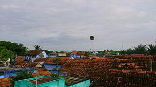
Moolakaraipatti is a Panchayat town in Tirunelveli district in the Indian state of Tamil Nadu.
Sivanthipuram is a panchayat town in Tirunelveli district in the Indian state of Tamil Nadu.
Tiruvaikuntam, also referred to as Srivaikuntam is a panchayat town in Thoothukudi district in the Indian state of Tamil Nadu. It is located on the banks of the river Thamirabarani.
Veeravanallur is a selection grade special panchayat town in the Cheranmahadevi taluk of Tirunelveli district in the Indian state of Tamil Nadu.
Vickramasingapuram or V.K.Puram is a Municipal town in Tirunelveli District in the Indian state of Tamil Nadu. It falls under the Ambasamudram Taluk. As of 2011, the town had a population of 47,241.
Alangulam is a town in Tenkasi district, Tamil Nadu, India. It is a Special Grade Town Panchayat and the centre of the Alangulam Taluk in Tenkasi district.
Pudupatti is a village in Pappakudi block in Tirunelveli district of Tamil Nadu, India. It is located 26 km towards west from District headquarters Tirunelveli, 11 km from Pappakudi, 651 km from state capital Chennai.

Sengottai is a town in the Tenkasi district, of Tamil Nadu, India. It is the gateway to southern Tamil Nadu and Kerala. Spread over an area of 2.68 km2 with a population of over 26,823, the economy of the town and Sengottai Taluk revolves around the cultivation of rice,coconut,Mango,clove and pepper. Sengottai is well known in Tamil Nadu as a major market of Dosa kal. This town has lot of Black smith shops.
The Ambasamudram taluk is in the Tirunelveli district of the Indian state of Tamil Nadu. The headquarters is the town of Ambasamudram.
Nallur is a panchayat town in Tenkasi district in the Indian state of Tamil Nadu. It is located in a municipality under Aalangulam Panchayat Union. Its parts are Kasiyapuram, Aladipatti, Vaithilingapuram,Sivakamiyapuram, Kamarajnagar, Aravankudieruppu, Periyarnagar,Rajivkantinagar.
Pappakudi block is a revenue block in the Tirunelveli district of Tamil Nadu, India. It has a total of 15 panchayat villages. Pappakudi a village located in the banks of Thamirabarani river.
Ambasamudram block is a revenue block in the Tirunelveli district of Tamil Nadu, India. It has a total of 12 panchayat villages.

Gadananathi (கடனாநதி)also can be called as Gadananadhi or Gatananadhi or Kadananathi or Kadananadhi is a river flowing in the Tirunelveli district of the Indian state of Tamil Nadu.
Thattankulam is one of the villages in Tirunelveli district in the Indian state of Tamil Nadu.
Kadanganeri is a village located at Alangulam Taluk in Tenkasi district of Tamil Nadu, India. Kadanganeri is a Village Panchayat comes under Alangulam block.

