Related Research Articles
Parker County is a county located in the U.S. state of Texas. As of the 2010 census, its population was 116,927. The county seat is Weatherford. The county was created in 1855 and organized the following year. It is named for Isaac Parker, a state legislator who introduced the bill that established the county in 1855.

Palo Pinto County is a county located in the U.S. state of Texas. As of the 2010 census, its population was 28,111. The county seat is Palo Pinto. The county was created in 1856 and organized the following year.

Hood County is a county located on the Edwards Plateau in the U.S. state of Texas. As of the 2010 census, the population was 51,182. Its county seat is Granbury. The county is named for John Bell Hood, a Confederate lieutenant general and the commander of Hood's Texas Brigade.

Graham is a city in north central Texas. It is the county seat and largest city of Young County, and as of the 2010 Census had a population of 8,903.

Mineral Wells is a city in Palo Pinto and Parker Counties in the U.S. state of Texas. The population was 16,788 at the 2010 census. The city is named for mineral springs in the area, which were highly popular in the early 1900s.
Elm Creek is the name of the following locations:

Possum Kingdom State Park is a state park in Palo Pinto County, Texas, USA, that was built in the 1940s by the Civilian Conservation Corps. It covers approximately 1,530 acres (620 ha), and lies in the Palo Pinto Mountains and Brazos River Valley of Texas. The park borders the large Possum Kingdom Lake, a 20,000-acre (8,100 ha) lake known for its clear blue waters. Possum Kingdom winds for 65 miles (105 km) down the Brazos River, and has more than 300 miles (480 km) of shoreline. A privately owned store and marina in the park cater to boaters and campers.
The term Cross Timbers, also known as Ecoregion 29, Central Oklahoma/Texas Plains, is used to describe a strip of land in the United States that runs from southeastern Kansas across Central Oklahoma to Central Texas. Made up of a mix of prairie, savanna, and woodland, it forms part of the boundary between the more heavily forested eastern country and the almost treeless Great Plains, and also marks the western habitat limit of many mammals and insects.

Lanfair Valley is located in the Mojave Desert in southeastern California near the Nevada state line. It is bounded on the north by the New York Mountains and Castle Mountains, on the east by the Piute Range, and on the south by the Woods Mountains and Vontrigger Hills. Joshua Trees can be found in most of the valley. Elevation is 4,045 feet.
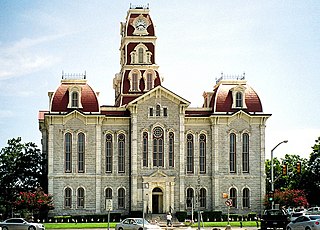
Palo Pinto is a census-designated place and unincorporated community and county seat in Palo Pinto County, Texas, United States. This was a new CDP for the 2010 census with a population of 333.

Prairie Dog Town Fork Red River is a sandy-braided stream about 120 mi (193 km) long, formed at the confluence of Palo Duro Creek and Tierra Blanca Creek, about 1.8 mi (2.9 km) northeast of Canyon in Randall County, Texas, and flowing east-southeastward to the Red River about 1 mi (2 km) east of the 100th meridian, 8 mi (13 km) south-southwest of Hollis, Oklahoma.

Possum Kingdom Lake, is a reservoir on the Brazos River located primarily in Palo Pinto County Texas. It was the first water supply reservoir constructed in the Brazos River basin. The lake has an area of approximately 17,000 acres (6,900 ha) with 310 miles (500 km) of shoreline. It holds 750,000 acre feet (930,000,000 m3) of water with 550,000 acre feet (680,000,000 m3) available for water supply.

The term Palo Pinto Mountains properly refers to a specific cuesta-like range of hills in western Palo Pinto County, Texas. The name Palo Pinto roughly translates to "painted stick" in reference to the juniper trees of the area. Isolated, rugged, and scenic, the ridge extends some 15 miles, from near the intersection of Texas State Highway 16 and Farm to Market Road 207 in the southwest, to Crawford Mountain just south of the Fortune Bend on the Brazos River in the northeast.

Metcalf Gap is a pass through the Palo Pinto Mountains located in the Western Cross Timbers region of northern Texas. Located roughly midway between the towns of Breckenridge and Mineral Wells, the pass lies at an elevation of about 1,200 feet and forms a distinct gap in the escarpment formed by the Palo Pinto Mountains, a fifteen-mile long range of cuesta-type hills that runs southwest to northeast across southern Palo Pinto, County. The pass, as well as a small, similarly named community at the eastern end of the pass, were named in honor of local rancher and surveyor J.J. Metcalf, who surveyed, among other things, the townsite of county seat Palo Pinto, then known as Golconda.
Keechi Creek is a stream in Palo Pinto County, Texas. It originates two miles east of Graford, and empties into the Brazos River northwest of Mineral Wells.
Brazos is an unincorporated community in Palo Pinto County, Texas, United States.
Oran is an unincorporated community in Palo Pinto County, Texas, United States.
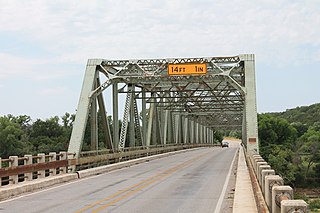
US 281 Bridge at the Brazos River refers to two bridges located south of Mineral Wells, Texas. They carry U.S. Route 281 (US 281) across the Brazos River.
Worser Creek is a stream in Palo Pinto County, Texas, in the United States. The creek flows seven miles (11 km) to its mouth at Palo Pinto Creek.
References
- "An Analysis of Texas Waterways" . Retrieved 2006-05-04.
- U.S. Geological Survey Geographic Names Information System: Palo Pinto Creek
- USGS Hydrologic Unit Map - State of Texas (1974)
Coordinates: 32°38′36″N98°6′12″W / 32.64333°N 98.10333°W
 | This article about a location in Eastland County, Texas is a stub. You can help Wikipedia by expanding it. |
 | This article about a location in Palo Pinto County, Texas is a stub. You can help Wikipedia by expanding it. |
 | This article about a location in Stephens County, Texas is a stub. You can help Wikipedia by expanding it. |
| | This article related to a river in Texas is a stub. You can help Wikipedia by expanding it. |