
Palo Pinto County is a county located in the U.S. state of Texas. As of the 2020 census, its population was 28,409. The county seat is Palo Pinto. The county was created in 1856 and organized the following year.

New Strawn is a city in Coffey County, Kansas, United States. As of the 2020 census, the population of the city was 414.

De Kalb is a city in Bowie County, Texas, United States; it is part of the Texarkana metropolitan statistical area. Its two area codes are 430 and 903. Its ZIP code is 75559. It is in the Central Time Zone, and its population was 1,527 at the 2020 United States census.

Silverton is a city in Briscoe County, Texas, United States. The population was 629 at the 2020 census.

Roby is a city in and the county seat of Fisher County, Texas, United States. The population was 591 at the 2020 census.
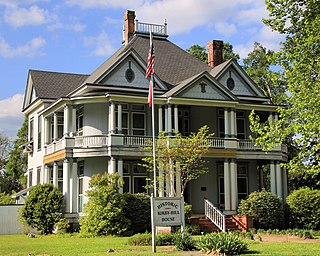
Kountze is a city in and the county seat of Hardin County, Texas, United States. The population was 1,981 at the 2020 census. The city is part of the Beaumont–Port Arthur Metropolitan Statistical Area.
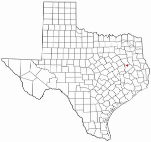
Grapeland is a city in Houston County, Texas, United States. Its population was 1,465 as of the 2020 census.
Bishop is a city in Nueces County, Texas, United States. The population was 3,174 as of the 2020 census, up from 3,134 in the 2010 census.

Mingus is a city in Palo Pinto County, Texas, United States. The population was 223 at the 2020 census.

Millsap is a town in Parker County, Texas, United States. Its population was 370 at the 2020 census.

Friona is a city in Parmer County, Texas, United States. The population was 4,171 at the 2020 census. Friona was established as a small community in 1898 by XIT Ranch, originally called Frio, which is also the word for "cold" in Spanish.

Iraan is a city in Pecos County, Texas, United States. Its population was 1,055 at the 2020 census. The city's name is an amalgamation of the first names of Ira and Ann Yates, owners of the ranch land upon which the town was built.
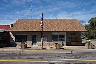
Emory is a city in Rains County, Texas, United States. The population was 1,239 at the 2010 census. It is the county seat of Rains County. Previously known as Springville, the city and county are named after Emory Rains, who was a legislator from the area. Rains was the author of the Homestead Law of Texas, which was later used as a model for the protection of homesteads throughout the United States. Special legislation passed to create Rains County called for the citizens to vote on the location of the county seat and for that selected town to be named Emory.
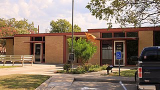
San Saba is a city located in, and the county seat of, San Saba County, Texas, United States. It was settled in 1854 and named for its location on the San Saba River and for Sabbas the Sanctified. Its population was 3,099 at the 2010 census.
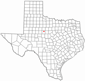
Tye is a city in Taylor County, Texas, United States. The population was 1,176 at the 2020 census. It is part of the Abilene, Texas Metropolitan Statistical Area.

Woodville is a town in and the county seat of Tyler County, Texas, United States. The town is intersected by three U.S. Numbered Highways: U.S. Route 69, U.S. Route 190, and U.S. Route 287. The population was 2,403 at the 2020 census. It is the county seat of Tyler County. The town was named after George Tyler Wood, governor of Texas from 1847 to 1849.

Bartlett is a city in Bell and Williamson counties in the U.S. state of Texas. The population was 1,633 at the 2020 census.

Ackerly is a city in Dawson and Martin Counties in the U.S. state of Texas. As of the 2020 Census, the population was 264. The Martin county portion of Ackerly is part of the Midland-Odessa metropolitan area.
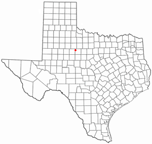
Hamlin is a city in Jones and Fisher Counties in the U.S. state of Texas. The population was 1,831 at the 2020 census. The Jones County portion of Hamlin is part of the Abilene, Texas metropolitan area.

Mineral Wells is a city in Palo Pinto and Parker Counties in the U.S. state of Texas. The population was 14,820 at the 2020 census. The city is named for mineral wells in the area, which were highly popular in the early 1900s.


