Panagia, Lemnos

Last updated

Panagia (Greek : Παναγία) is a village in the northeastern part of the island of Lemnos, Greece. It is part of the municipal unit of Moudros. In 2011 its population was 383 people, including the small village Kortisonas (pop. 2). [1]

Greek language language spoken in Greece, Cyprus and Southern Albania

Greek is an independent branch of the Indo-European family of languages, native to Greece, Cyprus and other parts of the Eastern Mediterranean and the Black Sea. It has the longest documented history of any living Indo-European language, spanning more than 3000 years of written records. Its writing system has been the Greek alphabet for the major part of its history; other systems, such as Linear B and the Cypriot syllabary, were used previously. The alphabet arose from the Phoenician script and was in turn the basis of the Latin, Cyrillic, Armenian, Coptic, Gothic, and many other writing systems.

Lemnos Place in Greece

Lemnos is a Greek island in the northern part of the Aegean Sea. Administratively the island forms a separate municipality within the Lemnos regional unit, which is part of the North Aegean region. The principal town of the island and seat of the municipality is Myrina. At 477.583 square kilometres (184.396 sq mi), it is the 8th-largest island of Greece.

Greece republic in Southeast Europe

Greece, officially the Hellenic Republic, also known as Hellas, is a country located in Southern and Southeast Europe, with a population of approximately 11 million as of 2016. Athens is the nation's capital and largest city, followed by Thessaloniki.

Contents

Population

Year Village population Community population
1928 406 -
1938 500 -
1961 697 -
1991 448 -
2001 447 453
2011 381 383

History

West of the village, in a small port near Cape Sotiras, an ancient site has been found. At the southern end of the bay a stele from the 4th century BC has been found, that reads: BENDIDORA METROPHANOU GERGISIOU. In medieval texts the location was mentioned as the valley of Saint Saviour. The map of the Italian traveller Buondelmonti (1418) mentions a chapel Sotira. A coastal settlement known as Sotira in northeastern Lemnos was mentioned on maps of other travellers including Belon (1588) and Dapper (1688). In 1858, when Conze visited the cape and the bay of Sotiras, he observed an old ruined stone pier and the chapel of Agios Sotiras.

Stele Stone or wooden slab erected for funerals or commemorative purposes

A stele, or occasionally stela, when derived from Latin, is a stone or wooden slab, generally taller than it is wide, erected in the ancient world as a monument. Grave stelae were often used for funerary or commemorative purposes. Stelae as slabs of stone would also be used as ancient Greek and Roman government notices or as boundary markers to mark borders or property lines.

Cristoforo Buondelmonti 15th-century Italian writer and geographer

Cristoforo Buondelmonti was an Italian Franciscan priest and traveler, and a pioneer in promoting first-hand knowledge of Greece and its antiquities throughout the Western world.

By the mid 19th century, there were no villages in the area of northeast Lemnos between Kontopouli and the cape Plaka. There were only a few isolated farms, which belonged to Turkish land owners from Agios Ypatios. The village of Panagia was founded around 1865 by residents of Agios Ypatios and Kontopouli that owned land in the area. The location of Panagia was chosen because of its equal distance to the east and west coast of the peninsula, providing greater safety. At Panagia an old Byzantine monastery was situated, at the foot of the hill Alepotrypes (Αλεπότρυπες).

Kontopouli Place in Greece

Kontopouli is a village and a community in the municipal unit of Moudros in the northeastern part of the island of Lemnos, Greece. In 2011 its population was 623 for the village and 634 for the community, which includes the small villages Agios Alexandros and Agios Theodoros. Its total area is 37.04 km². Kontopouli is 1 km northwest of Kalliopi, 3 km east of Repanidi and 8 km northeast of Moudros.

Plaka is a village in the northeasternmost part of the island of Lemnos, Greece. It is part of the municipal unit of Moudros. In 2011 its population was 310 people. The island of Imbros in Turkey is just 24 km northeast. It is situated somewhere in the middle of the straight line between Troy and Mount Athos. Some believe that it is the Ermaion lepas of the ancient, through which was transmitted with fire the news of the sack of Troy to Argos and Mycenae. Although the edge has an elevation of just 70 m, the cape comes deep into the sea and it is easily seen from those two areas. Therefore, in 1912 a 30 m high rotating lighthouse was built with a luminous range of 20 nautical miles (37 km).

Repanidi Place in Greece

Repanidi is a village and a community in the northeast of the island of Lemnos, Greece. It is part of the municipal unit of Moudros. It is located 2 km northeast of Romanou, 3 km west of Kontopouli, 3 km east of Lychna, 6 km northeast of Moudros and 21 km northeast of Myrina. In 2011 its population was 266 people. Its elevation is 30 m.

In 1874, it had 30 families. In another work of the same year, Panagia was mentioned as Tsiftlikia (Τσηφτλίκια). Apparently the name Panagia was not in use yet. It was first mentioned on a map in 1904 by Fredrich, together with the two nearby settlements Naxia and Petsa. In 1865, the first inhabitants built a church of Panagia (Our Lady) in the location of the old monastery. Later they built a newer church with a gift of $6,500 from Anastasios Diamantis, an immigrant from the USA. In 1887, a community school was founded in nearby Plaka, which also served pupils from Panagia. In 1903, a school was founded in Panagia. The school building was built between 1929 and 1932.

Panagia epithet

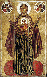
Panagia in Medieval and Modern Greek, also transliterated Panayia or Panaghia, is one of the titles of Mary, the mother of Jesus, used especially in Eastern Catholicism and Orthodox Christianity.

In spite of being situated in a remote part of Lemnos, the village grew between World Wars I and II, because several refugee families from Asia Minor settled there. The fertility of the soil also contributed to the growth, and in 1928 Panagia had 406 inhabitants. After World War II, the agricultural fields produced 407 tons of cotton and 700 tons of wheat. In 1961, it had 697 inhabitants. Later the population declined, but it is still one of the most lively villages on the island. It has a fishing club, a soccer club and an active cultural council.

Bibliography

Thessaloniki City in Macedonia, Greece

Thessaloniki, also familiarly known as Thessalonica, Salonica or Salonika, is the second-largest city in Greece, with over 1 million inhabitants in its metropolitan area, and the capital of Greek Macedonia, the administrative region of Central Macedonia and the Decentralized Administration of Macedonia and Thrace. Its nickname is η Συμπρωτεύουσα, literally "the co-capital", a reference to its historical status as the Συμβασιλεύουσα (Symvasilévousa) or "co-reigning" city of the Eastern Roman (Byzantine) Empire, alongside Constantinople.

See also

Related Research Articles

Lefkada (city) Place in Greece

Lefkada City is a city and a former municipality on the island of Lefkada, Ionian Islands, Greece. Since the 2011 local government reform it is part of the municipality Lefkada, of which it is a municipal unit. It is the capital and main town of the island of Lefkada, located in the northern and northeastern part of the island. The city had a population of 8,673 inhabitants at the 2011 census. The municipal unit has a land area of 60.628 square kilometres (23.409 sq mi) and a population of 13,490. Its next largest towns are Lygiá, Nikiána (724), Apólpaina (819), Frýni (494), Kariótes (532), and Tsoukaládes (514).

Agios Nikolaos, Chalkidiki Place in Greece

Agios Nikolaos is a village located 120 kilometers south-east from Thessaloniki on the Chalkidiki peninsula in Macedonia, Greece.

Moudros Place in Greece

Moudros is a town and a former municipality on the island of Lemnos, North Aegean, Greece. Since the 2011 local government reform it is part of the municipality Lemnos, of which it is a municipal unit. It covers the entire eastern peninsula of the island, with a land area of 185.127 km², covering 38.8% of the island's territory. The municipal seat was the town of Moúdros. Its next largest town is Kontopoúli (623). The municipal unit's total population was 3,925 in the 2011 census.

Nea Koutali Place in Greece

Nea Koutali is a municipal unit on the island of Lemnos, North Aegean, Greece. Located in the south central portion of the island with a land area of 75.735 square kilometres (29.241 sq mi), it accounts for about 15.9% of the island's area, making it the smallest of the four municipal units on Lemnos. The seat of government is the village of Kontias, while its next largest town is Nea Koutali with 442 people. Nea Koutali's total population as of 2011 was 2,526.

Neochori, Magnesia Place in Greece

Neochori is a village and a community situated on the peninsula of Pelion, Magnesia, eastern Thessaly, Greece. It was the seat of the former municipality Afetes. The village is hidden in the embrace of a vast pine forest 480 meters above sea level, and about 35 km southeast of the city of Volos. The community Neochori consists of the villages Neochori, Agios Dimitrios, Afyssos, Zervochia, Megali Vrysi and Plaka. The community stretches from the Aegean Sea coast of the Pelion peninsula to the Pagasetic Gulf. Agios Dimitrios and Plaka are on the Aegean coast, and the tourist centre Afyssos is on the Pagasetic coast.

Tsimandria Place in Greece

Tsimandria is a village and a community in the southwestern part of Lemnos, a Greek island in the northern part of the Aegean Sea. It is part of the municipal unit of Nea Koutali. It is 1.5 km south of Portianou, 2 km east of Kontias, 4 km southwest of Nea Koutali and 10 km east of Myrina. The eastern half of the Fakos peninsula and the islets Kastria and Kompi are part of the community. In 2011 its population was 259.

Pedino, Lemnos Place in Greece

Pedino is a community on the Greek island of Lemnos, Greece. It consists of the villages Vounaria, Neo Pedino and Palaio Pedino, and the uninhabited island Alogonisi. It is part of the municipal unit of Nea Koutali. In 2011 its population was 268.

Kontias Place in Greece

Kontias is a village on the Greek island of Lemnos, North Aegean. It is the seat of the municipal unit Nea Koutali. In 2011 its population was 572. Kontias is situated in the southwestern part of the island, 2 km west of Tsimandria, 3 km southwest of Portianou and 8 km east of the island capital Myrina

Angariones Place in Greece

Angariones is a village in the Greek island of Lemnos, part of the municipal unit Nea Koutali. In 2011 its population was 116. It is situated in the western part of the island, 1.5 km north of Portianou, 2 km west of Nea Koutali, 4 km northeast of Kontias, 4 km west of the Lemnos Airport and 10 km east of Myrina.

Kallithea, Lemnos Place in Greece

Kallithea is a village in the Greek island of Lemnos, part of the municipal unit Nea Koutali. In 2011 its population was 182.

Livadochori, Lemnos Place in Greece

Livadochori is a village and a community in the Greek island of Lemnos, part of the municipal unit Nea Koutali. In 2011 its population was 237 for the village, and 373 for the community, which includes the village Poliochni. It is situated in the central part of the island, 1 km northwest of Kallithea, 2 km north of Nea Koutali, 7 km northwest of Moudros and 12 km northeast of Myrina. The Lemnos International Airport is 3 km east.

Kalliopi, Greece Place in Greece

Kalliopi is a settlement in the municipal unit of Moudros, on the Greek island of Limnos. In 2011 its population was 207. It is situated in the eastern part of the island, 1 km southeast of Kontopouli and 1.5 km north of the lagoon Chortarolimni. The village's 3 km long beach is on the Keros Gulf. The gulf is east of the village and was an important port until the late Middle Ages. The name "Keros" meaning "horn" refers to its shape.

Agios Alexandros Place in Greece

Agios Alexandros is a settlement in the northeastern part of the Aegean island of Lemnos, Greece. It is part of the municipal unit of Moudros and the community of Kontopouli. The population was 0 at the 2011 census. It is located north of the Alyki Lagoon, 4 km southwest of Panagia and 5 km northeast of Kontopouli.

Kaminia, Lemnos Place in Greece

Kaminia is a village in the northeast of the island of Lemnos, Greece. It is a community of the municipal unit of Moudros. From 1918 until 1998, it was an independent community. The population in 2011 was 234 for the village and 243 for the community, which includes the village Vroskopos. It is located in the southeastern peninsula of the island, 5 km east of Moudros, 6 km northwest of Fisini and 7 km south of Kontopouli. Its elevation is about 60 m. Its area is 12.847 km2, of which 7.60 km2 are arable.

Lychna is a village and a community in the island of Lemnos, Greece. In 2001 its population was 110 people for the village, and 320 for the community, which includes the village Anemoessa. It is part of the municipal unit of Moudros. It is situated at about one kilometer from the swampy shore of the bay of Moudros, at 10 m elevation. It is 1.5 km south of Varos, 2 km northwest of Romanou, 4 km north of Moudros and 18 km east of Myrina.

References

Coordinates: 39°58′51″N25°24′23″E / 39.98083°N 25.40639°E / 39.98083; 25.40639

Geographic coordinate system Coordinate system

A geographic coordinate system is a coordinate system that enables every location on Earth to be specified by a set of numbers, letters or symbols. The coordinates are often chosen such that one of the numbers represents a vertical position and two or three of the numbers represent a horizontal position; alternatively, a geographic position may be expressed in a combined three-dimensional Cartesian vector. A common choice of coordinates is latitude, longitude and elevation. To specify a location on a plane requires a map projection.