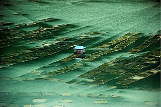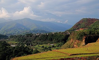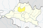
Makwanpur District, in Bagmati Province, earlier a part of Narayani Zone, is one of the seventy-seven districts of Nepal. The city of Hetauda serves as the district headquarters and also as the provincial headquarters. The district covers an area of 2,426 km2 (937 sq mi) and had a population of 392,604 in 2001 and 420,477 in 2011. The latest census of 2021 recorded the population of Makwanpur as 466,073.

Nuwakot District, a part of Bagmati Province, is one of the seventy-seven districts of Nepal. The district, with Bidur as its district headquarters, covers an area of 1,121 km2 (433 sq mi) and had a population of 288,478 in 2001 and 277,471 in 2011.
Bhalche is a village development committee in Nuwakot District in the Bagmati Zone of central Nepal. At the time of the 1991 Nepal census it had a population of 2947 living in 624 individual households.

Bungtang बुङताङ is a village development committee in Nuwakot District in the Bagmati Zone of central Nepal. At the time of the [2068 B.S. census] ] it had a population of 2069 living in 13.93 sq.km Area

Ratmate is a ward under Belkotgadhi Municipality but was village development committee in Nuwakot District in the Bagmati Province of central Nepal. At the time of the 1991 Nepal census it had a population of 2997 people living in 567 individual households. Bhubaneshwor Nepal is the president of this ward after local election held in 2079 BS where Mr. Nepal secured total of 835 votes. There are Villages like of Mahadevphant, ratmate and Chandretar. Mahadev Secondary School is the main educational hub. There are few brick company factory and there are huge sand/aggregate excavation from Trishuli river.

Kakani is a Gaunpalika and former village development committee in Nuwakot District in Bagmati Province of central Nepal. At the time of the 1991 Nepal census, the Kakani village development committee administered a population of 7816 living in 1343 individual households.

Suryodaya Municipality is a municipality located in Koshi Pradesh of Nepal in Ilam district. Suryodaya is the Nepali translation for “Sunrise".

Bagmati Province is one of the seven provinces of Nepal established by the constitution of Nepal. Bagmati is Nepal's second-most populous province and fifth largest province by area. It is bordered by Tibet Autonomous Region of China to the north, Gandaki Province to the west, Koshi Province to the east, Madhesh Province and the Indian state of Bihar to the south. With Hetauda as its provincial headquarters, the province is also the home to the country's capital Kathmandu, is mostly hilly and mountainous, and hosts mountain peaks including Gaurishankar, Langtang, Jugal, and Ganesh.
Khaniyabas is a Gaupalika(Nepali: गाउपालिका ; gaupalika) Formerly: village development committee) in Dhading District in the Bagmati Zone of central Nepal. It has a literacy rate of 59.22%. The local body was formed by merging three VDCs namely Jharlang, Darkha and Satyadevi. The population of the rural municipality is 12,749 according to the data collected on 2017 Nepalese local elections.
Galchhi is a Gaupalika(Nepali: गाउपालिका ; gaupalika) Formerly: village development committee) in Dhading District in the Bagmati Province of central Nepal. The local body was formed by merging three VDCs namely Baireni, Kalleri and Goganpani. Currently, it has a total of 8 wards. The population of the rural municipality is 27784 according to the data collected on 2017 Nepalese local elections.
Chhathar is a rural municipality (gaunpalika) out of four rural municipality located in Tehrathum District of Koshi Province of Nepal. There are a total of 6 municipalities in Tehrathum in which 2 are urban and 4 are rural.
Netrawati Dabjong is a rural municipality in Dhading District of central Nepal. The local body was formed by merging 3 VDCs namely Katunje, Semjong and Marpak. It has a total of five wards.

Tarakeshwar Rural Municipality is a Gaunpalika in Nuwakot District in Bagmati Province of central Nepal that was established in 11 March 2018 by merging the former Village Development Committees Khadga Bhanjyang(Ward no. 1 and 3), Gorsyang, Taruka and Dangsing. The headquarters of Tarkeshwor Gaupalika is located in Dangsing.

Nuwakot 1 is one of two parliamentary constituencies of Nuwakot District in Nepal. This constituency came into existence on the Constituency Delimitation Commission (CDC) report submitted on 31 August 2017.
Shivapuri is a Rural municipality located within the Nuwakot District of the Bagmati Province of Nepal. The municipality spans 101.5 square kilometres (39.2 sq mi) of area, with a total population of 17,203 according to a 2021 Nepal census.
Tadi is a Rural municipality located within the Nuwakot District of the Bagmati Province of Nepal. The municipality spans 69.80 square kilometres (26.95 sq mi) of area, with a total population of 17,932 according to a 2011 Nepal census.
Suryagadhi is a Rural municipality located within the Nuwakot District of the Bagmati Province of Nepal. The municipality spans 49.09 square kilometres (18.95 sq mi) of area, with a total population of 16,800 according to a 2011 Nepal census.
Kispang is a Rural municipality located within the Nuwakot District of the Bagmati Province of Nepal. The municipality spans 82.57 square kilometres (31.88 sq mi) of area, with a total population of 14,861 according to a 2011 Nepal census.
Myagang is a Rural municipality located within the Nuwakot District of the Bagmati Province of Nepal. The municipality spans 97.83 square kilometres (37.77 sq mi) of area, with a total population of 13,479 according to a 2011 Nepal census.
Bhimphedi is a Rural municipality located within the Makawanpur District of the Bagmati Province of Nepal. The rural municipality spans 245.27 square kilometres (94.70 sq mi) of area, with a total population of 23,344 according to a 2011 Nepal census.


