Taple (ताप्ले) is a village development committee in Gorkha District in the Gandaki Zone of northern-central Nepal. At the time of the 1991 Nepal census, it had a population of 4,398 and had 5000 houses in the town Hindu Muslim.
Patarasi is a rural municipality located in Jumla District of Karnali Province of Nepal.
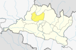
Bhalche is a village development committee in Nuwakot District in the Bagmati Zone of central Nepal. At the time of the 1991 Nepal census it had a population of 2947 living in 624 individual households.

Kakani is a Gaunpalika and former village development committee in Nuwakot District in Bagmati Province of central Nepal. At the time of the 1991 Nepal census, the Kakani village development committee administered a population of 7816 living in 1343 individual households.
Narayan is a municipality located in Dailekh District of Karnali Province of Nepal.
Dhairing is a village development committee in Parbat District in the Dhawalagiri Zone of central Nepal. At the time of the 2011 Nepal census it had a population of 3456 people living in 896 individual households. Temple Bhume Thann is located here.
Sundar Haraicha is a municipality in Morang District of Province No. 1 in Nepal. It is centered around Biratchowk town which is the gateway to Biratnagar. It borders Itahari Sub- Metropolitan city to the West, Dharan Sub- Metropolitan city to the Northwest and Belbari municipality to the East and is connected by the Mahendra Highway. It is one of the fastest growing cities in the Eastern Nepal and the second largest city of Morang district after Biratnagar with 121,305 inhabitants living in 26,677 households. It consists the town centres of Biratchowk and Gothgaun which are parts of the Greater Birat Development Area which incorporates the cities of Biratnagar-Itahari-Gothgau-Biratchowk-Dharan primarily located on the Koshi Highway in Eastern Nepal, with an estimated total urban agglomerated population of 804,300 people living in 159,332 households.
Khandachakra is an urban municipality located in Kalikot District of Karnali Province of Nepal.
Raskot is an urban municipality located in Kalikot District of Karnali Province of Nepal.
Tilagupha is an urban municipality located in Kalikot District of Karnali Province of Nepal.
Sinja is a rural municipality located in Jumla District of Karnali Province of Nepal.

Namkha is the largest rural municipality of Nepal located in Humla District of Karnali Province.
Bhumikasthan Municipality is a municipality located within the Arghakhanchi District of the Lumbini Province of Nepal. The municipality spans 159.13 square kilometres (61.44 sq mi), with a total population of 32,640 according to a 2011 Nepal census.
Belkotgadhi is a municipality located in Nuwakot District of Bagmati Province of Nepal. The municipality was established on 10 March 2017 merging the former VDCs: Belkot, Kumari, Duipipal, Ratmate, Jiling and Madanpur The municipality is divided into 13 wards and the headquarter of the municipality declared at Jiling. The municipality spans 155.6 square kilometres (60.1 sq mi) of area, with a total population of 39,888 individuals according to a 2011 Nepal census.
Shivapuri is a Rural municipality located within the Nuwakot District of the Bagmati Province of Nepal. The municipality spans 101.5 square kilometres (39.2 sq mi) of area, with a total population of 20,769 according to a 2011 Nepal census.
Tadi is a Rural municipality located within the Nuwakot District of the Bagmati Province of Nepal. The municipality spans 69.80 square kilometres (26.95 sq mi) of area, with a total population of 17,932 according to a 2011 Nepal census.
Suryagadhi is a Rural municipality located within the Nuwakot District of the Bagmati Province of Nepal. The municipality spans 49.09 square kilometres (18.95 sq mi) of area, with a total population of 16,800 according to a 2011 Nepal census.
Kispang is a Rural municipality located within the Nuwakot District of the Bagmati Province of Nepal. The municipality spans 82.57 square kilometres (31.88 sq mi) of area, with a total population of 14,861 according to a 2011 Nepal census.
Myagang is a Rural municipality located within the Nuwakot District of the Bagmati Province of Nepal. The municipality spans 97.83 square kilometres (37.77 sq mi) of area, with a total population of 13,479 according to a 2011 Nepal census.