Demographic features of the population of Botswana include population density, ethnicity, education level, health of the populace, economic status, religious affiliations and other aspects.

Hardap is one of the fourteen regions of Namibia, its capital is Mariental. Hardap contains the municipality of Mariental, the towns Rehoboth and Aranos, and the self-governed villages Gibeon, Gochas, Kalkrand, Stampriet and Maltahöhe. It is home to the Hardap Dam.

The North-West District or Ngamiland is one of the first-level administrative subdivisions of Botswana. For census and administrative purposes Ngamiland is subdivided into Ngamiland East, Ngamiland West and Ngamiland Delta (Okavango). It is governed by a District Commissioner, appointed by the national government, and the elected North-West District Council. The administrative centre is Maun.

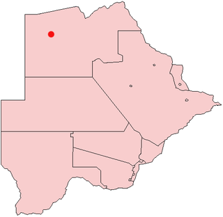
Gumare or Gomare is a rural village located in the North-West District of Botswana, near the Okavango Delta. The population of Gumare was 6,067 in 2001 census, but had risen to 8,532 iby the 2011 census.
Tlokweng is a peri-urban settlement classified as an urban village located east of the capital of Botswana, Gaborone and falling under the jurisdiction of South East District Council. It can be considered part of the conurbation of Gaborone. Tlokweng stands on the other side of the river, and is on the road to the border with South Africa, the border post being just 15 km to the east. The population was 35,982 at the 2011 census. It is now part of Gaborone agglomeration, home to 421,907 inhabitants at the 2011 census. The tribe originating from Tlokweng is referred to as Batlokwa. Many people from across Botswana have come to seek permanent and sometimes temporary settlement in Tlokweng because of its proximity to the capital city where most jobs are.

Mpandamatenga is a border post and settlement in Matabeleland North, Zimbabwe, adjacent to the Pandamatenga area in Botswana. It is located within Matetsi Safari Area. It can be reached by road from Hwange town and Hwange National Park.
Krouch Chhmar District is a district (srok) located in Tboung Khmum Province, Cambodia. The district capital is Krouch Chhmar town located around 35 kilometres north east of the provincial capital of Kampong Cham by water. The Mekong River forms western and northern borders of the districts and includes the Mekong island of Koh Pir in its area. Not surprisingly, communities in this isolated district are mostly clustered along the banks of the river and boats are an important form of transport.
Xakao is a village in North-West District of Botswana. It is located close to the Namibian border, where the river Okavango enters Botswana. The population was 1,049 in 2001 census.
Ngarangi is a village in North-West District of Botswana. It is located along the Okavango River, close to the Namibian border. The population was 948 in 2001 census.
Beetsha is a village in North-West District of Botswana. It is located north of the Okavango River and close to Okavango Delta. The population was 760 in 2001 census.
Gonutsoga, also Gonitsoga, is a village in North-West District of Botswana. It is located close to the western border against Namibia. The population was 506 in 2001 census.
Nxaunxau is a village in North-West District of Botswana. It is located close to Okavango Delta and Namibian border. The population was 330 in 2001 census.
Tsootsha, also known as Kalkfontein, is a village in Ghanzi District of Botswana. It is located close to the border with Namibia. The population was 1,397 in 2001 census.
Karakobis is a small village in Ghanzi District of Botswana. It is located close to the Namibian border. The population was 785 according to the 2001 census. The residents of Karakobis belong to a number of different indigenous tribes, some of which originated from South Africa and Namibia. These include the Barolong, Basarwa, Baherero, Bakgalagadi, Batlharo. Karakobis has little development beyond those to support basic government services. There is a kgotla, a VDC pre-school, a government primary school, government social welfare offices, government medical clinic and a government agriculture office. People in Karakobis survive mainly from subsistence and small-scale farming. The "lands" (farms) and cattle posts are within walking distance of the village.
Makunda is a village in Ghanzi District of Botswana. It is located close to the Namibian border. The population was 331 in 2001 census.
Machaneng is a village in Central District of Botswana. It is 11 kilometres (6.8 mi) from the Limpopo river and the border with South Africa, 80 kilometres (50 mi) east of Mahalapye. The population was 2,050 in 2001 census.
Lerala is a village in Central District of Botswana. The village is located at the south-eastern end of the Tswapong Hills, 30 km (19 mi) from the Limpopo River and the border with South Africa and approximately 90 km (56 mi) east of Palapye. The population of Lerala was 6,871 in the 2011 census, which was a 20.5% increase from the 2001 population.
Modipane is a village in Kgatleng District of Botswana. The village is located 25 km east of Gaborone, close to the border with South Africa and has a primary school. The population was 2,423 in 2001 census. Shawn Segotlong resides in Modipane btw
Mmankgodi is a village in Kweneng District of Botswana. It is located 35 km from Gaborone and around 30 km from the border with South Africa. The population of Mmankgodi was 6,802 in 2011 census.

Chobe District is an administrative district in the northern part of Botswana, with the headquarters in Kasane. In 2001 it was merged with Ngamiland, and until 2006 it shared with Ngamiland the North-West District Council as local government. Chobe National Park is in the Chobe District. As of 2011, the total population of the district was 23,347 compared to 18,258 in 2001. The growth rate of population during the decade was 2.49. The total number of workers constituted 12,059 with 6,113 males and 5,947 females, with majority of them working in public administration.


