Papuan Peninsula

Last updated
Papuan Peninsula
Bird's Tail Peninsula
Map of Paedophryne localities 2.png
Papuan Peninsula.jpg
Coordinates: 8°50′S147°30′E / 8.833°S 147.500°E / -8.833; 147.500
Location Papua New Guinea
Highest elevation4,038 m (13,248 ft)
Provinces Milne Bay Province, Oro Province, Central Province,
National Capital District;
parts of Morobe Province and Gulf Province
Cities Port Moresby, Popondetta, Alotau

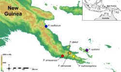
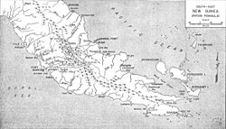
The Papuan Peninsula, also known as the Bird's Tail Peninsula, [1] is a large peninsula in Papua New Guinea, southeast of the city of Lae, that makes up the southeastern portion of the island of New Guinea. The peninsula is the easternmost extent of the New Guinea Highlands and consists largely of the Owen Stanley Range, with peaks such as Mount Victoria (4,038 m) and Mount Suckling (3,676 m). On the south coast is Port Moresby, the capital and largest city of Papua New Guinea.

The island of New Guinea is often visualized as being in the shape of a bird, with the Bird's Head Peninsula being at the northwest end of the island, and the Bird's Tail Peninsula at the southeast end. For example, American soldiers in WWII visualized it specifically as a turkey, and referenced the anatomy of the bird as a shorthand for explaining where various actions and deployments occurred on the island.

See also

Related Research Articles

<span class="mw-page-title-main">New Britain</span> Island in Papua New Guinea

New Britain is the largest island in the Bismarck Archipelago, part of the Islands Region of Papua New Guinea. It is separated from New Guinea by a northwest corner of the Solomon Sea and from New Ireland by St. George's Channel. The main towns of New Britain are Rabaul/Kokopo and Kimbe. The island is roughly the size of Taiwan. While the island was part of German New Guinea, it was named Neupommern . In common with most of the Bismarcks it was largely formed by volcanic processes, and has active volcanoes including Ulawun, Langila, the Garbuna Group, the Sulu Range, and the volcanoes Tavurvur and Vulcan of the Rabaul caldera. A major eruption of Tavurvur in 1994 destroyed the East New Britain provincial capital of Rabaul. Most of the town still lies under metres of ash, and the capital has been moved to nearby Kokopo.

<span class="mw-page-title-main">Bougainville Island</span> Island in Papua New Guinea

Bougainville Island is the main island of the Autonomous Region of Bougainville, which is part of Papua New Guinea. It was previously the main landmass in the German Empire-associated North Solomons. Its land area is 9,300 km2 (3,600 sq mi). The population of the whole province, including nearby islets such as the Carterets, is approximately 300,000. The highest point is Mount Balbi, on the main island, at 2,715 m (8,907 ft). The much smaller Buka Island, c. 500 km2 (190 sq mi), lies to the north, across the 400–500 m (1,300–1,600 ft) wide Buka Strait. Even though the strait is narrow, there is no bridge across it, but there is a regular ferry service between the key settlements on either side. The main airport in the north is in the town of Buka.

<span class="mw-page-title-main">Trans–New Guinea languages</span> Large Papuan language family

Trans–New Guinea (TNG) is an extensive family of Papuan languages spoken on the island of New Guinea and neighboring islands, a region corresponding to the country Papua New Guinea as well as parts of Indonesia.

<span class="mw-page-title-main">West Papua (province)</span> Province in Indonesia

West Papua, formerly Irian Jaya Barat, is a province of Indonesia. It covers the two western peninsulas of the island of New Guinea, the eastern half of the Bird's Head Peninsula and the Bomberai Peninsula, along with nearby smaller islands. The province is bordered to the north by the Pacific Ocean, to the west by the Halmahera Sea and the Ceram Sea, to the south by the Banda Sea, and to the east by the province of Central Papua and the Cenderawasih Bay. Manokwari is the province's capital and largest city. West Papua is the second-least populous province in Indonesia. It had a population of 1,134,068 at the 2020 Census, and the official estimate for mid 2022 was 1,183,307. However the total area and population was reduced by the Parliamentary decision on 17 November 2022 to create a 38th province of Indonesia, comprising Sorong city and the regencies of Sorong, South Sorong, Raja Ampat, Maybrat and Tambrauw; this new province, called Southwest Papua, came into existence from 8 December 2022. The reduced West Papua Province thus had a mid-2022 population estimated at only 561,403.

<span class="mw-page-title-main">Western New Guinea</span> Region of Indonesia on the island of New Guinea

Western New Guinea, also known as Papua, Indonesian New Guinea, Indonesian Papua, West Papua New Guinea, is the western, Indonesian half of the island of New Guinea. Since the island is alternatively named as Papua, the region is also called West Papua.

<span class="mw-page-title-main">West Papuan languages</span> Language family of Indonesia

The West Papuan languages are a proposed language family of about two dozen non-Austronesian languages of the Bird's Head Peninsula of far western New Guinea, the island of Halmahera and its vicinity, spoken by about 220,000 people in all. It is not established if they constitute a proper linguistic family or an areal network of genetically unrelated families.

<span class="mw-page-title-main">Bird's Head Peninsula</span> Peninsula in Indonesia

The Bird's Head Peninsula or Doberai Peninsula, is a large peninsula that makes up the northwest portion of the island of New Guinea, comprising the Indonesian provinces of Southwest Papua and West Papua. It is often referred to as The Vogelkop, and is so named because its shape looks like a bird's head on the island of New Guinea. The peninsula at the opposite end of the island is called the Bird's Tail Peninsula. The peninsula just to the south is called the Bomberai Peninsula.

<span class="mw-page-title-main">Brown quail</span> Species of bird

The brown quail, also known as the swamp quail, silver quail and Tasmanian quail, is an Australasian true quail of the family Phasianidae. It is a small, ground-dwelling bird and is native to mainland Australia, Tasmania and Papua New Guinea and has been introduced to New Zealand and Fiji. Widespread and common throughout its large range, the brown quail is evaluated as being of "least concern" by the International Union for Conservation of Nature on the IUCN Red List of Threatened Species.

<span class="mw-page-title-main">New Guinea Highlands</span> Natural region in New Guinea

The New Guinea Highlands, also known as the Central Range or Central Cordillera, is a long chain of mountain ranges on the island of New Guinea, including the island's tallest peak, Puncak Jaya, Indonesia, 16,024 ft (4,884 m), the highest mountain in Oceania. The range is home to many intermountain river valleys, many of which support thriving agricultural communities. The highlands run generally east-west the length of the island, which is divided politically between Indonesia in the west and Papua New Guinea in the east.

Bomberai Peninsula, otherwise known as the Bird's Beak Peninsula, is located in the Western New Guinea region, opposite to and to the south of the Bird's Head Peninsula. To the west lies the Sebakor Bay and to the south Kamrau Bay. Sabuda island lies off the western tip of the peninsula, and is separated from the mainland by Berau and Bintuni straits.

The Dagan or Meneao Range languages are a small family of Trans–New Guinea languages spoken in the Meneao Range of the "Bird's Tail" of New Guinea, the easternmost Papuan languages on the mainland. They are the most divergent of the several small families within the Southeast Papuan branch of Trans–New Guinea.

The Mailuan or Cloudy Bay languages are a small family of Trans–New Guinea languages spoken around Cloudy Bay in the "Bird's Tail" of New Guinea. They are classified within the Southeast Papuan branch of Trans–New Guinea.

The Yareban or Musa River languages are a small family of Trans–New Guinea languages spoken near the Musa River in the "Bird's Tail" of New Guinea. They are classified within the Southeast Papuan branch of Trans–New Guinea.

The Manubaran languages are a small family of Trans–New Guinea languages spoken around Mount Brown in the "Bird's Tail" of New Guinea. They are classified within the Southeast Papuan branch of Trans–New Guinea.

The Kwalean or Humene–Uare languages are a small family of Trans–New Guinea languages spoken in the "Bird's Tail" of New Guinea. They are classified within the Southeast Papuan branch of Trans–New Guinea.

The Koiarian languages Koiari are a small family of Trans–New Guinea languages spoken in the "Bird's Tail" of New Guinea. They are classified within the Southeast Papuan branch of Trans–New Guinea.

<span class="mw-page-title-main">Southeast Papuan languages</span> Language group of New Guinea

The Southeast Papuan or Papuan Peninsula languages are a group of half a dozen small families of Papuan languages in the "Bird's Tail" of New Guinea that are part of the Trans–New Guinea (TNG) phylum.

<span class="mw-page-title-main">New Guinea</span> Island in the Pacific Ocean

New Guinea is the world's second-largest island, with an area of 785,753 km2 (303,381 sq mi). Located in Oceania in the southwestern Pacific Ocean, the island is separated from Australia by the 150-kilometre wide Torres Strait, though both landmasses lie on the same continental shelf. Numerous smaller islands are located to the west and east.

<span class="mw-page-title-main">Central Range sub-alpine grasslands</span> Ecoregion in New Guinea

The Central Range sub-alpine grasslands is a montane grasslands and shrublands ecoregion on the island of New Guinea. The ecoregion covers the highest-elevation portions of the New Guinea Highlands, which extend along the spine of the island. The high elevations support rare tropical sub-alpine and alpine habitats, including many endemic plants and animals.

<span class="mw-page-title-main">Southeastern Papuan rain forests</span>

The Southeastern Papuan rain forests is a tropical moist forest ecoregion in southeastern New Guinea. The ecoregion covers the mountainous center and coastal lowlands of the Papuan Peninsula.

References

  1. Palmer, Bill (2017-12-04). The Languages and Linguistics of the New Guinea Area: A Comprehensive Guide. Walter de Gruyter GmbH & Co KG. p. 4. ISBN   9783110295252.