
East Northport is a hamlet and census-designated place (CDP) in the town of Huntington in Suffolk County, New York, United States. The population was 20,217 at the 2010 census.

The North-West District or Ngamiland is one of the first-level administrative subdivisions of Botswana. For census and administrative purposes Ngamiland is subdivided into Ngamiland East, Ngamiland West and Ngamiland Delta (Okavango). It is governed by a District Commissioner, appointed by the national government, and the elected North-West District Council. The administrative centre is Maun.

Kasane is a town in Botswana, close to Africa's 'Four Corners', where four countries almost meet: Botswana, Namibia, Zambia and Zimbabwe. It is at the far north-eastern corner of Botswana where it serves as the administrative center of the Chobe District. The population of Kasane was 9,244 in 2011 census.
Nala is a community development block that forms an administrative division in the Jamtara Sadar subdivision of the Jamtara district, Jharkhand state, India. It is located 27 km from Jamtara, the district headquarters.
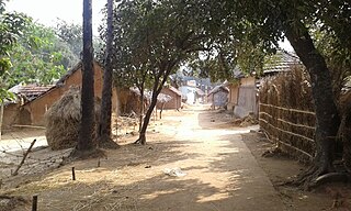
Amdanga is a community development block that forms an administrative division in North 24 Parganas district in the Indian state of West Bengal.
Hasnabad is a community development block that forms an administrative division in Basirhat subdivision of North 24 Parganas district in the Indian state of West Bengal.
Deganga is a community development block that forms an administrative division in North 24 Parganas district in the Indian state of West Bengal.
Sandeshkhali I is a community development block that forms an administrative division in Basirhat subdivision of North 24 Parganas district in the Indian state of West Bengal.
Pandamatenga is a village in the Chobe District, Botswana. It is located close to the country's border with Zimbabwe, whose border post is known as Mpandamatenga.
Kachikau is a village in North-West District of Botswana. It is located in the eastern part of the district, which previously formed Chobe District, and has both primary and secondary schools and a health clinic. The population was 881 in 2001 census.

Kavimba is a village in North-West District of Botswana. It is located in the eastern part of the district, which before 2001 formed Chobe District, and has a primary school and no secondary school. The population was 519 in 2001 census.
Lesoma is a village in North-West District of Botswana. It is located in the eastern part of the district, which before 2001 formed Chobe District and is close to town of Kasane. Lesoma has both primary and secondary schools, and the population was 410 in 2001 census.
Satau is a village in the Chobe District of Botswana, at 18°0′45″ south and 24°24′22″ east. The village is located in the eastern part of the district, which before 2001 formed part of the North-West District. Although a traditional village, Satau it has a primary school, a post office, a health post and a library. Electricity is also available in the village.

Chobe District is an administrative district in the northern part of Botswana, with the headquarters in Kasane. In 2001 it was merged with Ngamiland, and until 2006 it shared with Ngamiland the North-West District Council as local government. Chobe National Park is in the Chobe District. As of 2011, the total population of the district was 23,347 compared to 18,258 in 2001. The growth rate of population during the decade was 2.49. The total number of workers constituted 12,059 with 6,113 males and 5,947 females, with majority of them working in public administration.
Swarupnagar is a community development block that forms an administrative division in Basirhat subdivision of North 24 Parganas district in the Indian state of West Bengal.
Habra I is a community development block that forms an administrative division in Barasat Sadar subdivision of North 24 Parganas district in the Indian state of West Bengal.
Habra II is a community development block that forms an administrative division in Barasat Sadar subdivision of North 24 Parganas district in the Indian state of West Bengal.
Baduria is a community development block that forms an administrative division in Basirhat subdivision of North 24 Parganas district in the Indian state of West Bengal.
Sandeshkhali-II is a community development block that forms an administrative division in Basirhat subdivision of North 24 Parganas district in the Indian state of West Bengal.
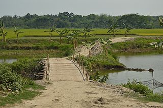
Bangaon is a community development block that forms an administrative division in Bangaon subdivision of North 24 Parganas district in the Indian state of West Bengal.
