
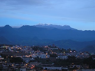
Parco dei Colli di Bergamo is a natural park in the province of Bergamo, Lombardy, northern Italy. [1]
Parco dei Colli di Bergamo is a natural park in the province of Bergamo, Lombardy, northern Italy. [1]

The park has a surface of 47 square kilometres (18 sq mi) and covers part of the city of Bergamo and of the surrounding municipalities. The largest part of the surface of the park is covered by woods. The fauna of the park includes foxes, European badgers and others mammals, while the European robin is the most widespread bird. [2] [3] The highest point of the park is Canto Alto at 1,144 metres (3,753 ft) above sea level; the lowest point is at 244 metres (801 ft).

The Andaman Sea is a marginal sea of the northeastern Indian Ocean bounded by the coastlines of Myanmar and Thailand along the Gulf of Martaban and west side of the Malay Peninsula, and separated from the Bay of Bengal to its west by the Andaman Islands and the Nicobar Islands. Its southern end is at Breueh Island just north of Sumatra, with the Strait of Malacca further southeast.
This article lists extreme locations on Earth that hold geographical records or are otherwise known for their geophysical or meteorological superlatives. All of these locations are Earth-wide extremes; extremes of individual continents or countries are not listed.
This is a list of the extreme points of Europe: the geographical points that are higher or farther north, south, east or west than any other location in Europe. Some of these positions are open to debate, as the definition of Europe is diverse.

The Province of Bergamo is a province in the Lombardy region of Italy. It has a population of 1,103,768 (2023), an area of 2,754.91 square kilometers (1,063.68 sq mi), and contains 243 comuni. Its capital is the city of Bergamo.

The Province of Lecco is a province in the Lombardy region of Italy. Its capital is the city of Lecco.

The Struve Geodetic Arc is a chain of survey triangulations stretching from Hammerfest in Norway to the Black Sea, through ten countries and over 2,820 kilometres (1,750 mi), which yielded the first accurate measurement of a meridian arc.

Chiquinquirá is a town and municipality in the Colombian Department of Boyacá, part of the subregion of the Western Boyacá Province. Located some 115 km north of Bogotá, Chiquinquirá is situated 2,556 metres (8,386 ft) above sea level and has a yearly average temperature 58 °F (14 °C)

The Slovincian National Park, also known as Słowiński National Park, is a national park in Pomeranian Voivodeship, northern Poland. It is situated on the Baltic coast, between Łeba and Rowy. The northern boundary of the park consists of 32.5 kilometres (20.2 mi) of coastline.

The Oglio is a left-side tributary of the river Po in Lombardy, Italy. It is 280 kilometres (170 mi) long. In the hierarchy of the Po's tributaries, with its 280 kilometres (170 mi) of length, it occupies the 2nd place per length, while it is the 4th per basin surface, and the 3rd per average discharge at the mouth.

Crystal Beach is a neighbourhood in Ottawa, Ontario, Canada. It is located in the west end of Ottawa, in Bay Ward. The neighbourhood is triangular in shape, and its boundaries can broadly be described as Carling Avenue to the northeast, Moodie Drive to the west, and Corkstown Road to the south. It is. According to the Canada 2011 Census, the total population of the neighbourhood was 2,416.
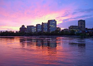
Place du Portage is a large office complex in the Hull sector of Gatineau, Quebec, Canada, situated along Boulevard Maisonneuve and facing the Ottawa River. It is owned and occupied by the Federal Government of Canada.
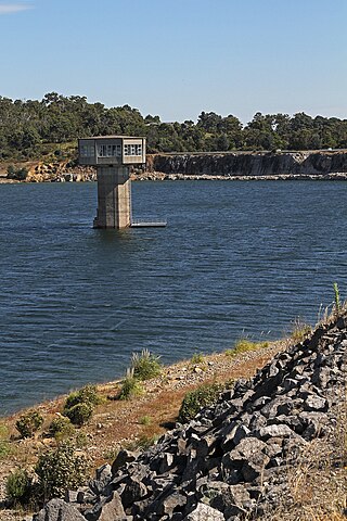
Cardinia Reservoir is an Australian man-made water supply saddle dam reservoir. The 287,000 ML water store is located in Emerald–Clematis–Dewhurst in south-eastern suburbs of Melbourne, Victoria. Construction started in May 1970 and was completed in 1973 at a cost of more than A$11.4 million. The dam that creates the impoundment is called the Cardinia Dam.

The Retezat Mountains are some of the highest massifs in Romania, being part of the Southern Carpathians. One of the important peaks is Păpuşa, with a height of 2,508 metres (8,228 ft).

The Autostrada A4, or Serenissima, is a motorway which connects Turin and Trieste via Milan and Venice. The city of Venice originally formed a bottleneck on the A4, but is now bypassed by the Passante di Mestre. The A4 passes just north of the city of Milan, where it is toll-free.
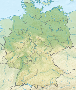
Germany is a country in Central and Western Europe that stretches from the Alps, across the North European Plain to the North Sea and the Baltic Sea. It is the second-most populous country in Europe after Russia, and is seventh-largest country by area in the continent. The area of Germany ranked 63rd and covers 357,021 km2 (137,847 sq mi), consisting of 349,223 km2 (134,836 sq mi) of land and 7,798 km2 (3,011 sq mi) of waters, smaller than Japan but larger than Republic of the Congo.

The Grigna is a mountain massif in the province of Lecco, Lombardy, northern Italy, with an elevation of 2,410 metres (7,907 ft). It is part of the Bergamo Alps, and it has two peaks, Grignone or Grigna settentrionale, the higher, and the lower Grignetta or Grigna meridionale (2,177 m).
The André-Michaux Ecological Reserve, or Réserve écologique André-Michaux, is an ecological reserve in Quebec, Canada. It protects a variety of vegetation types typically of the Canadian Shield.

The Olkaria Area is a region located immediately to the south of Lake Naivasha in the Great Rift Valley of Kenya, Africa. It is geothermally active and is being used to generate clean electric power. The region has an estimated potential of 2,000 MW. This is almost double the maximum daily electricity peak demand recorded in 2008/2009 for the entire country.
The Cauca Valley montane forests (NT0109) is an ecoregion in western Colombia. It covers the sides of the Cauca Valley, which runs from south to north between the Central and Western Ranges (cordilleras) of the Colombian Andes. The ecoregion is home to very diverse fauna and flora, due in part to its varied elevations and climates, in part to its position near the isthmus of Panama, the route along which North American species invaded South America and then diversified as they moved to the upper parts of the Andes. Little of the original habitat remains at lower levels, but higher up there are sizeable blocks of forest, some of which are protected.