Parecis plateau

Last updated

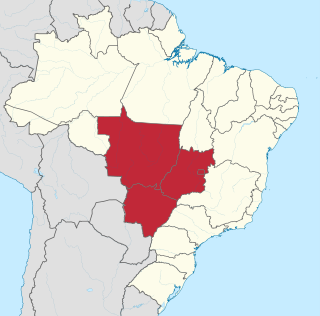
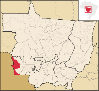
The Parecis plateau (Portuguese : Serra dos Parecis) is a plateau in the Brazilian state of Rondônia and adjacent west-central Mato Grosso. The municipality of Parecis is located at the plateau. Several large rivers have their origin on the plateau, notably the Guaporé, Ji-Paraná, Juruena and Paraguay River. The Mato Grosso Plateau is directly to the east of Parecis.

Portuguese language Romance language that originated in Portugal

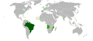
Portuguese is a Western Romance language originating in the Iberian Peninsula. It is the sole official language of Portugal, Brazil, Cape Verde, Guinea-Bissau, Mozambique, Angola, and São Tomé and Príncipe. It also has co-official language status in East Timor, Equatorial Guinea and Macau in China. As the result of expansion during colonial times, a cultural presence of Portuguese and Portuguese creole speakers are also found in Goa, Daman and Diu in India; in Batticaloa on the east coast of Sri Lanka; in the Indonesian island of Flores; in the Malacca state of Malaysia; and the ABC islands in the Caribbean where Papiamento is spoken, while Cape Verdean Creole is the most widely spoken Portuguese-based Creole. Reintegrationists maintain that Galician is not a separate language, but a dialect of Portuguese. A Portuguese-speaking person or nation is referred to as "Lusophone" (Lusófono).

Plateau An area of a highland, usually of relatively flat terrain

In geology and physical geography, a plateau, also called a high plain or a tableland, is an area of a highland, usually consisting of relatively flat terrain, that is raised significantly above the surrounding area, often with one or more sides with steep slopes. Plateaus can be formed by a number of processes, including upwelling of volcanic magma, extrusion of lava, and erosion by water and glaciers. Plateaus are classified according to their surrounding environment as intermontane, piedmont, or continental.

Brazil Federal republic in South America

Brazil, officially the Federative Republic of Brazil, is the largest country in both South America and Latin America. At 8.5 million square kilometers and with over 208 million people, Brazil is the world's fifth-largest country by area and the fifth most populous. Its capital is Brasília, and its most populated city is São Paulo. The federation is composed of the union of the 26 states, the Federal District, and the 5,570 municipalities. It is the largest country to have Portuguese as an official language and the only one in the Americas; it is also one of the most multicultural and ethnically diverse nations, due to over a century of mass immigration from around the world.

Related Research Articles

Mato Grosso State of Brazil

Mato Grosso is one of the states of Brazil, the third-largest by area, located in the western part of the country.

Central-West Region, Brazil Region in Brazil

The Central-West or Center-West Region of Brazil is composed of the states of Goiás, Mato Grosso and Mato Grosso do Sul; along with Distrito Federal, where Brazil's national capital, Brasília, is situated. This Region is right in the heart of Brazil, representing 18.86% of the national territory.

Juruena River river in Brazil

The Juruena River is a 1,240 km (770 mi) long river in west-central Brazil, in the state of Mato Grosso.

Sinop, Mato Grosso Municipality in Central-West, Brazil

Sinop is a city on the Brazilian state of Mato Grosso. The fourth-largest city in the state, its population in 2016 is estimated at more than 132,934 inhabitants, placing Sinop in 229th place in Brazil. It has an area of 3194.339 km ². A Sivam radar has been installed for monitoring the Amazon Basin. Also Embrapa has a branch in Sinop, the only one in the state of Mato Grosso. It is known as the Capital of Nortão, a major city of northern Mato Grosso.

The Mato Grosso Plateau is a plateau in central Brazil occupying most of the state of Mato Grosso. It contains mostly savanna and woodland. It is an ancient erosional plateau that extends from the border of Goiás state westward to the Parecis plateau, which lies near the Bolivian border. In the south it gives way to floodplains called the Pantanal.

Time in Brazil

Time in Brazil is calculated using standard time, and the country is divided into four standard time zones: UTC−02:00, UTC−03:00, UTC−04:00 and UTC−05:00.

Guaporé River river

Guaporé River is a river in western Brazil and northeastern Bolivia. It is 1,530 km (950 mi) long; 970 km (600 mi) of the river forms the border between Brazil and Bolivia.

Vila Bela da Santíssima Trindade Municipality in Central-West, Brazil

Vila Bela da Santíssima Trindade is a Brazilian municipality in Mato Grosso with 14,523 (2009) inhabitants. It is located at upper Guaporé River close to the border with Bolivia. It served as the capital of the Captaincy of Mato Grosso from 1752 to 1820.

The Parecis River is a river of Mato Grosso state in western Brazil.

Comodoro Municipality in Center-West, Brazil

Comodoro is a municipality in the state of Mato Grosso in the Central-West Region of Brazil.

Campo Novo do Parecis is a municipality in the state of Mato Grosso in the Central-West Region of Brazil.

Campos de Júlio is a municipality in the state of Mato Grosso in the Central-West Region of Brazil.

Primavera do Leste Municipality in Center-West, Brazil

Primavera do Leste is a municipality in the state of Mato Grosso in the Central-West Region of Brazil.

Conquista d'Oeste is a municipality in the state of Mato Grosso in the Central-West Region of Brazil.

Nova Lacerda is a municipality in the state of Mato Grosso in the Central-West Region of Brazil.

Vale de São Domingos is a municipality in the state of Mato Grosso in the Central-West Region of Brazil.

Guariba-Roosevelt Extractive Reserve

The Guariba-Roosevelt Extractive Reserve is an extractive reserve in the state of Mato Grosso, Brazil. A small traditional population live through fishing, hunting, small-scale agriculture and sale of forest products such as nuts. The reserve is under intense pressure from illegal logging and land grabbing.

Madeira-Tapajós moist forests

The Madeira-Tapajós moist forests (NT0135) is an ecoregion in the Amazon basin. It is part of the Amazon biome. The ecoregion extends southwest from the Amazon River between its large Madeira and Tapajós tributaries, and crosses the border into Bolivia. In the south it transitions into the cerrado biome of Mato Grosso. In the state of Rondônia it contains some of the most degraded land of the Amazon basin.

Parecis or Parecís may refer to:

References

    Coordinates: 14°00′00″S59°00′00″W / 14.0000°S 59.0000°W / -14.0000; -59.0000

    Geographic coordinate system Coordinate system

    A geographic coordinate system is a coordinate system that enables every location on Earth to be specified by a set of numbers, letters or symbols. The coordinates are often chosen such that one of the numbers represents a vertical position and two or three of the numbers represent a horizontal position; alternatively, a geographic position may be expressed in a combined three-dimensional Cartesian vector. A common choice of coordinates is latitude, longitude and elevation. To specify a location on a plane requires a map projection.