Related Research Articles

Murray County was one of the original Nineteen Counties in New South Wales and is now one of the 141 Lands administrative divisions of New South Wales. It included the area which is now part of Canberra and as far north as Lake George and Yass. It was originally bounded on the west by the Murrumbidgee River, on the east by the Shoalhaven River and on the north by the Yass River. A large area of the county was transferred to the Commonwealth government in 1909 in the Seat of Government Acceptance Act to make part of the Australian Capital Territory, along with land in Cowley County. Since then, the ACT border is now part of the western boundary. Part of the ACT border is determined by property boundaries in the Parish of Keewong, in the County of Murray; specifically the southern end of portions 177, 218, 211, 36, and 38. This is mentioned in the Seat of Government Acceptance Act of 1909.

Tuggeranong Parish is a parish of Murray County, New South Wales, a cadastral unit for use on land titles. It is now about a third of the size it was in the nineteenth century, after most of the land in the parish was transferred to the Australian Capital Territory in 1911. It currently includes a small section of land in New South Wales between the ACT border and Jerrabomberra Creek, but once included most of what is now the Canberra town centre of Tuggeranong.

Queanbeyan Parish is a parish of Murray County, New South Wales, a cadastral unit for use on land titles. It covers the city of Queanbeyan. It was originally bounded by the Molonglo River to the north, but is now bounded by the NSW-ACT border in the north and west. Parts of the western area of the parish were transferred to the Australian Capital Territory in 1909, including what are now the Canberra suburbs of Fyshwick, Narrabundah, Kingston, Oaks Estate, Harman and part of Hume.
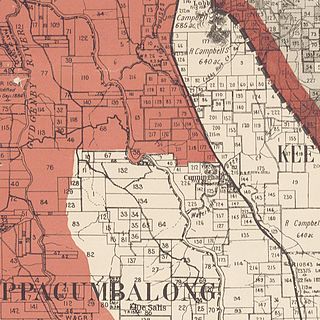
Keewong Parish is a parish of Murray County, New South Wales, a cadastral unit for use on land titles. A small part of the north-western end of the parish around 35°34′40″S149°07′28″E between the Murrumbidgee River and the Queanbeyan-Cooma railway line was transferred to the Australian Capital Territory in 1909. The southern ends of portions 177, 218, 211, 36, and 38 in the Parish of Keewong form part of the border of the ACT with New South Wales, which is mentioned in the Seat of Government Acceptance Act of 1909.
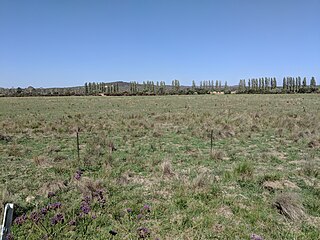
Wallaroo Parish is one of the 54 parishes of Murray County, New South Wales, a cadastral unit for use on land titles. It is bounded by the Murrumbidgee River in the west, Ginninderra Creek in the south and Gooromon Ponds in the east. The Australian Capital Territory has also formed a small part of the boundary since 1909, after a small part of land in the parish at 35°11′54″S149°00′00″E was transferred to the Commonwealth. This area is just to the west of Dunlop. The Wallaroo road is the main road in the area, which comes off the Barton Highway. The parish is similar to the locality of Wallaroo.

The parish of Doonside is an Australian cadastral parish in the NSW county of Narromine. It is located approximately midway between Tottenham and Narromine and is in Narromine Shire. The parish should not be confused with the western Sydney suburb of Doonside.
The parish of Algalah is an Australian cadastral parish in the NSW county of Narromine. It is located 367km west north west from Sydney approximately midway between Tottenham and Narromine and is in Narromine Shire, at 32°14′54″S147°49′04″E.
Biala, New South Wales is a civil parish of King County, New South Wales.
Nelanglo Parish is a civil parish of King County, New South Wales.
Rabnor Parish is a civil parish of King County, New South Wales. ).
Romner Parish is a civil parish of King County, New South Wales.
Winduella Parish is a civil parish of King County, New South Wales.
Ellenden Parish, is a civil parish of Murray County, New South Wales.
Ballallaba Parish is a civil parish of Murray County, New South Wales.
Larbert Parish is a civil parish of Murray County, New South Wales.
Monkellan Parish is a civil parish of Murray County, New South Wales.
Molonglo Parish, New South Wales is a civil parish of Murray County.
Jinglemoney Parish is a civil parish of Murray County, New South Wales. It is located around Bombay on Bombay Creek, a tributary of the Shoalhaven River in the Queanbeyan–Palerang Regional Council.

Napier is a rural locality of Warrumbungle Shire Council and a civil parish of Napier County New South Wales. and is at 31°35′54″S149°46′04″E.

Baby, New South Wales is a bounded rural locality and a civil parish of Gowen County, in New South Wales.
References
- ↑ Robert McLean, The New atlas of Australia : the complete work containing over one hundred maps and full descriptive geography of New South Wales, Victoria, Queensland, South Australia and Western Australia, together with numerous illustrations and copious indices (Sydney :J. Sands, [1886) Map 11.
- ↑ "Currandooly Parish". Geographical Names Register (GNR) of NSW. Geographical Names Board of New South Wales.

| This Southern Tablelands geography article is a stub. You can help Wikipedia by expanding it. |