Parish of Numby

Last updated

Numby, New South Wales is a civil parish of King County, New South Wales. [1] [2]

Lands administrative divisions of Australia

Lands administrative divisions of Australia are the cadastral divisions of Australia for the purposes of identification of land to ensure security of land ownership. Most states term these divisions as counties, parishes, hundreds, and other terms. The eastern states of Queensland, New South Wales, Victoria and Tasmania were divided into counties and parishes in the 19th century, although the Tasmanian counties were renamed land districts in the 20th century. Parts of South Australia (south-east) and Western Australia (south-west) were similarly divided into counties, and there were also five counties in a small part of the Northern Territory. However South Australia has subdivisions of hundreds instead of parishes, along with the Northern Territory, which was part of South Australia when the hundreds were proclaimed. There were also formerly hundreds in Tasmania. There have been at least 600 counties, 544 hundreds and at least 15,692 parishes in Australia, but there are none of these units for most of the sparsely inhabited central and western parts of the country.

King County, New South Wales Cadastral in New South Wales, Australia

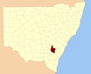
King County was one of the original Nineteen Counties in New South Wales and is now one of the 141 Cadastral divisions of New South Wales. It is in the area to the east of Yass. The northern part of it lies between the Lachlan River and the Boorowa River, including the locations of Frogmore, Taylors Flat, Gunnary, Rugby and Rye Park. The Crookwell River is also part of the northern boundary. The Yass River is the southern boundary.

The parish is at 34°08′54″S148°58′04″E / 34.14833°S 148.96778°E / -34.14833; 148.96778 Coordinates: 34°08′54″S148°58′04″E / 34.14833°S 148.96778°E / -34.14833; 148.96778 on the Lachlan River, near Bigga.

Civil parish Territorial designation and lowest tier of local government in England

In England, a civil parish is a type of administrative parish used for local government, they are a territorial designation which is the lowest tier of local government below districts and counties, or their combined form, the unitary authority. Civil parishes can trace their origin to the ancient system of ecclesiastical parishes which historically played a role in both civil and ecclesiastical administration; civil and religious parishes were formally split into two types in the 19th century and are now entirely separate. The unit was devised and rolled out across England in the 1860s.

Geographic coordinate system Coordinate system

A geographic coordinate system is a coordinate system that enables every location on Earth to be specified by a set of numbers, letters or symbols. The coordinates are often chosen such that one of the numbers represents a vertical position and two or three of the numbers represent a horizontal position; alternatively, a geographic position may be expressed in a combined three-dimensional Cartesian vector. A common choice of coordinates is latitude, longitude and elevation. To specify a location on a plane requires a map projection.

Lachlan River tributary to the Murrumbidgee River in New South Wales, Australia

The Lachlan River is an intermittent river that is part of the Murrumbidgee catchment within the Murray–Darling basin, located in the Southern Tablelands, Central West, and Riverina regions of New South Wales, Australia.

Related Research Articles

Wallaroo Parish is one of the 54 parishes of Murray County, New South Wales, a cadastral unit for use on land titles. It is bounded by the Murrumbidgee River in the west, Ginninderra Creek in the south and Gooromon Ponds in the east. The Australian Capital Territory has also formed a small part of the boundary since 1909, after a small part of land in the parish at 35°11′54″S149°00′00″E was transferred to the Commonwealth. This area is just to the west of Dunlop. The Wallaroo road is the main road in the area, which comes off the Barton Highway. The parish is similar to the locality of Wallaroo.

Illalong is a rural locality just off the Burley Griffin Way in south New South Wales.

Frost Parish is a civil parish of Narromine County, New South Wales

Goobarragandra, New South Wales is a rural locality in the Snowy Mountains west of Canberra, Australia.

Wyangle, New South Wales is a bounded rural locality west of Canberra, Australia and about 16 km. north-east of Tumut.

Yarrangobilly, New South Wales is a rural locality in the Snowy Mountains, west of Canberra, Australia, and is also a civil Parish of Buccleuch County.

Biala, New South Wales is a civil parish of King County, New South Wales.

Olney Parish, New South Wales is a civil parish of King County, New South Wales.

Rabnor Parish is a civil parish of King County, New South Wales. ).

Romner Parish is a civil parish of King County, New South Wales.

Winduella Parish is a civil parish of King County, New South Wales.

Nattung, New South Wales is a civil parish of Cowley County, New South Wales. Nattung is in the Snowy Monaro Regional Council at 35°44′54″S148°36′04″E. It lies in the headwaters of the Murrumbidgee River and in the Kosciuszko National Park. It is uninhabited.

Birrema, New South Wales

Birrema, New South Wales is a civil parish of Harden County, New South Wales.

Childowla, New South Wales is a civil parish of Buccleuch County, New South Wales.

Currawong, New South Wales, is rural locality of Hilltops Council and is a civil parish of Harden County, New South Wales.

Coppabella, New South Wales

Coppabella, New South Wales is a rural locality of Hilltops Council and a civil parish of Harden County, New South Wales.

Cowcumbala, New South Wales

Cowcumbala, New South Wales is a rural locality and civil parish of Harden County, New South Wales.

Bramina is a rural locality of the Snowy Mountains and a civil parish of Buccleuch County, New South Wales.

Weemabah is a civil parish of Narromine County located at 32°00′54″S 148°11′04″E, a cadastral division of New South Wales.

Backwater is a civil parish of Narromine County, New South Wales

References

  1. Robert McLean, The New atlas of Australia : the complete work containing over one hundred maps and full descriptive geography of New South Wales, Victoria, Queensland, South Australia and Western Australia, together with numerous illustrations and copious indices (Sydney :J. Sands, [1886) Map 11.
  2. "Numby Parish". Geographical Names Register (GNR) of NSW. Geographical Names Board of New South Wales . Retrieved 17 April 2018. OOjs UI icon edit-ltr-progressive.svg