Four Crosses is a village in Montgomeryshire in northern Powys, mid Wales, close to the border with Shropshire. It is in the community of Llandysilio. It lies on the A483 road which now bypasses the village to the west.

Ópusztaszer is a village in Csongrád county, in the Southern Great Plain region of southern Hungary. It is most known as the location of the Ópusztaszer National Heritage Park.
Targyailing is a village and township in the Tibet Autonomous Region of China.

Żednia is a village in the administrative district of Gmina Michałowo, within Białystok County, Podlaskie Voivodeship, in north-eastern Poland, close to the border with Belarus. It lies approximately 10 kilometres (6 mi) north-west of Michałowo and 22 km (14 mi) east of the regional capital Białystok.
Kowalewo is a village in the administrative district of Gmina Kolno, within Kolno County, Podlaskie Voivodeship, in north-eastern Poland. It lies approximately 13 kilometres (8 mi) north-east of Kolno and 83 km (52 mi) north-west of the regional capital Białystok.
Żerczyce is a village in the administrative district of Gmina Nurzec-Stacja, within Siemiatycze County, Podlaskie Voivodeship, in north-eastern Poland, close to the border with Belarus. It lies approximately 3 kilometres (2 mi) north of Nurzec-Stacja, 17 km (11 mi) north-east of Siemiatycze, and 71 km (44 mi) south of the regional capital Białystok.

Doshulu is a village in the Fizuli Rayon of Azerbaijan.
Wyżyce is a village in the administrative district of Gmina Drwinia, within Bochnia County, Lesser Poland Voivodeship, in southern Poland. It lies approximately 4 kilometres (2 mi) south-east of Drwinia, 12 km (7 mi) north of Bochnia, and 40 km (25 mi) east of the regional capital Kraków.
Dłużniewo Duże is a village in the administrative district of Gmina Staroźreby, within Płock County, Masovian Voivodeship, in east-central Poland. It lies approximately 8 kilometres (5 mi) north-east of Staroźreby, 29 km (18 mi) north-east of Płock, and 80 km (50 mi) north-west of Warsaw.
Budy Kraszewskie is a village in the administrative district of Gmina Raciąż, within Płońsk County, Masovian Voivodeship, in east-central Poland. It lies approximately 5 kilometres (3 mi) north-west of Raciąż, 29 km (18 mi) north-west of Płońsk, and 92 km (57 mi) north-west of Warsaw.
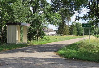
Chyczewo is a village in the administrative district of Gmina Raciąż, within Płońsk County, Masovian Voivodeship, in east-central Poland. It lies approximately 6 kilometres (4 mi) south-west of Raciąż, 24 km (15 mi) north-west of Płońsk, and 85 km (53 mi) north-west of Warsaw.
Cieciersk is a village in the administrative district of Gmina Raciąż, within Płońsk County, Masovian Voivodeship, in east-central Poland. It lies approximately 3 kilometres (2 mi) west of Raciąż, 27 km (17 mi) north-west of Płońsk, and 89 km (55 mi) north-west of Warsaw.
Olunin is a village in the administrative district of Gmina Iłów, within Sochaczew County, Masovian Voivodeship, in east-central Poland. It lies approximately 5 kilometres (3 mi) south-east of Iłów, 15 km (9 mi) north-west of Sochaczew, and 64 km (40 mi) west of Warsaw.
Doşulu is a village in the Jabrayil Rayon of Azerbaijan.
Dębogóra is a village in the administrative district of Gmina Czerwonak, within Poznań County, Greater Poland Voivodeship, in west-central Poland. It lies approximately 8 kilometres (5 mi) east of Czerwonak and 15 km (9 mi) north-east of the regional capital Poznań. It has about 100 inhabitants.
Piecuchy is a village in the administrative district of Gmina Szczytno, within Szczytno County, Warmian-Masurian Voivodeship, in northern Poland. It lies approximately 11 kilometres (7 mi) south-east of Szczytno and 51 km (32 mi) south-east of the regional capital Olsztyn.
Drahouš is a village and municipality in Rakovník District in the Central Bohemian Region of the Czech Republic.

Kušići is a village in the municipality of Ivanjica, Serbia. It is located on the slopes of Javor mountain, about 25 km from Ivanjica and 220 km from Belgrade and is 990m above sea level. According to the 2011 census, the village has a population of 498 inhabitants.
Sadad is a coastal village situated on the western shore of Bahrain. It is situated to the south of Malkiya and to the west of Hamad Town, in the Northern Governorate administrative region of the country.


