Related Research Articles

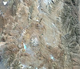
Nevado Ojos del Salado is a dormant complex volcano in the Andes on the Argentina–Chile border. It is the highest volcano on Earth and the highest peak in Chile. The upper reaches of Ojos del Salado consist of several overlapping lava domes, lava flows and volcanic craters, with sparse ice cover. The complex extends over an area of 70–160 square kilometres (27–62 sq mi) and its highest summit reaches an altitude of 6,893 metres (22,615 ft) above sea level. Numerous other volcanoes rise around Ojos del Salado.

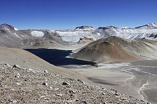
Licancabur is a stratovolcano on the border between Bolivia and Chile, south of the Sairecabur volcano and west of Juriques. Part of the Andean Central Volcanic Zone, it has a prominent, 5,916-metre (19,409 ft)-high cone. A 400-metre (1,300 ft) summit crater containing Licancabur Lake, a crater lake which is among the highest lakes in the world, caps the volcano. Three stages of lava flows emanate from the edifice.

Socompa is a large stratovolcano at the border of Argentina and Chile with an elevation of 6,051 metres (19,852 ft) metres. Part of the Chilean and Argentine Andean Volcanic Belt (AVB), it is part of the Central Volcanic Zone, one of the various segments of the AVB. This part of the Andean volcanic arc begins in Peru and runs first through Bolivia and Chile, and then through Argentina and Chile, and contains about 44 active volcanoes. Socompa lies close to the pass of the same name, where the Salta-Antofagasta railway crosses the border.
Viedma is a subglacial volcano whose existence is questionable. It is supposedly located below the ice of the Southern Patagonian Ice Field, an area disputed between Argentina and Chile. The 1988 eruption deposited ash and pumice on the ice field and produced a mudflow that reached Viedma Lake. The exact position of the edifice is unclear, both owing to the ice cover and because the candidate position, the "Viedma Nunatak", does not clearly appear to be of volcanic nature.

Monte Pissis is an extinct volcano on the border of the La Rioja and Catamarca provinces in Argentina, 25 km (16 mi) to the east of the Chilean border and about 550 km (340 mi) north of Aconcagua. The mountain is the third-highest in the Western Hemisphere. Monte Pissis is named after Pedro José Amadeo Pissis, a French geologist who worked for the Chilean government. Due to its location in the Atacama Desert, the mountain has very dry conditions but features an extensive glacier, with crevasses, which is unique in the region.

Incahuasi is a volcanic mountain in the Andes of South America. It lies on the border of the Catamarca Province of Argentina and the Atacama Region of Chile. Incahuasi has a summit elevation of 6,621 metres (21,722 ft) above sea level.

Cerro Galán is a caldera in the Catamarca Province of Argentina. It is one of the largest exposed calderas in the world and forms part of the Central Volcanic Zone of the Andes, one of the three volcanic belts found in South America. One of several major caldera systems in the Central Volcanic Zone, the mountain is grouped into the Altiplano–Puna volcanic complex.

Nevado San Francisco, or Cerro San Francisco, is a stratovolcano on the border between Argentina and Chile, located just southeast of San Francisco Pass. It is considered extinct and is one of the several 6,000 m (19,700 ft) peaks in the area, of which the chief is the Ojos del Salado. It is on the border of 2 provinces: Argentinean province of Catamarca; Chilean province of Copiapo.

Los Patos is a mountain in the Andes mountain range of South America. The peak is located on the international border of the Catamarca Province of Argentina and the Atacama Region of Chile. It has a summit elevation of 6,239 metres (20,469 ft).

Cerro Araral is an extinct volcano located in the Andes on the border between Chile and Bolivia in the Potosí Department and in the Antofagasta Region. It has a height of 5647 metres, rising over a base of 3900 metres and covers an area of 109.4 square kilometres (42.2 sq mi). The edifice has a volume of 43.4 cubic kilometres (10.4 cu mi), down from 47.2 cubic kilometres (11.3 cu mi) due to erosion. Based on the erosion rate, the volcano is 1.9-2.75 and forms an alignment with Cerro Ascotan. Its formation may be linked to the Altiplano-Puna Magma Body, which appear to have contributed to part of Araral's magmas. The modern snowline on the mountain lies at more than 5,700 metres (18,700 ft) altitude. There are archeological sites at its base and on its flanks. The volcanism is at first andesitic and later becomes intermediary between andesite and basalt, with olivine, plagioclase and pyroxene.

La Pacana is a Miocene age caldera in northern Chile's Antofagasta Region. Part of the Central Volcanic Zone of the Andes, it is part of the Altiplano-Puna volcanic complex, a major caldera and silicic ignimbrite volcanic field. This volcanic field is located in remote regions at the Zapaleri tripoint between Chile, Bolivia and Argentina.

Incapillo is a Pleistocene-age caldera in the La Rioja Province of Argentina. It is the southernmost volcanic centre in the Andean Central Volcanic Zone (CVZ) that erupted during the Pleistocene. Incapillo is one of several ignimbrite or caldera systems that, along with 44 active stratovolcanoes, are part of the CVZ.
Jotabeche is a Miocene-Pliocene caldera in the Atacama Region of Chile. It is part of the volcanic Andes, more specifically of the extreme southern end of the Central Volcanic Zone (CVZ). This sector of the Andean Volcanic Belt contains about 44 volcanic centres and numerous more minor volcanic systems, as well as some caldera and ignimbrite systems. Jotabeche is located in a now inactive segment of the CVZ, the Maricunga Belt.

Acamarachi is a 6,046-metre (19,836 ft) high volcano in northern Chile. In this part of Chile, it is the highest volcano. Its name means "black moon". It is a volcano in the Central Volcanic Zone of the Andes, a zone of strong volcanic activity during the last million years. Old volcanoes in the area are well-preserved, due to the dry climate.
Doña Ines is a volcano in Chile. It is a Miocene age stratovolcano which is formed from lava domes that form its summit area and nuee ardente deposits which form the flanks of the volcano.

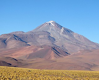
Llullaillaco is a dormant stratovolcano at the border of Argentina and Chile. It lies in the Puna de Atacama, a region of tall volcanic peaks on a high plateau close to the Atacama Desert, one of the driest places in the world. It is the second highest active volcano in the world after Ojos del Salado.
Cerros Bravos-Barros Negros is a volcanic complex in the Maricunga Belt in Chile. This 200-kilometre-long (120 mi) volcanic belt formed during the Oligocene-Miocene west of the Puna; the present-day Central Volcanic Zone lies northeast of the Maricunga Belt.
Ojos de Maricunga is a volcano in the Maricunga Belt of Chile, in the Cordillera Domeyko.(Muñoz 1894, p. 51)
Wheelwright caldera is a caldera in Chile. It is variously described as being between 11 kilometres (6.8 mi) and 22 kilometres (14 mi) wide and lies in the Central Volcanic Zone of the Andes. A lake lies within the caldera, which is among the largest of the Central Andes. The caldera lies in the region of Ojos del Salado, the world's tallest volcano.

Nevado Tres Cruces is a massif of volcanic origin in the Andes Mountains on the border of Argentina and Chile. It has two main summits, Tres Cruces Sur at 6,748 metres (22,139 ft) and Tres Cruces Centro at 6,629 m (21,749 ft) and a third minor summit, Tres Cruces Norte 6,030 m (19,780 ft). Tres Cruces Sur is the sixth highest mountain in the Andes.
References
- 1 2 3 Gonzalez-Ferran, Baker & Rex 1985, p. 431.
- 1 2 Mpodozis et al. 1995, p. 289.
- ↑ Moyano, Ricardo (2009). "El adoratorio del cerro El Potro: Arqueología de alta montaña en la cordillera de Copiapó, norte de Chile". Estudios Atacameños (in Spanish) (38): 39–54. doi:10.4067/S0718-10432009000200004. ISSN 0718-1043.
- ↑ Gonzalez-Ferran, Baker & Rex 1985, p. 436.
- ↑ Mpodozis et al. 1995, p. 278.
- ↑ Sillitoe, Richard H. (1994-10-01). "Erosion and collapse of volcanoes: Causes of telescoping in intrusion-centered ore deposits". Geology. 22 (10): 945–948. Bibcode:1994Geo....22..945S. doi:10.1130/0091-7613(1994)022<0945:EACOVC>2.3.CO;2. ISSN 0091-7613.
Sources
- Gonzalez-Ferran, O.; Baker, P.E.; Rex, D.C. (1985). "Tectonic-volcanic discontinuity at latitude 27° south Andean Range, associated with Nazca Plate Subduction". Tectonophysics. 112 (1–4): 423–441. Bibcode:1985Tectp.112..423G. doi:10.1016/0040-1951(85)90189-1.
- Mpodozis, Constantino; Cornejo, Paula; Kay, Suzanne M.; Tittler, Andrew (1995-12-01). "La Franja de Maricunga: sintesis de la evolucion del Frente Volcanico Oligoceno-Mioceno de la zona sur de los Andes Centrales". Andean Geology (in Spanish). 22 (2): 273–313. ISSN 0718-7106.