Pat, Jerusalem

Last updated
Goren-Goldstein park and the bilingual school (left) in Pat, 2007 Pat Jerusalem 10-2007.JPG
Goren-Goldstein park and the bilingual school (left) in Pat, 2007

Pat is a neighborhood in southwestern Jerusalem, located between Katamon in the north and Beit Safafa in the south.

Contents

History

The Pat neighborhood is named for Yaacov Pat, a commander of the Haganah. [1]

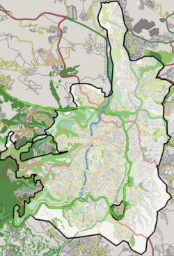
Pat was the last of the Katamonim neighborhoods built in the 1950s to provide housing for residents of the Maabara transit camps and other socio-economically weak populations. The main thoroughfare is Yaacov Pat Street, which separates it from Katamon Het.

In the 1990s, under the auspices of "Project Renewal," apartment blocks in Pat were expanded and faced with Jerusalem stone. The construction of Malha Mall, Teddy Stadium and the Jerusalem Railway Station, which are all near Pat, along with the development of the Talpiot industrial zone and the construction of the Begin Expressway, have increased property values.

Education and culture

Institutions include a religious high school – ORT Spanian, Pat community center [2] and a branch of Mishmar HaEzrahi. Also located in Pat is the WIZO Institute, a Tipat Halav mother and child station, and the Nishmat Torah institute for women. [3]

In 1981, the Jerusalem Foundation established a park and sports center on an area of 45 dunams that includes a Jerusalem Pine grove, a playground and sports facilities. In 2005-2007, the park was renovated and renamed the Mama Betty Park and Sports Center. [4]

In 2007, the Max Rayne School, a bilingual Hebrew–Arabic school was founded in Pat, open to all Jewish and Arab children in Jerusalem. [5]

Pat panorama ShchunatPat.jpg
Pat panorama

Related Research Articles

Northridge is a neighborhood in the San Fernando Valley region of the City of Los Angeles. The community is home to California State University, Northridge, and the Northridge Fashion Center.

Cedar Hills, Oregon Census-designated place in Oregon, United States

Cedar Hills is a census-designated place and neighborhood in Washington County, Oregon, United States south of U.S. Route 26 and west of Oregon Route 217 and within the Portland metropolitan area. Constructed starting in 1946, Cedar Hills was the largest single housing tract development in the western United States at the time of its completion in 1961.

Pisgat Zeev Israeli settlement in East Jerusalem

Pisgat Ze'ev is an Israeli settlement in East Jerusalem and the largest residential neighborhood in Jerusalem with a population of over 50,000. Pisgat Ze'ev was established by Israel as one of the city's five Ring Neighborhoods on land effectively annexed after the 1967 Six-Day War.

German Colony, Jerusalem Neighborhood in Jerusalem, originally built by the German Templars

The German Colony is a neighborhood in Jerusalem, established in the second half of the 19th century as a German Templer Colony in Palestine. Today the Moshava, as it is popularly known, is an upscale neighborhood bisected by Emek Refaim Street, an avenue lined with trendy shops, restaurants and cafes.

Katamon Neighborhood in Jerusalem

Katamon or Qatamon is a neighbourhood in south-central Jerusalem. The official Hebrew name, Gonen, is mainly used in municipal publications. Katamon is derived from the Greek κατὰ τῷ μοναστηρίῳ.

Gilo Neighborhood and Israeli settlement in East Jerusalem

Gilo is an Israeli settlement in south-western East Jerusalem, with a population of 30,000, mostly Jewish inhabitants. Although it is located within the Jerusalem Municipality, it is widely considered a settlement, because as one of the five Ring Neighborhoods built by Israel surrounding Jerusalem, it was built on land in the West Bank that was occupied by and effectively annexed to Israel following the 1967 Six-Day War and 1980 Jerusalem Law.

Highway 50 (Israel–Palestine)

Highway 50, officially called Begin Boulevard and also referred to as Menachem Begin Expressway or Begin Highway, is an urban freeway in western Jerusalem named after Israel's sixth Prime Minister, Menachem Begin. Local Jerusalemites simply refer to it as 'Begin'. It continues into the Palestinian territories.

Nishmat: The Jeanie Schottenstein Center for Advanced Torah Study for Women is a Modern Orthodox Jewish institution of higher Torah learning for women, or midrasha. It was one of the first educational frameworks to teach Talmud to women. It is a pioneer in certification of women as Yoatzot Halacha, experts in the intersection of women's health and Halacha. Nishmat opened in the Kiryat Moshe neighborhood of Jerusalem and later moved to Bayit VeGan. It is currently located in the Pat neighborhood of Jerusalem.

Hapoel Katamon Jerusalem F.C. Israeli football club

Hapoel Katamon Jerusalem F.C. was the name of the club that is called Hapoel Jerusalem, an Israeli fan-owned association football club in Jerusalem. It was conceived and founded in 2007 by Hapoel Jerusalem fans unhappy with the team's management.

Hand in Hand: Center for Jewish-Arab Education in Israel is a network of integrated, bilingual schools for Jewish and Arab children in Israel. Hand in Hand was co-founded by Israeli Arab educator Amin Khalaf and Israeli American educator Lee Gordon in 1997 with 50 students at two campuses.

Beit Safafa Palestinian town

Beit Safafa is a Palestinian town along the Green Line, with the vast majority of its territory in East Jerusalem and some northern parts in West Jerusalem.

Kiryat Shmuel, Jerusalem

Kiryat Shmuel is a neighborhood in central West Jerusalem founded in 1926. It is named for Rabbi Shmuel Salant, the Ashkenazi Chief Rabbi of Jerusalem in 1878-1909. Kiryat Shmuel is located between Rehavia and Katamon.

Rassco (neighborhood) Neighborhood of Jerusalem in Jerusalem District, Israel

Rassco is a neighborhood in central Jerusalem, built by the Rassco housing company. Rassco is located between Rehavia and Katamon.

Ras al-Amud Neighborhood in East Jerusalem

Ras al-Amud is a Palestinian neighborhood in East Jerusalem, located southeast of the Old City of Jerusalem, overlooking the Palestinian neighborhoods of Silwan to the south and Abu Dis and al-Eizariya to the east, and bordering the Jewish neighborhood of Ma'ale HaZeitim to the north, which overlooks the Temple Mount. There were about 11,922 Arabs living in the neighborhood in 2003.

Baka, Jerusalem

Baka is a neighborhood in southern Jerusalem. The official name is Geulim, which is mainly used on road signs.

Greek Colony, Jerusalem

The Greek Colony is a neighborhood in Jerusalem, bordering the German Colony and Katamon.

Yaacov Pat was a commander of the Haganah in Mandatory Palestine.

Jerusalem Road 20

Jerusalem Road 20 is a combination of existing roads and new construction creating a continuous route between Jerusalem's Highway 50 and Pisgat Ze'ev via Beit Hanina. The number "20" is a designation used by the Jerusalem Municipality. Several segments of the road follow national road 4197. The cost of the project was NIS 180 million and was completed on 5 May 2013.

Train Track Park

Train Track Park is a rail trail urban park in West Jerusalem. Featuring 7 kilometres (4.3 mi) of walking and biking trails, the park follows the route of the original Jaffa–Jerusalem railway from the Jerusalem Railway Station near the German Colony to Teddy Stadium in Malha. The park is built over – and incorporates in its design – the original railway tracks installed in 1892 and used through 1998. The park has been noted as a symbol of coexistence in the divided city, as it passes through Jewish and Arab neighborhoods and is used by residents of both.

City of David (Silwan) Palestinian village and Israeli settlement site

City of David (Silwan) is the Wadi Hilweh area of the Palestinian Arab village of Silwan, intertwined with an Israeli settlement. The Silwan area of East Jerusalem was annexed by Israel following the 1967 Six-Day War and 1980 Jerusalem Law, an action not recognized internationally. The international community regards Israeli settlements as illegal under international law, although Israel disputes this.

References

  1. "Jerusalem street names". Jerusalem.muni.il. 1957-12-30. Archived from the original on 2011-06-17. Retrieved 2013-12-05.
  2. Pat community center Archived July 25, 2008, at the Wayback Machine
  3. "Midreshet Nishmat". Nishmat.net. Retrieved 2013-12-05.
  4. "Jerusalem: Pat Neighhborhood". Goldstein-goren.org. Archived from the original on 2004-06-25. Retrieved 2013-12-05.
  5. "Max Rayne Hand In Hand Jerusalem School". Handinhandk12.org. Archived from the original on 2018-05-24. Retrieved 2013-12-05.

Coordinates: 31°45′02″N35°12′01″E / 31.750684°N 35.200375°E / 31.750684; 35.200375