From HebrewRamah, "The Hill". In Arabic: "Stagnant water"[2]
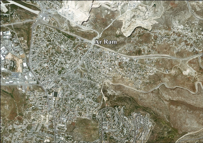
Al-Ram (Arabic: الرّام), also transcribed as Al-Ramm, El-Ram, Er-Ram, and A-Ram, is a Palestinian town which lies northeast of Jerusalem, just outside the city's municipal border. The village is part of the built-up urban area of Jerusalem, the Atarot industrial zone and Beit Hanina lie to the west, and Neve Yaakov borders it on the south,[3] with a built-up area of 3,289 dunums. According to the Palestinian Central Bureau of Statistics, a-Ram had a population of 15,814 in 2017.[1] The head of A-Ram's village council estimates that 58,000 people live there, more than half of them holding Israeli identity cards.[4]
Ossuaries dated to the first century BC and CE were discovered at Al-Ram bearing Hebrew inscriptions with names such as Miriam, Yehohanan, and Shimon ben Zekhariya.[10]
Crusader period
In Crusader sources, Al-Ram was named Aram, Haram, Rama, Ramatha, Ramitta, or Ramathes.[11] Al-Ram was one of 21 villages given by Godfrey of Bouillon (r. 1099–1100) as a fief to the Church of the Holy Sepulchre.[12][13] All the inhabitants of the village who were mentioned in Crusader sources between 1152 and 1160 had names which imply they were Christian.[14][15] The village was mentioned around 1161, when a dispute about a land boundary was settled.[15][16]
In 1838, Edward Robinson found the village to be very poor and small, but large stones and scattered columns indicated that it had previously been an important place.[5] In 1870 the French explorer Victor Guérin found the village to have 200 inhabitants,[18] while an Ottoman village list of about the same year showed that Er-Ram had 32 houses and a population of 120, though the population count included men only.[19][20]
In 1883, the PEF's Survey of Western Palestine described Er-Ram as a "small village in a conspicuous position on the top of a white hill, with olives. It has a well to the south. [..] The houses are of stone, partly built of old material".[21] "West of the village is a good birkeh with a pointed vault; lower down the hill a pillar-shaft broken in two, probably from the church. On the hill are cisterns. Drafted stones are used up in the village walls. At Khan-er-Ram, by the main road, is a quarry with half-finished blocks still in it, and two cisterns. The Khan appears to be quite modern, and is in ruins. There are extensive quarries on the hill-sides near it."[22]
In 1896, the population of Er-Ram was estimated to be about 240 persons.[23]
In a survey in 1945, Al-Ram had a population of 350, all Muslims,[27] and a total land area of 5,598 dunams.[28] 441 dunams were designated for plantations and irrigable land, 2,291 for cereals,[29] while 14 dunams were built-up area.[30]
The population in a 1967 census conducted by the Israeli authorities was 860, 86 of whom originated from the Israeli territory.[32]
According to ARIJ, after the 1995 accords, 33.2% (or about ~2,226 dunums) of Al-Ram's land is classified as Area B land, while the remaining 66.8% (~4,482 dunums) was defined as Area C.[33] Israel has confiscated land from Al-Ram in order to build two Israeli settlement/Industrial parks:
56 dunums were taken for the industrial Atarot site.[34]
In 2006, the Israeli High Court rejected three petitions objecting to the construction of a security barrier separating Al-Ram from Jerusalem.[35] The route of the fence planned to encircle northern Jerusalem has been revised several times. The latest plan, effectively implemented, called for a "minimalist" route following the municipal boundary at a distance of several hundred meters. This has left the town of Al-Ram almost entirely outside of the fence, with the exception of the southern part of the town, called Dahiyat al-Barid.[36][37]
Archaeology
Neolithic mask
The Survey of Western Palestine mentions that Dr. Chaplin, who had visited er-Ram with an interest for archaeological remains, had "a very curious stone mask... in his possession, obtained from the village. It represents a human face without hair or beard, the nose well-cut, the eyes and mouth very feebly designed. The mask is hollowed out behind, and has two deep holes at the back as if to fix it to a wall. It is over a foot in longer diameter, and curiously resembles some of the faces of the Moabite collection of Mr. Shapira. There cannot well be any question of its genuine character, and nothing like it has been found, so far as I know, in Palestine."[22][38] By 2018, a total of 15 such stone masks from the Pre-Pottery Neolithic B period have been discovered in the Southern Levant, one known to have had been bought in the late 19th century from villagers in Er-Ram and now kept at the Palestine Exploration Fund in London.[39]
Two Crusader structures have been identified in the town.
Tower
Archaeologists have identified the ruins of a Crusader courtyard building developed from an initial tower, as the grange of a Frankish new town founded by 1160.[41]
Former Crusader church
19th-century drawing of a lintel from a Crusader church, repurposed as a maqam
In 1838, Robinson noted that "A small mosk with columns seems once to have been a church".[5]
In 1870, Guérin described "a mosque, replacing a former Christian church, of which it occupies the choir; the inhabitants venerate there the memory of Shaykh Hasen. The columns of this sanctuary come from the church."[43]
In 1881, Lieutenant Conder reported: "At the shrine which is so conspicuous near this village are remains of a former chapel. The lintel stone (as it would seem), with a bas-relief of rosettes, has been found by Dr. Chaplin within the building."[22][38]
In 1883, SWP noted that "west of the village is the Mukam of Sheik Hasein, once a small Christian basilica". It further described it as "The remains of the north aisle 6 feet 8 inches wide, are marked by four columns 2 feet in diameter. The chamber of the saint's tomb occupies part of the nave, and into its north wall the lintel of the old door is built, a stone 10 feet long, half of which is visible, with designs as shown. In the courtyard east of this chamber is an old well of good water and a fine mulberry-tree. In the west wall of the Mukam other stones, with discs in low relief, are built in."[22]
↑ Finkelstein, I. (2008). Archaeology and the List of Returnees in the Books of Ezra and Nehemiah. Palestine Exploration Quarterly, 140(1), p. "Ramah is unanimously identified with the village of er-Ram north of Jerusalem. Only one modern survey was conducted at the site — by Feldstein et al. (1993, 168–169). They collected a large number of 359 sherds, of which 20% date to the Iron II, 2% to the Persian period and 13% to the Hellenistic period. This means that the site was strongly inhabited in the Iron II, that it declined in the Persian period, and that it recovered in the Hellenistic period. Ramah appears in the list of towns of Benjamin (Joshua 18.25) which dates to the late 7th century BCE (Alt 1925; Na’aman 1991) and in the book of Jeremiah (31.15; 40.1)."
↑ Corpus inscriptionum Iudaeae/Palaestinae: a multi-lingual corpus of the inscriptions from Alexander to Muhammad. Vol.IV: Iudaea / Idumaea. Eran Lupu, Marfa Heimbach, Naomi Schneider, Hannah Cotton. Berlin: de Gruyter. 2018. pp.231–233. ISBN978-3-11-022219-7. OCLC663773367.{{cite book}}: CS1 maint: others (link)
↑ Government of Palestine, Department of Statistics. Village Statistics, April, 1945. Quoted in Hadawi, 1970, p. 58Archived 2018-11-03 at the Wayback Machine
↑ Government of Palestine, Department of Statistics. Village Statistics, April, 1945. Quoted in Hadawi, 1970, p. 104Archived 2012-03-14 at the Wayback Machine
↑ Government of Palestine, Department of Statistics. Village Statistics, April, 1945. Quoted in Hadawi, 1970, p. 154Archived 2014-04-27 at the Wayback Machine
↑ Government of Jordan, Department of Statistics, 1964, p. 23
This page is based on this Wikipedia article Text is available under the CC BY-SA 4.0 license; additional terms may apply. Images, videos and audio are available under their respective licenses.


