Al-Judeira

Last updated

Contents

Al-Judeira
Arabic transcription(s)
   Arabic جديره
BirNaballah9947.JPG
al-Judeira in the front of the picture.
Palestine location map wide.png
Red pog.svg
Al-Judeira
Location of Al-Judeira within Palestine
Coordinates: 31°51′30″N35°11′52″E / 31.85833°N 35.19778°E / 31.85833; 35.19778
Palestine grid 168/140
State State of Palestine
Governorate Jerusalem
Government
  Type Village council
Population
 (2017) [1]
  Total
2,634
Name meaningThe sheep-fold [2]

Al-Judeira (Arabic : جديره) is a Palestinian village in the Jerusalem Governorate of the State of Palestine, in the central West Bank.

According to the Palestinian Central Bureau of Statistics, the town had a population of 2,634 in 2017. [1]

Toponymy

E. H. Palmer of the Palestine Exploration Fund wrote that Al-Judeira means "sheep-fold", after the Hebrew : גדרה, romanized: Gederah, "fold". [2]

Location

The barrier in northern Jerusalem, which confines al-Juderia to an enclave under Israeli control. East Jerusalem enclaves.jpg
The barrier in northern Jerusalem, which confines al-Juderia to an enclave under Israeli control.

Al Judeira is located (horizontally) 9.3 kilometers (5.8 mi) north-west of Jerusalem. To the east is Kalandia, Rafat is to the north, Al Jib is to the west, and Bir Nabala is to the south. [3]

History

Ancient period

Several scholars have suggested that Judeira is the site of Gederah in Benjamin, which is mentioned in the Bible as home to Yozabad the Gederathite, a Benjaminite warrior who defected to David. It is mentioned shortly after the nearby sites of Azmaveth (identified with modern-day Hizme), Anathoth (probably 'Anata) and Gibeon (Al Jib). [4] [5] [6]

Ottoman era

In the Ottoman census of the 1500s, Jadira was noted as a village located in the nahiya of Jerusalem. [7]

In 1838 el-Jedireh was noted as a Muslim village, located north of Jerusalem. [8] [9]

In 1863 Guérin described it as a small village, with a mosque consecrated to a Sheikh Yassin. In the courtyard in front of this sanctuary, he noticed what was possibly an old Corinthian capital, which had been made into a mortar, where the villagers pounded coffee. [10] An Ottoman village list from about 1870 found that the village had a population of 40, in a total of 13 houses, though the population count only included men. It was also noted that it was located east of Al Jib. [11] [12]

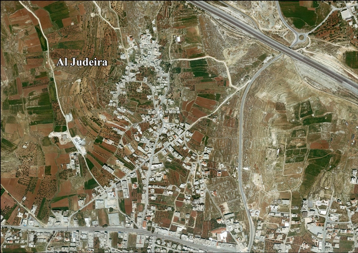
In 1883, the PEF's Survey of Western Palestine (SWP) described it as "a small village on a slope, surrounded by figs and olives, and with rock-cut tombs to the north." [4]

British Mandate era

In the 1922 census of Palestine conducted by the British Mandate authorities, Ijdireh had a population of 122, all Muslims, [13] increasing in the 1931 census to 139 Muslim inhabitants, in 31 inhabited houses. [14]

In the 1945 statistics Judeira had a population of 190 Muslims, [15] with 2,044 dunams of land, according to an official land and population survey. [16] Of this, 353 dunams were plantations and irrigable land, 1,314 used for cereals, [17] while 7 dunams were built-up (urban) land. [18]

Jordanian era

In the wake of the 1948 Arab–Israeli War, and after the 1949 Armistice Agreements, al-Judeira came under Jordanian rule.

The Jordanian census of 1961 found 328 inhabitants in Judeira. [19]

Post-1967

Since the Six-Day War in 1967, al-Judeira has been under Israeli occupation.

After the 1995 accords, 25.4% of the village’s land was classified as Area B, the remaining 74.6% is classified was Area C. [20]

In 2005, Israel started the construction of a separation barrier around al-Judeira, Al Jib, Bir Nabala, Beit Hanina al-Balad and Kalandiya. [21] The wall was built on Palestinian land seized by Military Orders. [22] The wall completely surrounds the villages, forming an enclave. [23]

Related Research Articles

<span class="mw-page-title-main">Rafat, Jerusalem</span> Town in Jerusalem Governorate, West Bank

Rafat is a Palestinian town in the Jerusalem Governorate of the State of Palestine, located approximately 4 km (2.5 mi) southwest of the city of Ramallah in the central West Bank. According to the Palestinian Central Bureau of Statistics, it had a population of 2,941 in 2017. Its total land area consists of 3,773 dunams.

<span class="mw-page-title-main">Birzeit</span> Palestinian Christian town north of Ramallah, West Bank

Birzeit, also Bir Zeit, is a Palestinian Christian town north of Ramallah, in the West Bank. Its population in the 2017 census was 5,878. Birzeit is home to Birzeit University and to the Birzeit Brewery.

<span class="mw-page-title-main">Shuqba</span> Palestinian town in Ramallah and al-Bireh, State of Palestine

Shuqba is a Palestinian town in the Ramallah and al-Bireh Governorate, located 17 kilometers northwest of the city of Ramallah in Palestine.

<span class="mw-page-title-main">Al Jib</span> Municipality type D in Jerusalem

Al Jib or al-Jib is a Palestinian village in the Jerusalem Governorate of the State of Palestine, located ten kilometers northwest of Jerusalem, partially in the seam zone of the West Bank. The surrounding lands are home to Al Jib Bedouin. Since 1967, Al Jib has been occupied by Israel and about 90% of its lands are classified as Area C. About a quarter of the land is seized by Military Orders for the establishment of Israeli settlements. Al Jib's Al Khalayleh neighborhood was separated from the rest of the city by the West Bank barrier. According to the Palestinian Central Bureau of Statistics, Al Jib had a population of approximately 4,700 in 2006 and 3,862 by 2017.

<span class="mw-page-title-main">Husan</span> Palestinian town in the Bethlehem Governate

Husan is a Palestinian town located 9 km (5.6 mi) west of Bethlehem, in the Bethlehem Governorate. According to the Palestinian Central Bureau of Statistics, Husan had a population of 7,048 in 2017.

<span class="mw-page-title-main">Surif</span> Municipality type A in Hebron, State of Palestine

Surif is a Palestinian City in the Hebron Governorate located 25 km northwest of the city of Hebron. According to the Palestinian Central Bureau of Statistics census, Surif had a population of 17,287 in 2017. The population is entirely Muslim.

<span class="mw-page-title-main">Al-Shuyukh</span> Municipality type C in Hebron, State of Palestine

Ash-Shuyukh or al-Shuyukh is a Palestinian town in the Hebron Governorate of the State of Palestine, located 6 km northeast of the city of Hebron. According to the Palestinian Central Bureau of Statistics, Ash-Shuyukh had a population of 12,052 in 2017.

<span class="mw-page-title-main">Deir Qaddis</span> Municipality type D in Ramallah and al-Bireh, State of Palestine

Deir Qaddis is a Palestinian town in the Ramallah and al-Bireh Governorate of the State of Palestine, in the central West Bank, located sixteen kilometers west of Ramallah. According to the Palestinian Central Bureau of Statistics, the town had a population of 2,452 inhabitants in 2017. The town consists of 8,207 dunams, of which 438 dunams are classified as built-up area. As a result of 1995 accords, 7.7% of Deir Qaddis' land was transferred to the Palestinian National Authority for civil affairs, so-called Area B, but Israel still retains full control of 92.3% of the town, being in Area C.

Qatanna is a Palestinian town in the central West Bank part of the Jerusalem Governorate, located 12 km. northwest of Jerusalem. According to the Palestinian Central Bureau of Statistics, the town had a population of 6,981 inhabitants in 2017. Primary health care for the town is level 2.

<span class="mw-page-title-main">Bir Nabala</span> Municipality type D in Jerusalem, Palestine

Bir Nabala is a Palestinian enclave town in the West Bank located eight kilometers northeast of Jerusalem, in Palestine. In mid-year 2006, it had an estimated population of 6,100 residents. By 2017, the population was 6,004 Three Bedouin tribes — Abu Dhak, Tel al ‘Adassa and Jahalin — live in Bir Nabala. Bir Nabala has a built-up area of 1,904 dunams, which combined with nearby al-Jib, Beit Hanina al Balad and al-Judeira form an enclave in the Seam Zone, walled in by the Israeli West Bank barrier.

<span class="mw-page-title-main">Kharbatha al-Misbah</span> Arab village in the Ramallah and al-Bireh Governate

Kharbatha al-Misbah is a Palestinian town in the central West Bank, located 12.5 kilometers (7.8 mi) west of Ramallah in the Ramallah and al-Bireh Governorate. According to the Palestinian Central Bureau of Statistics, the town had a population of 6,366 in 2017. It has a total land area of 4,431 dunams, of which 644 are built-up areas and the remainder agricultural lands and forests.

<span class="mw-page-title-main">Abu Qash</span> Municipality type C in Ramallah and al-Bireh, State of Palestine

Abu Qash is a Palestinian village located in the Ramallah and al-Bireh Governorate in the northern West Bank, located north of Ramallah and south of the Birzeit University. According to the 2017 census conducted by the Palestinian Central Bureau of Statistics, it had a population of 2,237.

<span class="mw-page-title-main">Beit Sira</span> Municipality type D in Ramallah and al-Bireh, State of Palestine

Beit Sira is a Palestinian village in the central West Bank, located 22 kilometers west of Ramallah and is a part of the Ramallah and al-Bireh Governorate. The village is situated along the Green Line. During the 1948 Arab-Israeli War, around 4,000 dunams of its land became a part of the "No-Man's Land" strip between the north-central West Bank and Israel. Currently Beit Sira's jurisdiction is 3,120 dunams, of which 441 dunams are built-up areas and the remainder is open spaces for future construction or agricultural land.

<span class="mw-page-title-main">Saffa, Ramallah</span> Town in the West Bank, State of Palestine

Saffa is a Palestinian town in the Ramallah and al-Bireh Governorate, located west of Ramallah in the northern West Bank. According to the Palestinian Central Bureau of Statistics (PCBS), the town had a population of 4,374 inhabitants in 2017.

<span class="mw-page-title-main">Deir Ibzi</span> Municipality type C in Ramallah and al-Bireh, State of Palestine

Deir Ibzi is a Palestinian town in the Ramallah and al-Bireh Governorate, located west of Ramallah in the northern West Bank. According to the Palestinian Central Bureau of Statistics, the town had a population of 2,590 inhabitants in 2017.

<span class="mw-page-title-main">Beit Duqqu</span> Municipality type D in Jerusalem

Beit Duqqu is a Palestinian village in the Jerusalem Governorate, located northwest of Jerusalem in the central West Bank. According to the Palestinian Central Bureau of Statistics, the town had a population of 1,754 in 2017.

<span class="mw-page-title-main">Burham, Ramallah</span> Local Development Committee in Ramallah and al-Bireh, State of Palestine

Burham is a Palestinian village in the Ramallah and al-Bireh Governorate located twelve kilometers north of Ramallah. The largest nearby town is Bir Zeit located to the southeast. The average elevation of Burham is 680 meters above sea level. The village was established during the Byzantine Empire rule over Palestine.

<span class="mw-page-title-main">Beit Ijza</span> Village in Jerusalem Governorate

Beit Ijza ; is a village in the Jerusalem Governorate in the central West Bank with an area of 2,526 dunams. Located approximately six miles north of Jerusalem, it had a population of 698 in 2007 and 854 by 2017.

<span class="mw-page-title-main">Abu Shukheidim</span> Municipality type C in Ramallah and al-Bireh, State of Palestine

Abu Shukheidim was a Palestinian village in the Ramallah and al-Bireh Governorate.

Jibiya is a Palestinian village in the Ramallah and al-Bireh Governorate. It was founded after the 16th century. It is mentioned in text from 1697.

References

  1. 1 2 Preliminary Results of the Population, Housing and Establishments Census, 2017 (PDF). Palestinian Central Bureau of Statistics (PCBS) (Report). State of Palestine. February 2018. pp. 64–82. Retrieved 2023-10-24.
  2. 1 2 Palmer, 1881, p. 296
  3. Al Judeira Village Profile, ARIJ, p. 4
  4. 1 2 Conder and Kitchener, 1883, SWP III, pp. 9 10
  5. Ehrlich, Carl S. (1992). "Gederah". The Anchor Yale Bible Dictionary. 2. doi:10.5040/9780300261882-714.
  6. I Chronicles. Jacob M. Myers ([1st ed.] ed.). Garden City, N.Y.: Doubleday. 1965. p. 96. ISBN   0-385-01259-4. OCLC   917910.{{cite book}}: CS1 maint: others (link)
  7. Toledano, 1984, p. 294, has Jadira at location 35°11′35″E 31°51′35″N.
  8. Robinson and Smith, 1841, vol 3, Appendix 2, p. 122
  9. Robinson and Smith, 1841, vol 2, p. 137
  10. Guérin, 1868, p. 392
  11. Socin, 1879, p. 153
  12. Hartmann, 1883, p. 127, noted 17 houses
  13. Barron, 1923, Table VII, Sub-district of Jerusalem, p. 15
  14. Mills, 1932, p. 40
  15. Government of Palestine, Department of Statistics, 1945, p. 25
  16. Government of Palestine, Department of Statistics. Village Statistics, April, 1945. Quoted in Hadawi, 1970, p. 57 Archived 2011-06-04 at the Wayback Machine
  17. Government of Palestine, Department of Statistics. Village Statistics, April, 1945. Quoted in Hadawi, 1970, p. 103 Archived 2016-03-03 at the Wayback Machine
  18. Government of Palestine, Department of Statistics. Village Statistics, April, 1945. Quoted in Hadawi, 1970, p. 153 Archived 2016-03-03 at the Wayback Machine
  19. Government of Jordan, Department of Statistics, 1964, p. 23
  20. Al Judeira Village Profile, ARIJ, p. 17
  21. High Court approves Bir Nabalah enclave. B'Tselem, 26 November 2006
  22. Israel’s Segregation Wall Encircles Three Palestinian Villages in Northwest Jerusalem Archived 2007-06-02 at the Wayback Machine ARIJ, 7 May 2005
  23. "West Bank Closures - Jerusalem" (PDF). United Nations Office for the Coordination of Humanitarian Affairs. March 2004. Archived from the original (PDF) on 2007-10-14. Retrieved 2007-10-14.

Bibliography