Al-Jib is identified with the ancient Canannite and Israelite city of Gibeon (from Biblical Hebrew: gēb "pit, ditch, trench").[7][8] The first scientific identification of Al-Jib with the ancient Gibeon was made by Edward Robinson in 1838.[9][10] Archaeological excavations led by James Pritchard in 1956, 1957, and 1959 confirmed this identification with the discovery of the "Al Jib jar handles", 56 jar handles inscribed with the Semitic name gb'n.[9] The inscriptions were dated to the latter years of the Kingdom of Judah and have been cross-referenced against genealogical lists in the Book of Chronicles. While they include many Benjaminite names, they also include non-Israelite names, attesting to the intermixing of local population.[9]
Gibeon prospered during the late Iron Age II, when the town had strong fortifications, a winery and a sophisticated water system. An intricate cemetery from the same period was discovered just east of the tell.[11]
A vaulted building still remaining in the centre of Al Jib has been dated from between the mid-5th and mid-8th centuries CE.[12] The building has earlier been described as a church[13] from the Crusader era, with "total length of the chapel appears to have been 40 feet east and west, 22 feet north and south. The apses have been apparently built up. There were three bays of arches, and in the side walls are small doors with lintels".[14] D. Pringle dismissed the possibility that this was a former church, and suggest instead that it was an Umayyad palace building, or possibly dating from the Abbasid era.[15]
By the 1550s the agricultural revenues of Al Jib belonged to the endowment (waqf) of MamlukSultan Inal (r. 1453–61) in Egypt. However, three tribes of the Hutaym Bedouin were affiliated with the village. The taxes they paid plus levies normally earmarked for the military were in the 1550s designated for the waqf of Hasseki Sultan Imaret in Jerusalem.[19] In the 1596 tax-records it appeared as Jib, located in the Nahiya of Jabal Quds of the Liwa of Al-Quds. The population was 103 households,[20] large enough to be divided into four quarters.[21] The villagers paid a fixed tax-rate of 33,3% on agricultural products, including wheat, barley, olive trees, fruit trees, grape syrup or molasse, in addition to occasional revenues, goats and beehives; a total of 16,060 Akçe.[22]
In 1838 Edward Robinson described it as a village of moderate size, with the houses standing very irregularly and unevenly. He further noted "One large massive building still remains, perhaps a castle or tower of strength. The lower rooms a vaulted with round arches of hewn stones fitted together with great exactness. The stones outside are large; and the whole appearance is that of antiquity."[10]El-Jib was further noted as a Muslim village, part of the El-Kuds district.[23]
In 1863 Victor Guérin found that Al Jib had 500 inhabitants,[24] while an Ottoman village list from about 1870 found that the village had a population of 219, in a total of 65 houses, though that population count included men, only.[25][26]
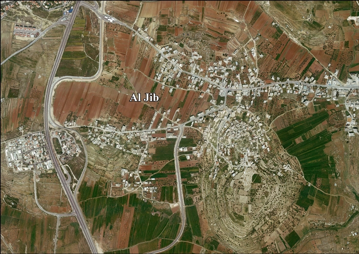
In 1883, the PEF's Survey of Western Palestine (SWP) described it as "on the end of a hill, rising 300 feet above the valley. On the south is a narrow plain, and there is an open valley on the east, whilst to the north and west there is also a flat plain. The hill is thus isolated, and a position naturally of great strength. The houses cover the northern part of the hill. The village is of moderate size, the houses of stone, with a central tower, and massive foundations exist among the modern buildings. On the east, rather lower than the village and a little below the top of the ridge, is the spring, which issues from a cave. Below it are remains of a good-sized reservoir. There are many springs on the south and west, and caves in the southern side of the hill. Olives, figs, pears, apples, and vines are cultivated round the village and in the plain; there are also extensive corn-fields in the low ground."[27]
In 1896 the population of Ed-dschib was estimated to be about 567 persons.[28]
In the early 1930s, Grace Mary Crowfoot noted how the women of Al Jib and Kafr al-Labad made pottery (without a wheel), looking much like ware made in the 8th and 7th BCE.[31]
In the 1945 statistics, Al Jib had a population of 830 Muslims,[32] and a total land area of 8,205 dunams.[33] 1,132 dunams were designated for plantations and irrigable land, 4,754 for cereals,[34] while 57 dunams were built-up area.[35]
Jordanian era
in the wake of the 1948 Arab-Israeli War, and after the 1949 Armistice Agreements, Al Jib came under Jordanian rule.
Since the 1967 Six-Day war, al-Jib has been under Israeli occupation. The population in the 1967 census conducted by the Israeli authorities was 1,173, 27 of whom originated from Israeli territory.[37]
Under the 1995 Oslo II Accord, 7.5% of the total village area was classified as Area B, and the remaining 92.5% became Area C, under full Israeli control.[38]
Separation wall
The barrier in northern Jerusalem, which confines Al Jib to an enclave under Israeli control.
In 2005, Israel started the construction of a separation barrier around Al Jib, al-Judeira, Bir Nabala, Beit Hanina al-Balad and Kalandiya.[39] The wall was built on Palestinian land seized by Military Orders.[40] The wall completely surrounds the villages, forming an enclave.[5] One effect is that it prevents the Palestinian residents without Israeli citizenship or permanent residency cards from using the nearby road-system serving Jerusalem and nearby Israeli settlements.
The wall has also divided the village of Al Jib. Part of their farm-land lies on the other side of the wall and only a limited number of residents have limited access. A complete neighborhood, Al Khalayleh, with an estimated population of 700 citizens, is now located west of the Wall in a separate enclave between Israeli settlements. In April 2012, Israel demolished a number of houses in Al Khalayleh and displaced 67 Palestinian refugees from the neighborhood, most of whom were children. About half of Al Jib's total area, including Al Khalayleh, is located on the other side of the barrier.[38][bettersourceneeded]
Israel claims that it intends to build two alternate roads that will link the enclave to the rest of the West Bank to prevent its complete isolation. One will connect the enclave with Ramallah, which lies to its north, while the other will connect Al Jib to the Bedouin area, which lies to its west, by means of three underground passageways and two bridges. The road's construction will require complex engineering work and will cost tens of millions of shekels, so it is likely that the project will take a long time, if ever, to complete[38][39]
B'Tselem points out that because thousands of the enclave's residents hold Israeli identity cards, they are entitled to free access to East Jerusalem by law, and that the barrier thus "will severely impair [their] human rights" by cutting off direct access.[39]
Preservation
Al Jib is on the list of "Endangered Cultural Heritage Sites in the West Bank Governorates" compiled by the Ministry of Planning and International Cooperation (MOCIP) of the Palestinian National Authority (PNA) due to the excavations of ancient Gibeon.[41] During the second Intifada, the Palestinian Association for Cultural Exchange (PACE) brought together Palestinian youth and elders from the surrounding villages to repair and restore the ancient water pool and other sites around the village.[42]
↑ Solomon Skoss, The Hebrew-Arabic Dictionary of the Bible known as Kitab Jami al-Alfaz (Agron) of David ben Abraham Al-Fasi, the Karaite (New Haven: Yale 1936), introd. p. xxxviii.
↑ According to Hütteroth and Abdulfattah, 1977, p. 122, all the inhabitants were Christian. According to Toledano, 1984, pp. 311-314, the population of Al Jib was Muslim, as Al Jib never had a Christian population in the sixteenth century.
↑ Government of Palestine, Department of Statistics, 1945, p. 25
↑ Government of Palestine, Department of Statistics. Village Statistics, April, 1945. Quoted in Hadawi, 1970, p. 57Archived 2011-06-04 at the Wayback Machine
↑ Government of Palestine, Department of Statistics. Village Statistics, April, 1945. Quoted in Hadawi, 1970, p. 103Archived 2016-03-03 at the Wayback Machine
↑ Government of Palestine, Department of Statistics. Village Statistics, April, 1945. Quoted in Hadawi, 1970, p. 153Archived 2016-03-03 at the Wayback Machine
↑ Government of Jordan, Department of Statistics, 1964, p. 23
This page is based on this Wikipedia article Text is available under the CC BY-SA 4.0 license; additional terms may apply. Images, videos and audio are available under their respective licenses.


