"}" id="mwBA">
Beitunia | |
---|---|
Arabic transcription(s) | |
• Arabic | بيتونيا |
• Latin | Beituniya (official) Beatonia (unofficial) |
![]() View of the city from the west | |
Location of Beitunia within Palestine | |
Coordinates: 31°53′20″N35°10′03″E / 31.88889°N 35.16750°E | |
Palestine grid | 166/143 |
State | State of Palestine |
Governorate | Ramallah and al-Bireh |
Government | |
• Type | Municipality |
• Head of Municipality | Ribhi Dola |
Area | |
• Municipality type B | 26,174 dunams (26.2 km2 or 10.1 sq mi) |
Population (2017) [1] | |
• Municipality type B | 26,604 |
• Density | 1,000/km2 (2,600/sq mi) |
• Metro | 153,237 |
Name meaning | Beitunia, personal name [2] |
Website | www.beitunia.ps |
Beitunia (Arabic : بيتونيا), also Bitunya, is a Palestinian city located 3 kilometers (1.9 mi) west of Ramallah and 14 kilometers (8.7 mi) north of Jerusalem, in the Ramallah and al-Bireh Governorate of Palestine, in the central West Bank. According to the Palestinian Central Bureau of Statistics, the city had a population of 26,604 in 2017, [1] making it the third largest locality in its governorate after al-Bireh and Ramallah.
Potsherds from the Byzantine, Mamluk and early Ottoman period have been found. A 1982 survey found two pillars and remnants of an olive press, along with another pillar located in one of the courtyards. The Mandatory DOA documented a medieval structure in ruins, characterized by vaults, alongside a white mosaic floor, a damaged pillar, a winepress, a rock-cut reservoir, and burial caves. [3]
In 1883, the PEF's Survey of Western Palestine suggested that Beitunia was the Crusader village Uniet, which was one of 21 villages given by King Godfrey as a fief to the Church of the Holy Sepulchre. [4] However, in 1887, Röhricht identified Beitunia with Beitiumen, another fief given by the King to the Holy Sepulchre. [5] [6] Conder found this to be "evidently correct" and hence "very doubtful" that Beitunia was Uniet. [7] Abel, writing in 1931, suggested that Beitunia was Beit Uniet, mentioned in an early 12th-century text. [3]
A large vaulted building in the town, named Badd al Balad ("oil press of the village") has been dated to the Crusader era. [8] [9]
Beitunia, like the rest of Palestine, was incorporated into the Ottoman Empire in 1517, and in the census of 1596, the village was located in the Nahiya of Quds of the Liwa of Quds. The population was 75 households and 5 bachelors, all Muslim. They paid a fixed tax rated of 33,3% on wheat, barley, olives, vineyards, fruit trees, goats and/or beehives, in addition to occasional revenues; a total of 23,000 akçe. [10]
In 1738 Richard Pococke called it "a place called Bethany to the north." [11]
The American scholar Edward Robinson noted it in 1838, [12] as a Muslim village, part of the El-Kuds district. [13]
In 1870 the French explorer Victor Guérin found that Beitunia contained six hundred inhabitants. [14] Socin found from an official Ottoman village list from about the same year (1870) that Beitunia had a total of 147 houses and a population of 481, though the population count included men, only. [15] [16]
Several inscriptions, dating to 1873-74 and forwards, have been described from the house of the village Mukhtar. [17]
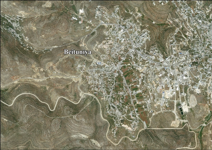
In 1883, the PEF's Survey of Western Palestine described Beitunia as "A good-sized village of stone, surrounded by olives, standing high on a flat rocky ridge, with a plain to the east. To the east are cisterns, wine-presses, and a pond (el Baliia), which contains water in winter. On the north and east are rock-cut tombs with well-cut entrances, but blocked up." [18]
In 1896 the population of Betunja was estimated to be about 1,056 persons. [19]
In the 1922 census of Palestine conducted by the British Mandate authorities, Beitunia had a population of 948 Muslim, [20] increasing in the 1931 census to 1,213, still all Muslim, in 277 houses. [21]
Due to a lack of economic opportunities in the early 20th century, many people emigrated. Some went to the Chicago area, and were involved in the startup of the Bridgeview Mosque. [22] [23]
In the 1945 statistics the population was 1,490, all Muslims, [24] while the total land area was 23,366 dunams, according to an official land and population survey. [25] Of this, 7,854 were allocated for plantations and irrigable land, 8,381 for cereals, [26] while 77 dunams were classified as built-up areas. [27]
In the wake of the 1948 Arab–Israeli War, and after the 1949 Armistice Agreements, Beitunia came under Jordanian rule.
In 1961, the population of Beituniya was 2,216. [28]
Since the Six-Day War in 1967, Beitunia has been under Israeli occupation. After 1995, under the Oslo Accords, 3,759 dunums (17.8%) of the town's lands were classified as Area A, 472 dunums (2.2%) were classified as Area B, while the remaining 16,896 dunums (80%) were classified as Area C. Israel has confiscated land from Beitunia in order to construct two Israeli settlements: Beit Horon and Giv'at Ze'ev. [29] [30]
According to the Oslo Accords, the IDF is prevented from entering areas A (an area under full Palestinian Authority control), but Operation Defensive Shield in 2002 abolished this distinction when the IDF searched that year in Beitunia for a suspect who wanted to make himself a "martyr." [31] The IDF-search extended to Qalandiya, Bayt Surik, Bayt Deko, al-Judeirah, and Hizma.
Beitunia's land area consists of 2, 617.4 hectares (26,174 dunams) of which 336.2 hectares is built-up area. The Israeli West Bank barrier separates the urban area from 66% of the town's lands, however, most of the cut-off territory (Seam Zone) is made-up of forest and open spaces making it prime agricultural and grazing land. [32]
Salah El-Dein Mosque is located to the west of the city and was established in 2002. It is named related to the old Muslim leader Salah Al-Dein Al-Ayoubi. It is considered one of the main mosques in the area. It consists of 3 floors and has a capacity for approximately 500 persons.[ citation needed ]
Fadel Abu Zahira (9 years old) was shot and killed on 18 April 2002 in his own home in Beitunia. The bullet came from an armored vehicle and went through the window. Hussein Mahmoud 'Awad 'Alian (17 years old) was killed by Israeli gunfire on 16 April 2004 during demonstrations against the barrier. [33]
Two boys, Nadim Nawarah and Mohammad Odeh, were shot and killed in the Beitunia killings on 15 May 2014. One Israeli policeman was arrested for Nawarah's death, [34] and was later under a plea deal sentenced to 9 months in jail. [35] [36]
Rafat is a Palestinian town, located approximately 4 km (2.5 mi) southwest of the city of Ramallah in the central West Bank in the northern Jerusalem Governorate. According to the Palestinian Central Bureau of Statistics, it had a population of 2,941 in 2017. Its total land area consists of 3,773 dunams.
Al-Bireh, al-Birah, or el-Bira is a Palestinian city in the central West Bank, 15 kilometers (9.3 mi) north of Jerusalem. It is the capital of the Ramallah and al-Bireh Governorate of the State of Palestine. It is situated on the central ridge running through the West Bank and is 860 meters (2,820 ft) above sea level, covering an area of 22.4 square kilometers (8.6 sq mi). Al-Bireh is under the administration of the Palestinian National Authority.
Turmus Ayya is a Palestinian town located in the Ramallah and al-Bireh Governorate in the West Bank, in Palestine. According to the Palestinian Central Bureau of Statistics (PCBS), it had a population of 2,464 in 2017. A large percentage of the residents are Palestinian binationals with US citizenship.
Ajjul is a Palestinian village in the Ramallah and al-Bireh Governorate in the northern West Bank, located north of Ramallah. There are two archaeological sites or khirbets to the east of the village. One of the khirbets is dedicated to a former resident of Ajjul, Sheikh Abdul. Ajjul is governed by a village council of three members.
Beitin is a Palestinian village in the Ramallah and al-Bireh Governorate in the central West Bank, located 5 kilometers (3.1 mi) northeast of Ramallah along the Ramallah-Nablus road. The Palestinian village of Dura al-Qar' and Ein Yabrud lie to the north, Rammun to the east, Deir Dibwan to the southeast and al-Bireh to the southwest. The Israeli settlement of Beit El is northwest of Beitin.
Kharbatha al-Misbah is a Palestinian town in the central West Bank, located 12.5 kilometers (7.8 mi) west of Ramallah in the Ramallah and al-Bireh Governorate. According to the Palestinian Central Bureau of Statistics, the town had a population of 6,366 in 2017. It has a total land area of 4,431 dunams, of which 644 are built-up areas and the remainder agricultural lands and forests.
Abu Qash is a Palestinian village located in the Ramallah and al-Bireh Governorate in the northern West Bank, located north of Ramallah and south of the Birzeit University. According to the 2017 census conducted by the Palestinian Central Bureau of Statistics, it had a population of 2,237.
Saffa is a Palestinian town in the Ramallah and al-Bireh Governorate, located west of Ramallah in the northern West Bank. According to the Palestinian Central Bureau of Statistics (PCBS), the town had a population of 4,374 inhabitants in 2017.
Deir Abu Mash'al is a Palestinian village in the Ramallah and al-Bireh Governorate of the State of Palestine, located 24 kilometers (15 mi) west of Ramallah in the northern West Bank. According to the Palestinian Central Bureau of Statistics (PCBS), the village had a population of 4,233 inhabitants in 2017.
Deir as-Sudan is a Palestinian town in the Ramallah and al-Bireh Governorate, located 20 kilometers Northwest of Ramallah in the northern West Bank. According to the Palestinian Central Bureau of Statistics (PCBS), the town had a population of approximately 2,159 inhabitants in 2017.
al-Mazra'a ash-Sharqiya is a Palestinian town in the Ramallah and al-Bireh Governorate, located northeast of Ramallah in the northern West Bank. According to the Palestinian Central Bureau of Statistics (PCBS), the town had a population of 4,063 inhabitants in 2017.
Kafr Malik is a Palestinian town in the Ramallah and al-Bireh Governorate of the State of Palestine, located 17 kilometers Northeast of Ramallah in the northern West Bank. According to the Palestinian Central Bureau of Statistics (PCBS), the town had a population of 2,946 inhabitants in 2017.
Jammala is a Palestinian town in the Ramallah and al-Bireh Governorate, located 18 kilometers Northwest of Ramallah in the northern West Bank. According to the Palestinian Central Bureau of Statistics (PCBS), the town had a population of 1,664 inhabitants in 2017.
Biddu is a Palestinian town in the Jerusalem Governorate, located 6 kilometers northwest of Jerusalem in the West Bank. According to the Palestinian Central Bureau of Statistics, the town had a population of 8,231 in 2017. Biddu is at an altitude of 806m to 834m. Giv'on HaHadashah lies 2 km east of Biddu.
Beit Surik is a Palestinian village in the Jerusalem Governorate, located 12 kilometers Northwest of Jerusalem in the northern West Bank. According to the Palestinian Central Bureau of Statistics, the town had a population of 4,025 in 2017.
Ein Qiniya or 'Ayn Kiniya is a Palestinian village in the northern West Bank, located 7 kilometers (4.3 mi) northwest of Ramallah and is a part of the Ramallah and al-Bireh Governorate. Ein Qiniya has existed since the Roman-era of rule in Palestine. The village is very small with no public structures or institutions and is governed by a local development committee. Ein Qiniya is regionally notable for being a spring and autumn time picnic resort.
Beit 'Anan is a Palestinian village in the Quds Governorate, located northwest of Jerusalem. In 2017, it had a population of 4,210. Some residents of Beit 'Anan hold Israeli identity cards, while others hold Palestinian identity cards.
Burham is a Palestinian village in the Ramallah and al-Bireh Governorate located twelve kilometers north of Ramallah. The largest nearby town is Bir Zeit located to the southeast. The average elevation of Burham is 680 meters above sea level. The village was established during the Byzantine Empire rule over Palestine.
Ein Siniya is a small Palestinian village in the Ramallah and al-Bireh Governorate, 10 kilometers (6.2 mi) north of Ramallah, and approximately 1km northeast from Jifna. It lies in a valley surrounded with olive and fig-terraces.
Jibiya is a Palestinian village in the Ramallah and al-Bireh Governorate. It was founded after the 16th century. It is mentioned in text from 1697.