Deir Qaddis

Last updated • 3 min readFrom Wikipedia, The Free Encyclopedia

Deir Qaddis
Arabic transcription(s)
   Arabic دير قديس
   Latin Deir Qiddis (official)
Dayr Qaddis (unofficial)
Deir Qaddis6142.jpg
View of Deir Qaddis
Palestine location map wide.png
Red pog.svg
Deir Qaddis
Location of Deir Qaddis within Palestine
Coordinates: 31°56′58″N35°02′44″E / 31.94944°N 35.04556°E / 31.94944; 35.04556
Palestine grid 154/150
State State of Palestine
Governorate Ramallah and al-Bireh
Government
  Type Village council
  Head of MunicipalityFares Ibrahim
Area
  Total
8,207  dunams (8.2 km2 or 3.2 sq mi)
Elevation
[1]
372 m (1,220 ft)
Population
 (2017) [2]
  Total
2,452
  Density300/km2 (770/sq mi)
Name meaning"Monastery of the saint" [3]

Deir Qaddis (Arabic : دير قديس) is a Palestinian town in the Ramallah and al-Bireh Governorate of the State of Palestine, in the central West Bank, located sixteen kilometers west of Ramallah. [4] According to the Palestinian Central Bureau of Statistics, the town had a population of 2,452 inhabitants in 2017. [2] The town consists of 8,207 dunams, of which 438 dunams are classified as built-up area. As a result of 1995 accords, 7.7% of Deir Qaddis' land was transferred to the Palestinian National Authority for civil affairs, so-called Area B, but Israel still retains full control of 92.3% of the town, being in Area C. [5]

Contents

Location

Deir Qaddis is located 15.7 kilometers (9.8 mi) north-west of Ramallah. It is bordered by Kharbatha Bani Harith and Al-Itihad to the east, Shibtin to the north, Ni’lin to the west, and Bil’in to the south. [1]

Etymology

In the 19th century, the name Deir Qaddis was interpreted to mean "monastery of the saint". [3] Qaddis means a holy person and is of Aramaic origin. [6]

History

French explorer Victor Guérin found remains of houses built with large blocks and several cisterns dug into the rock, [7] while SWP (1882) notes a ruined monastery and a nearby cave. According to SWP the name of the village indicated that a convent had existed there. [8]

A survey by Finkelstein and Lederman uncovered no ancient pottery. [9]

Ottoman era

The village was incorporated into the Ottoman Empire in 1517 with all of Palestine, and in 1596 it appeared in the tax registers as Dayr Qiddis in the Nahiya of Ramlah of the Liwa of Gazza. It had a population of 11 households, all Muslim, and paid taxes on wheat, barley, summer crops, olive- and fruit trees, goats and beehives, and a press for olives or grapes; a total of 5,400 akçe. [10] In 1838 Deir el-Kaddis was described as a village in the Beni Hasan area west of Jerusalem. [11] [12] [13]

In 1863 Guérin estimated that Deir Kaddis had about 350 inhabitants, [7] while an Ottoman village list from 1870 showed Der Kaddis had 36 houses and a population of 112, a count that included only men. [14] [15]

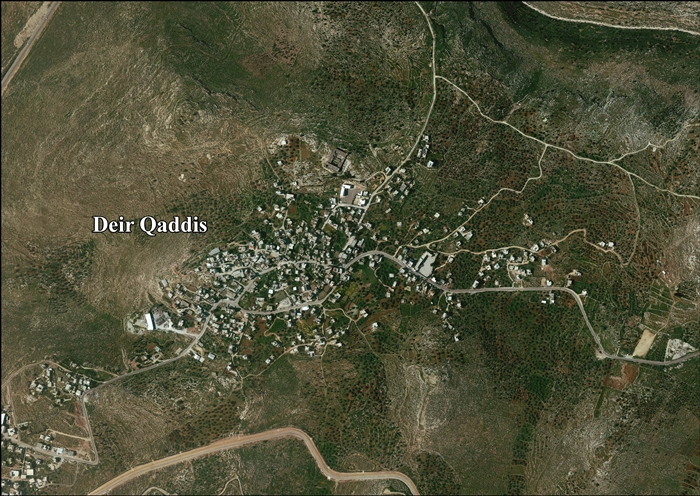
In 1883, the PEF's Survey of Western Palestine described Deir el Kuddis as a "small hamlet on a high hill-top, with gardens to the north [..] There is a well on the east." [8]

British Mandate era

In the 1922 census of Palestine, conducted by the British Mandate authorities, Deir Qaddis had a population of 299 inhabitants, all Muslims, [16] increasing in the 1931 census to a population of 368 Muslims in 82 houses. [17]

In the 1945 statistics, the population of Deir Qaddis was 440 Muslims, [18] with 8,224 dunams of land, according to an official land and population survey. [19] 1,815 dunams were used for plantations and irrigable land, 1,069 dunams for cereals, [20] while 8 dunams were built-up (urban) land. [21]

Jordanian era

In the wake of the 1948 Arab–Israeli War, Deir Qaddis came under Jordanian rule.

The Jordanian census of 1961 found 752 inhabitants in Deir Qaddis. [22]

Post-1967

Deir Qaddis came under Israeli occupation during the 1967 Six-Day War. The population in the 1967 census conducted by the Israeli authorities was 461, 25 of whom originated from the Israeli territory. [23]

After the 1995 accords, 7.7% of the village's total area has been classified as Area B land, while the remaining 93.3% is Area C. [5]

According to ARIJ, Israel built three Israeli settlements on the village lands: 1818 dunams for Modi'in Illit, [24] 446 dunams for Nili, [24] 471 dunams for Na'ale. [24]

In 2008, access to some of the village land was cut off by the Israeli West Bank barrier. Access was restored in 2012. [25]

The town's prominent families are Husain, Qattosa, Nasser, Abu Zeid, Hamada, Awadh, Abu Laban and Kreish. [26]

Related Research Articles

<span class="mw-page-title-main">Shuqba</span> Palestinian town in Ramallah and al-Bireh, State of Palestine

Shuqba is a Palestinian town in the Ramallah and al-Bireh Governorate, located 17 kilometers northwest of the city of Ramallah in Palestine.

<span class="mw-page-title-main">Deir Ballut</span> Municipality type D in Salfit, State of Palestine

Deir Ballut is a Palestinian town in the Salfit Governorate in the northern West Bank, 41 kilometers (25 mi) south west of Nablus. According to the Palestinian Central Bureau of Statistics, it had a population of 3,873 in 2017.

<span class="mw-page-title-main">Deir Dibwan</span> Municipality type D in Ramallah and al-Bireh, State of Palestine

Deir Dibwan is a Palestinian city in the Ramallah and al-Bireh Governorate in the central West Bank east of Ramallah. It is also the capital of the Eastern District with Mr. Iyad Mohammad Habbas Al-Awawdah the mayor. According to the Palestinian Central Bureau of Statistics the town had a population of 4,169 inhabitants in 2017. There were 5,016 people from Deir Dibwan living abroad. Deir Dibwan was built close to the ruins of Et-Tell.

<span class="mw-page-title-main">Ein Yabrud</span> Municipality type C in Ramallah and al-Bireh, State of Palestine

Ein Yabrud is a Palestinian town in the Ramallah and al-Bireh Governorate in the central West Bank. It is located approximately 7 km northeast of the city of Ramallah and its elevation is 800 m. According to the Palestinian Central Bureau of Statistics (PCBS) the town had a population of 2,515 in 2017.

<span class="mw-page-title-main">Kafr ad-Dik</span> Village in Salfit Governorate, West Bank

Kafr ad-Dik is a Palestinian town located 9.5 kilometers west of Salfit in the Salfit Governorate of Palestine, in the northern West Bank. According to the Palestinian Central Bureau of Statistics (PCBS), the town had a population of 5,551 in 2017.

<span class="mw-page-title-main">Deir Jarir</span> West Bank town in Ramallah and al-Bireh Governorate

Deir Jarir is a Palestinian town in the Ramallah and al-Bireh Governorate of the State of Palestine, in the central West Bank, located twelve kilometers northeast of Ramallah. It is situated on a hilltop overlooking the Jordan Valley at an elevation of 900 metres. According to the Palestinian Central Bureau of Statistics (PCBS), Deir Jarir had a population of 4,469 inhabitants in 2017.

<span class="mw-page-title-main">Salim, Nablus</span> Municipality type D in Nablus, State of Palestine

Salim is a Palestinian town in the northern West Bank, located six kilometers east of Nablus and is a part of the Nablus Governorate. According to the Palestinian Central Bureau of Statistics (PCBS), Salim had a population of 6,266 inhabitants in 2017.

<span class="mw-page-title-main">Beitillu</span> Municipality type C in Ramallah and al-Bireh, State of Palestine

Beitillu is a Palestinian town located in the Ramallah and al-Bireh Governorate in the northern West Bank, 19 kilometers Northwest of Ramallah. According to the Palestinian Central Bureau of Statistics, it had a population of 3,465 in 2017.

<span class="mw-page-title-main">Saffa, Ramallah</span> Town in the West Bank, State of Palestine

Saffa is a Palestinian town in the Ramallah and al-Bireh Governorate, located west of Ramallah in the northern West Bank. According to the Palestinian Central Bureau of Statistics (PCBS), the town had a population of 4,374 inhabitants in 2017.

<span class="mw-page-title-main">Deir Abu Mash'al</span> Municipality type C in Ramallah and al-Bireh, State of Palestine

Deir Abu Mash'al is a Palestinian village in the Ramallah and al-Bireh Governorate of the State of Palestine, located 24 kilometers (15 mi) west of Ramallah in the northern West Bank. According to the Palestinian Central Bureau of Statistics (PCBS), the village had a population of 4,233 inhabitants in 2017.

<span class="mw-page-title-main">Deir as-Sudan</span> Municipality type C in Ramallah and al-Bireh, State of Palestine

Deir as-Sudan is a Palestinian town in the Ramallah and al-Bireh Governorate, located 20 kilometers Northwest of Ramallah in the northern West Bank. According to the Palestinian Central Bureau of Statistics (PCBS), the town had a population of approximately 2,159 inhabitants in 2017.

<span class="mw-page-title-main">Burqa, Ramallah</span> Municipality type C in Ramallah and al-Bireh, Palestine

Burqa is a town in the Ramallah and al-Bireh Governorate, located east of Ramallah in the northern West Bank, Palestine. According to the Palestinian Central Bureau of Statistics (PCBS), the town had a population of 2,047 inhabitants in the 2017 census.

<span class="mw-page-title-main">Deir 'Ammar</span> Municipality type D in Ramallah and al-Bireh, State of Palestine

Deir 'Ammar is a Palestinian town in the Ramallah and al-Bireh Governorate, located 17 km (11 mi) northwest of Ramallah in the northern West Bank. According to the Palestinian Central Bureau of Statistics (PCBS), the town had a population of 3,353 inhabitants in 2017.

<span class="mw-page-title-main">Deir Ibzi</span> Municipality type C in Ramallah and al-Bireh, State of Palestine

Deir Ibzi is a Palestinian town in the Ramallah and al-Bireh Governorate, located west of Ramallah in the northern West Bank. According to the Palestinian Central Bureau of Statistics, the town had a population of 2,590 inhabitants in 2017.

<span class="mw-page-title-main">Ein Qiniya</span> Local Development Committee in Ramallah and al-Bireh, State of Palestine

Ein Qiniya or 'Ayn Kiniya is a Palestinian village in the northern West Bank, located 7 kilometers (4.3 mi) northwest of Ramallah and part of the Ramallah and al-Bireh Governorate of the State of Palestine. Ein Qiniya has existed since the Roman-era of rule in Palestine. The village is very small with no public structures or institutions and is governed by a local development committee. Ein Qiniya is regionally notable for being a spring and autumn time picnic resort.

<span class="mw-page-title-main">Burham, Ramallah</span> Local Development Committee in Ramallah and al-Bireh, State of Palestine

Burham is a Palestinian village in the Ramallah and al-Bireh Governorate located twelve kilometers north of Ramallah. The largest nearby town is Bir Zeit located to the southeast. The average elevation of Burham is 680 meters above sea level. The village was established during the Byzantine Empire rule over Palestine.

<span class="mw-page-title-main">Deir Nidham</span> Municipality type D in Ramallah and al-Bireh, State of Palestine

Deir Nidham is a Palestinian village in the Ramallah and al-Bireh Governorate in the central West Bank. It is located approximately 23 kilometers (14 mi) northwest of the city of Ramallah and its elevation is 590 meters (1,940 ft). According to the Palestinian Central Bureau of Statistics (PCBS) 2017 census, the town had a population of 876.

<span class="mw-page-title-main">Kharbatha Bani Harith</span> Municipality type D in Ramallah and al-Bireh, State of Palestine

Kharbatha Bani Harith is a Palestinian village in the central West Bank, located 15 kilometers west of Ramallah in the Ramallah and al-Bireh Governorate. According to the Palestinian Central Bureau of Statistics, the village had a population of 3,471 in 2017. It has a total land area of 7,120 dunams.

<span class="mw-page-title-main">Abu Shukheidim</span> Municipality type C in Ramallah and al-Bireh, State of Palestine

Abu Shukheidim was a Palestinian village in the Ramallah and al-Bireh Governorate.

<span class="mw-page-title-main">Umm Safa</span> Village in the Ramallah and al-Bireh Governorate, West Bank

Umm Safa/Kafr Ishwa or Um Al-Safa is a Palestinian village in the Ramallah and al-Bireh Governorate.

References

  1. 1 2 Deir Qaddis Village Profile, ARIJ, p. 4
  2. 1 2 Preliminary Results of the Population, Housing and Establishments Census, 2017 (PDF). Palestinian Central Bureau of Statistics (PCBS) (Report). State of Palestine. February 2018. pp. 64–82. Retrieved 2023-10-24.
  3. 1 2 Palmer, 1881, p. 228
  4. The Case of Deir Qiddis village Applied Research Institute - Jerusalem 10 November 2007.
  5. 1 2 Deir Qaddis Village Profile, ARIJ, p. 16
  6. Marom, Roy; Zadok, Ran (2023). "Early-Ottoman Palestinian Toponymy: A Linguistic Analysis of the (Micro-)Toponyms in Haseki Sultan's Endowment Deed (1552)". Zeitschrift des Deutschen Palästina-Vereins. 139 (2).
  7. 1 2 Guérin, 1875, p. 85
  8. 1 2 Conder and Kitchener, 1882, p. 297
  9. Finkelstein, Israel; Lederman, Zvi; Bunimovitz, Shlomo (1997). Finkelstein, Israel; Lederman, Zvi (eds.). Highlands of Many Cultures. Jerusalem: Institute of Archaeology of Tel Aviv University Publications Section. p. 192. ISBN   965-440-007-3.
  10. Hütteroth and Abdulfattah, 1977, p. 154
  11. Robinson and Smith, 1841, vol 2, p. 133
  12. Robinson and Smith, 1841, vol 3, p. 66
  13. Robinson and Smith, 1841, vol 3, Appendix 2, p. 123
  14. Socin, 1879, p. 152
  15. Hartmann, 1883, p. 140, also noted 36 houses
  16. Barron, 1923, Table VII, Division Jaffa, Sub-district of Ramleh, p. 22
  17. Mills, 1932, p. 19
  18. Government of Palestine, Department of Statistics, 1945, p. 29
  19. Government of Palestine, Department of Statistics. Village Statistics, April, 1945. Quoted in Hadawi, 1970, p. 66
  20. Government of Palestine, Department of Statistics. Village Statistics, April, 1945. Quoted in Hadawi, 1970, p. 114
  21. Government of Palestine, Department of Statistics. Village Statistics, April, 1945. Quoted in Hadawi, 1970, p. 164
  22. Government of Jordan, Department of Statistics, 1964, p. 24
  23. Perlmann, Joel (November 2011 – February 2012). "The 1967 Census of the West Bank and Gaza Strip: A Digitized Version" (PDF). Levy Economics Institute . Retrieved 24 June 2016.
  24. 1 2 3 Deir Qaddis Village Profile, ARIJ, p. 17
  25. Ocha Monthly report, 2012
  26. History of Dayr Qaddis Palestine Remembered. (in Arabic)

Bibliography