Shabtin

Last updated
Shabtin
Arabic transcription(s)
   Arabic شبتين/شبطين
ShabtinNili6841.JPG
Shabtin
Palestine location map wide.png
Red pog.svg
Shabtin
Location of Shabtin within Palestine
Coordinates: 31°58′26″N35°02′59″E / 31.97389°N 35.04972°E / 31.97389; 35.04972
Palestine grid 154/153
StateFlag of Palestine.svg  State of Palestine
Governorate Ramallah and al-Bireh
Government
  Type Municipality
Population
 (2017) [1]
  Total1,136
Name meaningfrom personal name [2]

Shabtin is a Palestinian village in the Ramallah and al-Bireh Governorate of the State of Palestine, in the central West Bank.

Contents

Location

Shabtin is located 14.4 kilometres (9 mi) north-west of Ramallah. Shabtin is bordered by Al Itihad to the east, Shuqba to the north, Ni'lin to the west, and Deir Qaddis to the south. [3]

History

Just southeast of the village (at grid no. 1544/1528) is Kh. Shabtin, where pottery sherds from the Persian, [4] Persian/Hellenistic, [4] late Roman, [5] Byzantine [4] [5] Umayyad/Abbasid eras have been found. [4] The SWP noted "Traces of ruins" here. [6]

Pottery sherds from the Roman/Byzantine eras have been found at Shabtin. [7]

During the Crusader era, the area was a Crusader stronghold, centred around Aboud. Remains of a house from Crusader era have been identified in the centre of Shabtin. [8]

Sherds from the Mamluk era have been found in Shabtin, together with a hoard of 45 Mamluk gold coins. [7]

Ottoman era

Sherds from the early Ottoman era has also been found here. [7]

In the 1840s, the village got caught up in the Qays–Yaman rivalry and was at one time plundered. [9]

In 1870, Victor Guérin noted the village, Cheptin, on the slopes of a hill in the distance. [10] An Ottoman village list of the same year, 1870, showed that Schetin had 16 houses and a population of 42, though the population count only included men. [11] [12]

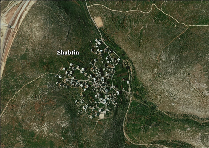
In 1882, the PEF's Survey of Western Palestine (SWP) described ‘’Shebtin’’ as: "a small village in a valley, with a well to the east. It appears to be an ancient site, and has rock cut tombs south of it." [13]

British Mandate era

In the 1922 census of Palestine, conducted by the British Mandate authorities, Shebtin had a population of 63 inhabitants, all Muslims, [14] increasing in the 1931 census to a population of 110, still all Muslim, in 20 houses. [15]

In 1945 statistics the population of Shabtin was 150 Muslims, [16] with 4,423 dunams of land, according to an official land and population survey. [17] Of this, 27 dunams were used for plantations and irrigable land, 1,158 dunams for cereals, [18] while 7 dunams were built-up (urban) land. [19]

Jordanian era

In the wake of the 1948 Arab–Israeli War, Shabtin came under Jordanian rule.

The Jordanian census of 1961 found 232 inhabitants. [20]

Post-1967

During the Six-Day War in 1967, Shabtin came under Israeli occupation.

After the 1995 accords, 7.2% of Shabtin land was classified as Area B, the remaining 92.8% as Area C. [21]

Israel has confiscated 1,781 dunams of land from Shabtin in order to construct two settlements, Nili and Na'aleh. [22]

Related Research Articles

<span class="mw-page-title-main">Birzeit</span> Palestinian Christian town north of Ramallah, West Bank

Birzeit, also Bir Zeit, is a Palestinian Christian town north of Ramallah, in the central West Bank, in the State of Palestine. Its population in the 2017 census was 5,878. Birzeit is home to Birzeit University and to the Birzeit Brewery.

<span class="mw-page-title-main">Shuqba</span> Palestinian town in Ramallah and al-Bireh, State of Palestine

Shuqba is a Palestinian town in the Ramallah and al-Bireh Governorate, located 17 kilometers northwest of the city of Ramallah in Palestine.

<span class="mw-page-title-main">Ein Yabrud</span> Municipality type C in Ramallah and al-Bireh, State of Palestine

Ein Yabrud is a Palestinian town in the Ramallah and al-Bireh Governorate in the central West Bank. It is located approximately 7 km northeast of the city of Ramallah and its elevation is 800 m. According to the Palestinian Central Bureau of Statistics (PCBS) the town had a population of 2,515 in 2017.

<span class="mw-page-title-main">Deir Qaddis</span> Municipality type D in Ramallah and al-Bireh, State of Palestine

Deir Qaddis is a Palestinian town in the Ramallah and al-Bireh Governorate of the State of Palestine, in the central West Bank, located sixteen kilometers west of Ramallah. According to the Palestinian Central Bureau of Statistics, the town had a population of 2,452 inhabitants in 2017. The town consists of 8,207 dunams, of which 438 dunams are classified as built-up area. As a result of 1995 accords, 7.7% of Deir Qaddis' land was transferred to the Palestinian National Authority for civil affairs, so-called Area B, but Israel still retains full control of 92.3% of the town, being in Area C.

<span class="mw-page-title-main">Kobar</span> Place in Ramallah and al-Bireh, Palestine

Kobar is a Palestinian village in the Ramallah and al-Bireh Governorate in the northern West Bank. Kobar is located at an altitude of 670 meters (2,200 ft) above sea level with a mean annual rainfall of 669.8 mm. The average annual temperature is 16 °C and the average annual humidity is approximately 61%.

Qira is a Palestinian town located in the Salfit Governorate in the northern West Bank, 19 kilometers southwest of Nablus. According to the Palestinian Central Bureau of Statistics, it had a population of approximately 1,278 in 2017.

<span class="mw-page-title-main">Abu Qash</span> Municipality type C in Ramallah and al-Bireh, State of Palestine

Abu Qash is a Palestinian village located in the Ramallah and al-Bireh Governorate in the northern West Bank, located north of Ramallah and south of the Birzeit University. According to the 2017 census conducted by the Palestinian Central Bureau of Statistics, it had a population of 2,237.

<span class="mw-page-title-main">Jurish</span> Municipality type D in Nablus, State of Palestine

Jurish is a Palestinian town in the Nablus Governorate in northern West Bank, located 27 kilometers Southeast of Nablus. According to the Palestinian Central Bureau of Statistics (PCBS), the town had a population of 1,541 inhabitants in 2017.

<span class="mw-page-title-main">Zeita Jamma'in</span> Municipality type C in Nablus, State of Palestine

Zeita Jamma'in is a Palestinian village in the Nablus Governorate in northern West Bank, located 16 kilometers southwest of Nablus. The village is located just north of Jamma'in, from which the village receives its name. According to the Palestinian Central Bureau of Statistics (PCBS), Zeita Jamma'in had a population of 2,740 inhabitants in 2017.

<span class="mw-page-title-main">Saffa, Ramallah</span> Town in the West Bank, State of Palestine

Saffa is a Palestinian town in the Ramallah and al-Bireh Governorate, located west of Ramallah in the northern West Bank. According to the Palestinian Central Bureau of Statistics (PCBS), the town had a population of 4,374 inhabitants in 2017.

<span class="mw-page-title-main">Deir Abu Mash'al</span> Municipality type C in Ramallah and al-Bireh, State of Palestine

Deir Abu Mash'al is a Palestinian village in the Ramallah and al-Bireh Governorate of the State of Palestine, located 24 kilometers (15 mi) west of Ramallah in the northern West Bank. According to the Palestinian Central Bureau of Statistics (PCBS), the village had a population of 4,233 inhabitants in 2017.

<span class="mw-page-title-main">Deir as-Sudan</span> Municipality type C in Ramallah and al-Bireh, State of Palestine

Deir as-Sudan is a Palestinian town in the Ramallah and al-Bireh Governorate, located 20 kilometers Northwest of Ramallah in the northern West Bank. According to the Palestinian Central Bureau of Statistics (PCBS), the town had a population of approximately 2,159 inhabitants in 2017.

<span class="mw-page-title-main">Surda</span> Municipality type C in Ramallah and al-Bireh, State of Palestine

Surda is a Palestinian town in the Ramallah and al-Bireh Governorate, located northeast of Ramallah in the northern West Bank. According to the Palestinian Central Bureau of Statistics (PCBS), the town had a population of 1,308 inhabitants in 2017.

<span class="mw-page-title-main">Burham, Ramallah</span> Local Development Committee in Ramallah and al-Bireh, State of Palestine

Burham is a Palestinian village in the Ramallah and al-Bireh Governorate located twelve kilometers north of Ramallah. The largest nearby town is Bir Zeit located to the southeast. The average elevation of Burham is 680 meters above sea level. The village was established during the Byzantine Empire rule over Palestine.

<span class="mw-page-title-main">Deir Nidham</span> Municipality type D in Ramallah and al-Bireh, State of Palestine

Deir Nidham is a Palestinian village in the Ramallah and al-Bireh Governorate in the central West Bank. It is located approximately 23 kilometers (14 mi) northwest of the city of Ramallah and its elevation is 590 meters (1,940 ft). According to the Palestinian Central Bureau of Statistics (PCBS) 2017 census, the town had a population of 876.

<span class="mw-page-title-main">Kharbatha Bani Harith</span> Municipality type D in Ramallah and al-Bireh, State of Palestine

Kharbatha Bani Harith is a Palestinian town in the central West Bank, located 15 kilometers west of Ramallah in the Ramallah and al-Bireh Governorate. The name of the town is probably a corruption of Khirbat Bani Harith. According to the Palestinian Central Bureau of Statistics, the town had a population of 3,471 in 2017. It has a total land area of 7,120 dunams.

<span class="mw-page-title-main">Abu Shukheidim</span> Municipality type C in Ramallah and al-Bireh, State of Palestine

Abu Shukheidim was a Palestinian village in the Ramallah and al-Bireh Governorate.

<span class="mw-page-title-main">Umm Safa</span> Municipality type D in Ramallah and al-Bireh, State of Palestine

Umm Safa/Kafr Ishwa or Um Al-Safa is a Palestinian village in the Ramallah and al-Bireh Governorate.

Jibiya is a Palestinian village in the Ramallah and al-Bireh Governorate.

<span class="mw-page-title-main">Jiljilyya</span> Municipality type D in Ramallah and al-Bireh, State of Palestine

Jiljilyya is a Palestinian village in the Ramallah and al-Bireh Governorate in the northern West Bank.

References

  1. Preliminary Results of the Population, Housing and Establishments Census, 2017 (PDF). Palestinian Central Bureau of Statistics (PCBS) (Report). State of Palestine. February 2018. pp. 64–82. Retrieved 2023-10-24.
  2. Palmer, 1881, p. 241
  3. Shabtin Village Profile, ARIJ, p. 4
  4. 1 2 3 4 Finkelstein et al, 1997, p. 194
  5. 1 2 Dauphin, 1998, p. 830
  6. Conder and Kitchener, 1882, SWP II, p. 355
  7. 1 2 3 Finkelstein et al, 1997, p. 195
  8. Ellenblum, 2003, pp. 134, 180
  9. Macalister and Masterman, 1906, pp. 43-44
  10. Guérin, 1875, p. 81
  11. Socin, 1879, p.161 It was also noted to be in the Ramla district, and noted after Der Kaddis
  12. Hartmann, 1883, p. 140, also noted 16 houses
  13. Conder and Kitchener, 1882, SWP II, p. 298
  14. Barron, 1923, Table VII, Division Jaffa, Sub-district of Ramleh, p. 22
  15. Mills, 1932, p. 23
  16. Government of Palestine, Department of Statistics, 1945, p. 30
  17. Government of Palestine, Department of Statistics. Village Statistics, April, 1945. Quoted in Hadawi, 1970, p. 68
  18. Government of Palestine, Department of Statistics. Village Statistics, April, 1945. Quoted in Hadawi, 1970, p. 117
  19. Government of Palestine, Department of Statistics. Village Statistics, April, 1945. Quoted in Hadawi, 1970, p. 167
  20. Government of Jordan, Department of Statistics, 1964, p. 24
  21. Shabtin Village Profile, ARIJ, p. 15
  22. Shabtin Village Profile, ARIJ, p. 16

Bibliography