Al-Janiya

Last updated

Contents

al-Janiya
Arabic transcription(s)
   Arabic الجانيه
Jiniya9257.JPG
Palestine location map wide.png
Red pog.svg
al-Janiya
Location of al-Janiya within Palestine
Coordinates: 31°56′18″N35°07′19″E / 31.93833°N 35.12194°E / 31.93833; 35.12194
Palestine grid 161/149
State State of Palestine
Governorate Ramallah and al-Bireh
Government
  Type Village council
Population
 (2017) [1]
  Total
1,296
Name meaning"to gather fruit" [2]

Al-Janiya (Arabic : الجانيه) is a Palestinian village in the Ramallah and al-Bireh Governorate located 8 kilometers northwest of Ramallah in the northern West Bank. According to the Palestinian Central Bureau of Statistics (PCBS), the village had a population of 1,296 inhabitants by 2017. [1]

Location

Al Janiya is located 8.5 km west of Ramallah. It is bordered by Al-Zaytouneh and Ein Qiniya to the east, Ras Karkar and Kafr Ni'ma to the west, Al-Zaytouneh and Al-Itihad to the north, and Deir Ibzi to the south. [3]

Etymology

Originally called Dajānah /[id-]Dəjāniyi, الدجانية/ in 16th century Ottoman documents, the surname Dajāni الدجاني is derived from it. Roy Marom and Ran Zadok have shown that the initial /d/ was lost for assimilation of the silent /d/ with the /j/ [dj/ like in jāj < dəjāj < dajāj “chicken”. [4]

History

Shards from the Iron Age II, [5] Hellenistic, [5] Roman [5] and Byzantine [5] [6] era have been found here. [7] Shards have also been found here from the Crusader/Ayyubid and Mamluk eras. [5] There are Arabic and Greek inscriptions in the village mosque, which has been dated to 731 A.H., that is, 1330-31 C.E. [5] [8] [9] [10] [11]

Ottoman era

Shards have been found here from the early Ottoman era. [5] In the Ottoman census of 1500s, Dajjaniyya was located in the nahiya of Quds. [12]

In 1838 el-Janieh was noted as partly a Greek Christian and partly a Muslim village, part of Beni Harith area, located north of Jerusalem. [13] [14]

Al-Janiya, together with er-Ras, were the chief towns for the ruling family of Simhan. The chief Sheikh of the Simhan family was Isma'il, who was killed by Ibrahim Pasha in the 1834 uprising. After Isma'il, Hasan es-Sa'id and Mohammah ibn Isma'il became the rulers. [15]

In 1870, Victor Guérin found it to be a village of 400 inhabitants, all Muslims except a few "Grec schismatique". He also suggested that the mosque stood on the site of a previous church. [16] An Ottoman village list from about same year found that the village had a population of 29 "Greeks" in 8 houses, and 268 Muslims in 58 houses, though the population count included men, only. It was noted that it was located NWW of Ramallah. [17] [18]

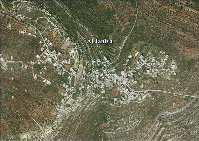
In 1882, the PEF's Survey of Western Palestine (SWP) described it: "A small village on high ground, with two Mukams and a well on the east; on the north is a modern graveyard. Olives exist round." [19]

Two different estimates were given of the population of Ed-dschanije in 1896, one gave a population of 528, [20] while another estimate gave the population to be 342 Muslims and 36 Christians. [21]

British Mandate era

In the 1922 census of Palestine conducted by the British Mandate authorities, Al-Janiya had a population of 180; 177 Muslims and 3 Orthodox Christians. [22] [23] This had increased by the time of the 1931 census to 250, 245 Muslims and 5 Christians, in 60 houses. [24]

In the 1945 statistics the population was 300, all Muslims, [25] while the total land area was 7,565 dunams, according to an official land and population survey. [26] Of this, 2,961 were plantations and irrigable land, 1,423 for cereals, [27] while 40 dunams were classified as built-up (urban) areas. [28]

Jordanian era

In the wake of the 1948 Arab–Israeli War, and after the 1949 Armistice Agreements, Al-Janiya came under Jordanian rule.

The Jordanian census of 1961 found 451 inhabitants in Janiya. [29]

Post-1967

Since the Six-Day War in 1967, Al-Janiya has been under Israeli occupation.

After the 1995 accords, 7.9% of village land was classified as Area B, the remaining 92.1% as Area C. 867 dunams of land was confiscated for the Israeli settlement of Dolev, in addition to 1,667 dunams for the settlement of Talmon. [30]

In 1989, 4,000 acres of privately owned land in Al-Janiya was confiscated and given to the Israeli settlement of Talmon. [31] By 2010, Al-Janiya had lost 10,000 acres due to Israeli confiscations. [32] [33]

By 2012, Israeli settlers regularly came armed, taking control of a local water source. [34] The spring, Ein El Masraj, earlier used for irrigation by Al-Janiya, had been physically taken over by Israeli settlers from Talmon, who had renamed it Ein Talmon. The spring Ein El Mallah, used by Al-Janiya both for domestic use and irrigation, was in danger of being taken over. [35]

By 2014, farming on local land was difficult, since Israeli authorities have declared much of it, enclosing olive groves, a 'closed military zone', which Palestinian farmers are allowed to access on average only two days a year, and many of the trees are uprooted by settlers. [36]

In November 2016, Israeli settlers attacked four Palestinian farmers while they were harvesting their olives. [37] The settlers, according to Palestinian witnesses and victims, shouted "Kill the Arabs" and "we will kill you, you sluts", and were armed with knives and clubs. After beating them up, they were filmed returning to an outpost below Neria, Mateh Binyamin. [38]

Maqam of ash-Sheikh Ahmed a-Dajani

In the center of the village al-Janiya, housed within a mosque, lies the maqam (holy tomb) of ash-Sheikh Ahmed a-Dajani. This Sufi sheikh, hailing from North Africa, resided in the village, then called Dajjaniyya, during the 16th century. He is considered a patriarch of the Dajani family of Jerusalem, whose members are said to be from the lineage of Husayn ibn Ali. However, the tomb bears an inscription stating it was built in 1330, a date that does not align with the time of the saint, which according to Muslim sources, was buried in the Mamilla Cemetery in Jerusalem in 1562. [39]

Al-Dajani's occupation involved overseeing trade convoys traveling from Fez in Morocco to Medina in the Arabian Peninsula. However, after a conflict with the wealthiest family in the village, he decided to depart, despite the village mukhtar requesting him to stay. Before leaving, he agreed to change his last name to raise the prestige and renown of the village, ensuring everyone would know he had been a resident there. Angered by the behavior of the local villagers towards the sheikh, the mukhtar declared that he would change the name of Dajjaniyya to the current name, al-Janiya. [39]

Related Research Articles

<span class="mw-page-title-main">Dura al-Qar'</span> Municipality type D in Ramallah and al-Bireh, State of Palestine

Dura al-Qar' or Dura al-Qari'a is a Palestinian town in the central West Bank, part of the Ramallah and al-Bireh Governorate. According to the Palestinian Central Bureau of Statistics, Dura al-Qar' had a population of 3,032 inhabitants in 2017.

Qatanna is a Palestinian town in the central West Bank part of the Jerusalem Governorate, located 12 km. northwest of Jerusalem. According to the Palestinian Central Bureau of Statistics, the town had a population of 6,981 inhabitants in 2017. Primary health care for the town is level 2.

<span class="mw-page-title-main">Kharbatha al-Misbah</span> Arab village in the Ramallah and al-Bireh Governate

Kharbatha al-Misbah is a Palestinian town in the central West Bank, located 12.5 kilometers (7.8 mi) west of Ramallah in the Ramallah and al-Bireh Governorate. According to the Palestinian Central Bureau of Statistics, the town had a population of 6,366 in 2017. It has a total land area of 4,431 dunams, of which 644 are built-up areas and the remainder agricultural lands and forests.

<span class="mw-page-title-main">Beitillu</span> Municipality type C in Ramallah and al-Bireh, State of Palestine

Beitillu is a Palestinian town located in the Ramallah and al-Bireh Governorate in the northern West Bank, 19 kilometers Northwest of Ramallah. According to the Palestinian Central Bureau of Statistics, it had a population of 3,465 in 2017.

<span class="mw-page-title-main">Abu Qash</span> Municipality type C in Ramallah and al-Bireh, State of Palestine

Abu Qash is a Palestinian village located in the Ramallah and al-Bireh Governorate in the northern West Bank, located north of Ramallah and south of the Birzeit University. According to the 2017 census conducted by the Palestinian Central Bureau of Statistics, it had a population of 2,237.

<span class="mw-page-title-main">Beit Sira</span> Municipality type D in Ramallah and al-Bireh, State of Palestine

Beit Sira is a Palestinian village in the central West Bank, located 22 kilometers west of Ramallah and is a part of the Ramallah and al-Bireh Governorate. The village is situated along the Green Line. During the 1948 Arab-Israeli War, around 4,000 dunams of its land became a part of the "No-Man's Land" strip between the north-central West Bank and Israel. Currently Beit Sira's jurisdiction is 3,120 dunams, of which 441 dunams are built-up areas and the remainder is open spaces for future construction or agricultural land.

<span class="mw-page-title-main">Saffa, Ramallah</span> Town in the West Bank, State of Palestine

Saffa is a Palestinian town in the Ramallah and al-Bireh Governorate, located west of Ramallah in the northern West Bank. According to the Palestinian Central Bureau of Statistics (PCBS), the town had a population of 4,374 inhabitants in 2017.

<span class="mw-page-title-main">Kafr Malik</span> Municipality type C in Ramallah and al-Bireh, State of Palestine

Kafr Malik is a Palestinian town in the Ramallah and al-Bireh Governorate of the State of Palestine, located 17 kilometers Northeast of Ramallah in the northern West Bank. According to the Palestinian Central Bureau of Statistics (PCBS), the town had a population of 2,946 inhabitants in 2017.

<span class="mw-page-title-main">Burqa, Ramallah</span> Municipality type C in Ramallah and al-Bireh, Palestine

Burqa is a town in the Ramallah and al-Bireh Governorate, located east of Ramallah in the northern West Bank, Palestine. According to the Palestinian Central Bureau of Statistics (PCBS), the town had a population of 2,047 inhabitants in the 2017 census.

<span class="mw-page-title-main">Jammala</span> Municipality type C in Ramallah and al-Bireh, State of Palestine

Jammala is a Palestinian town in the Ramallah and al-Bireh Governorate, located 18 kilometers Northwest of Ramallah in the northern West Bank. According to the Palestinian Central Bureau of Statistics (PCBS), the town had a population of 1,664 inhabitants in 2017.

<span class="mw-page-title-main">Ras Karkar</span> Palestinian village in Ramallah and al-Bireh, State of Palestine

Ras Karkar is a Palestinian village in the Ramallah and al-Bireh Governorate of the State of Palestine, located 11 kilometers (6.8 mi) northwest of Ramallah in the northern West Bank.

<span class="mw-page-title-main">Deir 'Ammar</span> Municipality type D in Ramallah and al-Bireh, State of Palestine

Deir 'Ammar is a Palestinian town in the Ramallah and al-Bireh Governorate, located 17 km (11 mi) northwest of Ramallah in the northern West Bank. According to the Palestinian Central Bureau of Statistics (PCBS), the town had a population of 3,353 inhabitants in 2017.

<span class="mw-page-title-main">Deir Ibzi</span> Municipality type C in Ramallah and al-Bireh, State of Palestine

Deir Ibzi is a Palestinian town in the Ramallah and al-Bireh Governorate, located west of Ramallah in the northern West Bank. According to the Palestinian Central Bureau of Statistics, the town had a population of 2,590 inhabitants in 2017.

<span class="mw-page-title-main">Kafr Ni'ma</span> Municipality type C in Ramallah and al-Bireh, State of Palestine

Kafr Ni'ma is a Palestinian town in the Ramallah and al-Bireh Governorate, located 13 kilometers northwest of Ramallah in the northern West Bank. According to the Palestinian Central Bureau of Statistics (PCBS), the town had a population of 4,659 inhabitants in 2017.

<span class="mw-page-title-main">Surda</span> Municipality type C in Ramallah and al-Bireh, State of Palestine

Surda is a Palestinian town in the Ramallah and al-Bireh Governorate of the State of Palestine, located northeast of Ramallah in the northern West Bank. According to the Palestinian Central Bureau of Statistics (PCBS), the town had a population of 1,308 inhabitants in 2017.

<span class="mw-page-title-main">Beit Duqqu</span> Municipality type D in Jerusalem

Beit Duqqu is a Palestinian village in the Jerusalem Governorate, located northwest of Jerusalem in the central West Bank. According to the Palestinian Central Bureau of Statistics, the town had a population of 1,754 in 2017.

<span class="mw-page-title-main">Ein Qiniya</span> Local Development Committee in Ramallah and al-Bireh, State of Palestine

Ein Qiniya or 'Ayn Kiniya is a Palestinian village in the northern West Bank, located 7 kilometers (4.3 mi) northwest of Ramallah and part of the Ramallah and al-Bireh Governorate of the State of Palestine. Ein Qiniya has existed since the Roman-era of rule in Palestine. The village is very small with no public structures or institutions and is governed by a local development committee. Ein Qiniya is regionally notable for being a spring and autumn time picnic resort.

<span class="mw-page-title-main">Yabrud, Ramallah</span> Municipality type D in Ramallah and al-Bireh, State of Palestine

Yabrud is a Palestinian village in the Ramallah and al-Bireh Governorate in the central West Bank. It is located approximately 13 km northeast of the city of Ramallah and its elevation is 790 m. According to the Palestinian Central Bureau of Statistics (PCBS) 2017 census, the town had a population of 575.

<span class="mw-page-title-main">Al-Mazra'a al-Qibliya</span> Municipality type C in Ramallah and al-Bireh, State of Palestine

Al-Mazra'a al-Qibliya is a Palestinian village in the Ramallah and al-Bireh Governorate. The village had a population of 5,180 in 2017.

<span class="mw-page-title-main">Abu Shukheidim</span> Municipality type C in Ramallah and al-Bireh, State of Palestine

Abu Shukheidim was a Palestinian village in the Ramallah and al-Bireh Governorate.

References

  1. 1 2 Preliminary Results of the Population, Housing and Establishments Census, 2017 (PDF). Palestinian Central Bureau of Statistics (PCBS) (Report). State of Palestine. February 2018. pp. 64–82. Retrieved 2023-10-24.
  2. Palmer, 1881, p. 229
  3. Al Janiya Village Profile, ARIJ, p. 4
  4. Marom, Roy; Zadok, Ran (2023). "Early-Ottoman Palestinian Toponymy: A Linguistic Analysis of the (Micro-)Toponyms in Haseki Sultan's Endowment Deed (1552)". Zeitschrift des Deutschen Palästina-Vereins. 139 (2).
  5. 1 2 3 4 5 6 7 Finkelstein et al., 1997, p. 314
  6. Dauphin, 1998, p. 833
  7. de Roziére, 1849, pp. 223-224, No. 120; cited in Röhricht, 1893, RRH, p. 50, No 200; cited in Finkelstein et al., 1997, p. 314
  8. Wright, 1903, pp. 180–181
  9. Peters, 1903, pp. 30-31
  10. Peters, 1904, pp. 384–385
  11. Sharon, 2016, pp. 167-171
  12. Toledano, 1984, p. 292, has Dajjaniyya at location 31°57′20″N 35°05′55″E
  13. Robinson and Smith, 1841, vol 2, p. 133
  14. Robinson and Smith, 1841, vol 3, p. 66, Appendix 2, p. 124
  15. Macalister and Masterman, 1905, p. 354
  16. Guérin, 1875, p. 83
  17. Socin, 1879, p. 153 It was also noted that it was in the Beni Harit area
  18. Hartmann, 1883, p. 126, noted 63 houses
  19. Conder and Kitchener, 1882, SWP II, p. 294
  20. Schick, 1896, p. 122
  21. Schick, 1896, p. 124
  22. Barron, 1923, Table VII, Sub-district of Ramallah, p. 16
  23. Barron, 1923, Table XIV, p. 45
  24. Mills, 1932, p. 49.
  25. Government of Palestine, Department of Statistics, 1945, p. 26
  26. Government of Palestine, Department of Statistics. Village Statistics, April, 1945. Quoted in Hadawi, 1970, p. 64
  27. Government of Palestine, Department of Statistics. Village Statistics, April, 1945. Quoted in Hadawi, 1970, p. 112
  28. Government of Palestine, Department of Statistics. Village Statistics, April, 1945. Quoted in Hadawi, 1970, p. 162
  29. Government of Jordan, Department of Statistics, 1964, p. 24
  30. Al Janiya Village Profile, ARIJ, pp. 15-16
  31. A walk in the hills, by Raja Shehadeh, December 1, 2008
  32. Separate and Unequal: Israel’s Discriminatory Treatment of Palestinians in the Occupied Palestinian Territories, HRW, 2010
  33. Seven days, five years: A week visiting my family in Israel, David Meir Grossman, July 28, 2014, Tablet
  34. West Bank farmers frightened away from water springs by Israeli settlers Archived 2017-09-14 at the Wayback Machine , 22 March 2012, Al Arabiya
  35. How dispossession happens. The humanitarian impact of the takeover of Palestinian springs by Israeli settlers, March 2012, United Nations Office for the Coordination of Humanitarian Affairs occupied Palestinian territory, p. 23
  36. 'Denied land access, Palestinians miss olive harvest,' Archived 2014-10-31 at the Wayback Machine Ma'an News Agency 29 October 2014.
  37. "OCHA OPT Weekly Report (1 - 14 Nov. 2016)". Question of Palestine. 2016-11-17. Retrieved 2018-11-25.
  38. A pogrom shakes a Palestinian village strangled by Israeli settlements, By Gideon Levy and Alex Levac, Nov. 11, 2016, Haaretz
  39. 1 2 Tal, Uri (2023). Muslim Shrines in Eretz Israel: History, Religion, Traditions, Folklore. Jerusalem: Yad Izhak Ben-Zvi. p. 210. ISBN   978-965-217-452-9.

Bibliography