Abwein

Last updated

Contents

Abwein
Place
Arabic transcription(s)
   Arabic عبوين
Abwein4060 d59.JPG
Abwein from the north
Palestine location map wide.png
Red pog.svg
Abwein
Location of Abwein
Coordinates: 32°1′57″N35°11′57″E / 32.03250°N 35.19917°E / 32.03250; 35.19917
Palestine grid 169/160
StateFlag of Palestine.svg  State of Palestine
Governorate Ramallah and al-Bireh
Government
  Head of MunicipalityFatima Sahweil
Area
  Total
16,205  dunams (16.205 km2 or 6.257 sq mi)
Population
 (2017) [1]
  Total
3,496
  Density220/km2 (560/sq mi)
Name meaningfrom a personal name [2]
Website www.abwain.org

Abwein (Arabic : عبوين) is a Palestinian village in the Ramallah and al-Bireh Governorate of the State of Palestine, located about 37 kilometers north of Ramallah, in the northern West Bank. According to the Palestinian Central Bureau of Statistics, Abwein's population was 3,496 in 2017. [1]

Abwein's main agricultural products are olives, figs, grapes, apples, peaches, pears, and vegetables.[ citation needed ] There are three schools in the town with about 1,200 students and about 200 students are enrolled in various Palestinian universities. Abwein also has three mosques, the largest of which is the Farouk Mosque. [3]

Location

Abwein is located 14.3 km north of Ramallah. It is bordered by Jilijliya and Sinjil to the east, Ammuriya and Al-Lubban ash-Sharqiya to the north, Bani Zeid ash Sharqiya to the west, and Atara to the south. [4]

History

Pottery sherds from Iron Age II, Persian, Hellenistic, Byzantine, and Crusader/Ayyubid era have been found. [5]

Reinhold Röhricht identified Abwein as the Crusader village of Casale Bubil or Casale Bubin. [6]

In the village is an old maqam (holy man's tomb) called ash-Shaykh Ya'qub. According to Moshe Sharon, the tomb has been neglected. The tombstone was in secondary use in a terrace. It had an inscription dating to September 1339 in Mamluk naskhi script dedicated to a Hajji Ya'qub, son of Shaikh Dawud ibn Ahmad, who died that year. It also refers to the Mamluk sultan of that time period, al-Nasir Muhammad. [7] Pottery sherds from the Mamluk era [5] and a hoard of 406 silver coins, mostly from the period of Sultan Baibars, have also been found. [8]

Ottoman era

The village was incorporated into the Ottoman Empire in 1517 with all of Palestine, and in 1596 it appeared in the Ottoman tax registers as being in the nahiya (subdistrict) of Quds, part of the liwa (district) of Quds. It had a population of 53 households, all Muslims. The villagers paid a fixed tax rate of 33.3% on wheat, barley, olive trees, vineyards, fruit trees, goats and/or beehives; a total of 8,750 akçe. All of the revenue went to a Waqf. [9]

In 1838 it was noted as a Muslim village in the Bani Zeid administrative region. [10] During this time, residents from Abwein settled in Sarafand al-Kharab near al-Ramla. [11]

In 1870 Victor Guérin visited the village, which he called "A'youein", and estimated it to have about 300 inhabitants. He described it as having abundant water-sources, beautiful walnut trees, and gardens with figs, olives and pomegranates. [12] An Ottoman village list of about the same year, 1870, showed that Abwein had 158 houses and a population of 429, though the population count included men only. [13] [14]

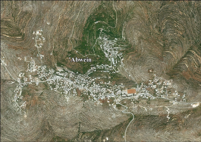
In 1882, the PEF's Survey of Western Palestine described Abwein as a village situated on the slope of a hill, with a well to the south, and olive trees on its lower north side. [15]

In 1896 the population of Abwain was estimated to be about 933 persons. [16]

British Mandate era

In the 1922 census of Palestine conducted by the British Mandate authorities, Abwein had a population of 543 Muslims, [17] increasing in the 1931 census to 695, still all Muslim, in 171 houses. [18]

In the 1945 statistics the population was 880 Muslims, [19] while the total land area was 16,205 dunams, according to an official land and population survey. [20] Of this, 1,863 were allocated for plantations and irrigable land, 8,296 for cereals, [21] while 36 dunams were classified as built-up areas. [22]

Jordanian era

In the wake of the 1948 Arab–Israeli War, and after the 1949 Armistice Agreements, Abwein came under Jordanian rule.

The Jordanian census of 1961 found 1,174 inhabitants. [23]

1967, aftermath

Since the Six-Day War in 1967, Abwein has been under Israeli occupation.

After the 1995 accords, 79.8% of village land is defined as Area A land, 9,2% as Area B, and the remainder 11% as Area C. [4]

The Sahweil Castle in Abwein was renovated in 1996. [24] In 2005, a 13-member municipality was established by the Palestinian National Authority to administer the town's civil affairs. [4] In the December 2004 Palestinian municipal elections, 28 candidates competed for the mayoral seat and despite strong opposition from religious parties, Fatima Sahweil, a member of Fatah and principal of a local girls' high school, won. The Fatah list won a total of 12 of Abwein Municipality's 13 seats. [25]

Demography

Most of Abwein's current inhabitants belong to the Sahweil and Mazahim families. According to the 'Abwein Municipal Council, the town's inhabitants are descendants of Abu Ayyub al-Ansari tribe. [4]

See also

Related Research Articles

Kafr Ein is a Palestinian village in the Ramallah and al-Bireh Governorate, located northwest of Ramallah in the central West Bank. According to the Palestinian Central Bureau of Statistics (PCBS), Kafr Ein had a population of 1,958 inhabitants in 2017. Most of the village's population comes from the Barghouti, Rifa' and Rafati clans.

<span class="mw-page-title-main">Qarawat Bani Zeid</span> Municipality type D in rb, State of Palestine

Qarawat Bani Zeid is a Palestinian village in the Ramallah and al-Bireh Governorate, located 22 kilometers northwest of Ramallah in the northern West Bank. According to the Palestinian Central Bureau of Statistics (PCBS), Qarawat Bani Zeid had a population of 3,415 inhabitants in 2017. Almost all of Qarawat Bani Zeid is under the complete control of the Palestinian National Authority, as it is located within Area A.

Ajjul is a Palestinian village in the Ramallah and al-Bireh Governorate in the northern West Bank, located north of Ramallah. There are two archaeological sites or khirbets to the east of the village. One of the khirbets is dedicated to a former resident of Ajjul, Sheikh Abdul. Ajjul is governed by a village council of three members.

<span class="mw-page-title-main">Kobar</span> Place in Ramallah and al-Bireh, State of Palestine

Kobar is a Palestinian village in the Ramallah and al-Bireh Governorate of the State of Palestine, in the northern West Bank. Kobar is located at an altitude of 670 meters (2,200 ft) above sea level with a mean annual rainfall of 669.8 mm. The average annual temperature is 16 °C and the average annual humidity is approximately 61%.

<span class="mw-page-title-main">Saffa, Ramallah</span> Town in the West Bank, State of Palestine

Saffa is a Palestinian town in the Ramallah and al-Bireh Governorate, located west of Ramallah in the northern West Bank. According to the Palestinian Central Bureau of Statistics (PCBS), the town had a population of 4,374 inhabitants in 2017.

<span class="mw-page-title-main">Deir Abu Mash'al</span> Municipality type C in Ramallah and al-Bireh, State of Palestine

Deir Abu Mash'al is a Palestinian village in the Ramallah and al-Bireh Governorate of the State of Palestine, located 24 kilometers (15 mi) west of Ramallah in the northern West Bank. According to the Palestinian Central Bureau of Statistics (PCBS), the village had a population of 4,233 inhabitants in 2017.

<span class="mw-page-title-main">Deir as-Sudan</span> Municipality type C in Ramallah and al-Bireh, State of Palestine

Deir as-Sudan is a Palestinian town in the Ramallah and al-Bireh Governorate, located 20 kilometers Northwest of Ramallah in the northern West Bank. According to the Palestinian Central Bureau of Statistics (PCBS), the town had a population of approximately 2,159 inhabitants in 2017.

<span class="mw-page-title-main">Mazari an-Nubani</span> Palestinian town near Ramallah, West Bank

Mazari an-Nubani is a Palestinian town in the Ramallah and al-Bireh Governorate, located 25 kilometers North of Ramallah in the northern West Bank. According to the Palestinian Central Bureau of Statistics (PCBS), the town had a population of 2,436 inhabitants in 2017.

<span class="mw-page-title-main">Al-Mazra'a ash-Sharqiya</span> Municipality type C in Ramallah and al-Bireh, State of Palestine

al-Mazra'a ash-Sharqiya is a Palestinian town in the Ramallah and al-Bireh Governorate, located northeast of Ramallah in the northern West Bank. According to the Palestinian Central Bureau of Statistics (PCBS), the town had a population of 4,063 inhabitants in 2017.

Khirbet Abu Falah is a Palestinian village in the Ramallah and al-Bireh Governorate, located 26 kilometers (16 mi) north of Ramallah in the central West Bank. According to the Palestinian Central Bureau of Statistics (PCBS), the village had a population of 4,394 in the 2017 census.

<span class="mw-page-title-main">Kafr Malik</span> Municipality type C in Ramallah and al-Bireh, State of Palestine

Kafr Malik is a Palestinian town in the Ramallah and al-Bireh Governorate of the State of Palestine, located 17 kilometers Northeast of Ramallah in the northern West Bank. According to the Palestinian Central Bureau of Statistics (PCBS), the town had a population of 2,946 inhabitants in 2017.

<span class="mw-page-title-main">Kafr Ni'ma</span> Municipality type C in Ramallah and al-Bireh, State of Palestine

Kafr Ni'ma is a Palestinian town in the Ramallah and al-Bireh Governorate, located 13 kilometers northwest of Ramallah in the northern West Bank. According to the Palestinian Central Bureau of Statistics (PCBS), the town had a population of 4,659 inhabitants in 2017.

<span class="mw-page-title-main">Surda</span> Municipality type C in Ramallah and al-Bireh, State of Palestine

Surda is a Palestinian town in the Ramallah and al-Bireh Governorate of the State of Palestine, located northeast of Ramallah in the northern West Bank. According to the Palestinian Central Bureau of Statistics (PCBS), the town had a population of 1,308 inhabitants in 2017.

<span class="mw-page-title-main">Ein Qiniya</span> Local Development Committee in Ramallah and al-Bireh, State of Palestine

Ein Qiniya or 'Ayn Kiniya is a Palestinian village in the northern West Bank, located 7 kilometers (4.3 mi) northwest of Ramallah and part of the Ramallah and al-Bireh Governorate of the State of Palestine. Ein Qiniya has existed since the Roman-era of rule in Palestine. The village is very small with no public structures or institutions and is governed by a local development committee. Ein Qiniya is regionally notable for being a spring and autumn time picnic resort.

<span class="mw-page-title-main">Burham, Ramallah</span> Local Development Committee in Ramallah and al-Bireh, State of Palestine

Burham is a Palestinian village in the Ramallah and al-Bireh Governorate located twelve kilometers north of Ramallah. The largest nearby town is Bir Zeit located to the southeast. The average elevation of Burham is 680 meters above sea level. The village was established during the Byzantine Empire rule over Palestine.

<span class="mw-page-title-main">Ein Siniya</span> Local Development Committee in Ramallah and al-Bireh, State of Palestine

Ein Siniya is a small Palestinian village in the Ramallah and al-Bireh Governorate, 10 kilometers (6.2 mi) north of Ramallah, and approximately 1km northeast from Jifna. It lies in a valley surrounded with olive and fig-terraces.

<span class="mw-page-title-main">Deir Nidham</span> Municipality type D in Ramallah and al-Bireh, State of Palestine

Deir Nidham is a Palestinian village in the Ramallah and al-Bireh Governorate in the central West Bank. It is located approximately 23 kilometers (14 mi) northwest of the city of Ramallah and its elevation is 590 meters (1,940 ft). According to the Palestinian Central Bureau of Statistics (PCBS) 2017 census, the town had a population of 876.

<span class="mw-page-title-main">Bani Zeid al-Sharqiya</span> Municipality type C in Ramallah and al-Bireh, State of Palestine

Bani Zeid al-Sharqiya is a Palestinian town in the northern West Bank, located north of Ramallah in the Ramallah and al-Bireh Governorate. It was formed as a result of a merger of the villages of 'Arura, Mazari al-Nubani, and Abwein, although the latter separated from the municipality. Bani Zeid al-Sharqiya is 3 kilometers (1.9 mi) north of Ajjul and other nearby localities include Deir as-Sudan to the southeast, Kafr Ein to the east, and Abwein to the southwest.

Jibiya is a Palestinian village in the Ramallah and al-Bireh Governorate. It was founded after the 16th century. It is mentioned in text from 1697.

<span class="mw-page-title-main">Jiljilyya</span> Municipality type D in Ramallah and al-Bireh, State of Palestine

Jiljilyya is a Palestinian village in the Ramallah and al-Bireh Governorate in the northern West Bank.

References

  1. 1 2 Preliminary Results of the Population, Housing and Establishments Census, 2017 (PDF). Palestinian Central Bureau of Statistics (PCBS) (Report). State of Palestine. February 2018. pp. 64–82. Retrieved 2023-10-24.
  2. Palmer, 1881, p. 221
  3. Abwein Municipality - Palestine Archived 2021-11-26 at the Wayback Machine Abwein Municipal Website
  4. 1 2 3 4 'Abwein Town Profile (PDF), ARIJ, 2012, retrieved 2015-06-30
  5. 1 2 Finkelstein and Lederman, 1997, p. 483.
  6. Röhricht, 1887, p. 204; cited in Finkelstein and Lederman, 1997, p. 483.
  7. Sharon, 1997, pp. 14-15.
  8. Mayer, 1934, pp. 167–171; cited in Finkelstein and Lederman, 1997, p. 483.
  9. Hütteroth and Abdulfattah, 1977, p. 112.
  10. Robinson and Smith, 1841, vol 3, Appendix 2, p. 125
  11. Marom, Roy (2022). "Lydda Sub-District: Lydda and its countryside during the Ottoman period". Diospolis - City of God: Journal of the History, Archaeology and Heritage of Lod. 8: 124.
  12. Guérin, 1875, p. 169.
  13. Socin, 1879, p. 142 Also noted that it was in the Beni Zeid district
  14. Hartmann, 1883, pp. 107, 113-114, also noted 158 houses
  15. Conder and Kitchener, 1882, SWP II, p. 289.
  16. Schick, 1896, p. 124
  17. Barron, 1923, Table VII, Sub-district of Ramallah, p. 16.
  18. Mills, 1932, p. 49.
  19. Government of Palestine, Department of Statistics, 1945, p. 26
  20. Government of Palestine, Department of Statistics. Village Statistics, April, 1945. Quoted in Hadawi, 1970, p. 64.
  21. Government of Palestine, Department of Statistics. Village Statistics, April, 1945. Quoted in Hadawi, 1970, p. 111.
  22. Government of Palestine, Department of Statistics. Village Statistics, April, 1945. Quoted in Hadawi, 1970, p. 161.
  23. Government of Jordan, 1964, p. 24
  24. Irving, 2012, p. 248.
  25. "Palestinian Women Triumph at Polls", Los Angeles Times , Associated Press, 2004-12-28, retrieved 2015-06-30

Bibliography