Kiryat Menachem

Last updated • 3 min readFrom Wikipedia, The Free Encyclopedia
Panama Street Park, Kiryat Menachem Jerusalem Panama St. (8118446379).jpg
Panama Street Park, Kiryat Menachem

Kiryat Menachem (Hebrew : קרית מנחם) is a neighborhood in southwest Jerusalem. It is bordered by Ir Ganim to the south and east, Mount Ora to the west, and the Jerusalem hills to the north. To the west are steep hills that descend toward streams that flow into Nahal Sorek to the north of Hadassah Ein Karem Hospital. The neighborhood overlooks the village of Ein Karem, Nahal Sorek, and the ruins of Sataf.

Contents

Name

The neighborhood was named for American Zionist leader Max (Menachem) Bressler, head of the Jewish National Fund, during his lifetime. [1]

Demographics

An arial view of Kiryat Menachem and Kiryat Yovel Kiryat Menachem and Kiryat Yovel.jpg
An arial view of Kiryat Menachem and Kiryat Yovel

Kiryat Menachem and Ir Ganim are a single geographic unit with a population of about 15,000. The neighborhood's population is quite heterogeneous, with veteran residents and new immigrants from Ethiopia and the former Soviet Union.

There are various types of housing in the neighborhood, in keeping with the population's mixture of socioeconomic levels. These include low-rise buildings and homes with gardens, mainly in Ir Ganim A and Ir Ganim B, and high-rise buildings of 4–8 stories with very small apartments throughout most of the rest of the neighborhood. Some of these buildings, particularly in Ir Ganim C and parts of Kiryat Menachem, were erected in the 1950s as temporary housing for immigrants, and are now in serious disrepair. In the 1990s urban renewal projects were carried out in these neighborhoods and some of the buildings were renovated and expanded.

Since this neighborhood is on the outskirts of Jerusalem and has a mixture of populations that have no easy access to the cultural and leisure activities in the city center, the Kiryat Menachem-Ir Ganim neighborhood has developed social solidarity and community institutions that make this area a desirable place to live.

Educational institutions

Kiryat Menachem has many educational institutions, including the Henrietta Szold Institute, National Institute for Research in the Behavioral Sciences, Guatemala School, Chabad School and Reishit state religious school built by the urban kibbutz located in the neighborhood. The local Amit high school is for both religious and non-religious students, with the vast majority of the students coming from outside the neighborhood. Kiryat Menachem's youth belong to chapters of three youth movements: Scouts, Ezra and Acharai.

Community organizations

Various community organizations operate in Kiryat Menachem, such as:

There are many active volunteer groups in Kiryat Menachem, joined each year by graduates of the "Scouts" and "Acharai" youth movements. Further more there is also a group of national service girls from the "Bat Ami" organization.

Ganim Community Council

Kiryat Menachem water tower Kiryat Menachem Water Tower-1 (6915901265).jpg
Kiryat Menachem water tower

Ganim Community Council serves the Kiryat Menachem, Ir Ganim and Givat Massuah neighborhoods.

The Community Council was established in the 1980s as part of the organization of Community Council throughout the city. The Community Council is administered by publicly elected leaders who serve as mediators between the community and the authorities. Ganim Community Council provides services in the areas of education, social services and leisure to a mixed population of various ages.

See also

Related Research Articles

<span class="mw-page-title-main">Petah Tikva</span> City in Israel

Petah Tikva, also known as Em HaMoshavot, is a city in the Central District of Israel, 10.6 km (6.6 mi) east of Tel Aviv. It was founded in 1878, mainly by Haredi Jews of the Old Yishuv, and became a permanent settlement in 1883 with the financial help of Baron Edmond de Rothschild.

<span class="mw-page-title-main">Beit Shemesh</span> City in Israel

Beit Shemesh is a city located approximately 30 kilometres (19 mi) west of Jerusalem in Israel's Jerusalem District. A center of Haredi Judaism and Modern Orthodoxy, Beit Shemesh has a population of 170,683 as of 2024.

<span class="mw-page-title-main">Kiryat Bialik</span> City in Israel

Kiryat Bialik is a city in the Haifa District in Israel. The city was established on July 18, 1934, during the Fifth Aliyah. It is one of the five Krayot suburbs to the north of Haifa. In 2022 it had a population of 44,620.

<span class="mw-page-title-main">Hadassah Women's Zionist Organization of America</span> Jewish-American volunteer womens organization

Hadassah, The Women's Zionist Organization of America is an American Jewish volunteer women's organization. Founded in 1912 by Henrietta Szold, it is one of the largest international Jewish organizations, with nearly 300,000 members in the United States. Hadassah fundraises for community programs and health initiatives in Israel, including the Hadassah Medical Organization, two leading research hospitals in Jerusalem. In the US, the organization advocates on behalf of women's rights, religious autonomy and US–Israel diplomacy. In Israel, Hadassah supports health education and research, women's initiatives, schools and programs for underprivileged youth.

<span class="mw-page-title-main">Hafetz Haim</span> Kibbutz in south-central Israel

Hafetz Haim is a religious kibbutz in central Israel. Located in the Shephelah, it falls under the jurisdiction of Nahal Sorek Regional Council. In 2022 it had a population of 575.

<span class="mw-page-title-main">Kiryat Anavim</span> Place in Jerusalem, Israel

Kiryat Anavim is a kibbutz in the Judean Hills of Israel. It was the first kibbutz established in the Judean Hills. It is located west of Jerusalem, and falls under the jurisdiction of the Mateh Yehuda Regional Council. In 2022 it had a population of 489.

<span class="mw-page-title-main">Nave Sha'anan, Haifa</span> Neighborhood in Haifa, Israel

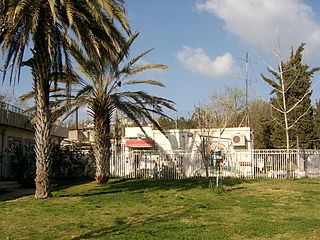
Nave Sha'anan is a large residential neighborhood in eastern Haifa, Israel that extends from the lower inclines of Mount Carmel to midway across its slopes. The main campus of the Technion university is located in the outskirts of Nave Sha'anan.

<span class="mw-page-title-main">Giv'at Shmuel</span> City in Israel

Giv'at Shmuel is a city in the Center District of Israel. It is located in the eastern part of the Gush Dan Metropolitan Area and bordered by Ramat Gan and Bnei Brak to the West, Kiryat Ono to the South and Petah Tikva to the East and North. In 2022 it had a population of 28,994.

<span class="mw-page-title-main">Kiryat HaYovel</span> Neighborhood in Jerusalem on Mount Herzl

Kiryat HaYovel is a neighborhood in southwestern Jerusalem on Mount Herzl. It was built in the early 1950s to house Jewish refugees who fled the Arab world. Today, Kiryat HaYovel has a population of 25,000 residents.

<span class="mw-page-title-main">Be'er Tuvia Regional Council</span> Regional council in South, Israel

Be'er Tuvia Regional Council, is a regional council in the Southern District of Israel.

<span class="mw-page-title-main">Neighborhoods of Beersheba</span>

The neighborhoods of Beersheba refer to urban and residential districts in the city of Beersheba, Southern District, Israel.

<span class="mw-page-title-main">Yoav Regional Council</span> Regional council

Yoav Regional Council is a regional council in the Southern District of Israel. It is located near the cities of Kiryat Gat, Kiryat Malakhi and Ashkelon. It was founded in 1952, covering an area of 230,000 dunams (230 km2), with a population of about 5,300.

<span class="mw-page-title-main">Kfar Menahem</span> Kibbutz in southern Israel

Kfar Menahem is a kibbutz in southern Israel. Located about 7 km east of Kiryat Malakhi, it falls under the jurisdiction of Yoav Regional Council. In 2022 it had a population of 1,371.

An urban kibbutz is a form of kibbutz located within an existing city. There are currently just over 100 in Israel, totalling around 2,000 members.

<span class="mw-page-title-main">Yad Binyamin</span> Community settlement in central Israel

Yad Binyamin is a community settlement in central Israel. The seat of Nahal Sorek Regional Council, it is located adjacent to the junction of three major highways: Highway 3, Highway 6, and Highway 7. In 2022 it had a population of 4,278.

<span class="mw-page-title-main">Kiryat Unsdorf</span>

Kiryat Unsdorf, also known as Sorotzkin, after its main street, is a Haredi Jewish neighborhood in Jerusalem. It is located along the northern edge of the mountain plateau on which central Jerusalem lies. Constructed between 1970 and 1985, Unsdorf is home to several landmark educational centers. A large percentage of residents are American or British-born.

<span class="mw-page-title-main">Shmuel HaNavi (neighborhood)</span> Neighbourhood in Jerusalem

Shmuel HaNavi is a neighborhood in north-central Jerusalem. It is bordered by the Sanhedria Cemetery to the north, Maalot Dafna to the east, Arzei HaBira to the south, and the Bukharan Quarter to the west. It is named after Shmuel HaNavi Street, which runs along its western border and is the main road leading to the tomb of Samuel the prophet just outside Jerusalem's city limits.

<span class="mw-page-title-main">Ir Ganim</span>

Ir Ganim is a neighborhood in southwest Jerusalem, bordering Kiryat Menachem.

<span class="mw-page-title-main">Hebrew Scouts Movement in Israel</span>

The Hebrew Scouts Movement in Israel is an Israeli Jewish co-ed Scouting and Guiding association with about 100,000 members. The Hebrew Scouts Movement is now the largest youth movement in Israel.

Tziki Tzvi Avisar Israeli politician

Tziki Tzvi Avisar is an Israeli politician, entrepreneur, and public servant who currently serves as the Mayor of Kiryat Motzkin. He is the founder and former chairman of Over The Rainbow – the Zionist movement, a World Zionist Congress faction.

References

  1. Dunn, Edwin C. "Max Bressler, 64, A Key Zionist, Dies; Led Jewish National Fund, Aided Israel Bond Drive". The New York Times . p. 34. Retrieved 12 August 2012. (See also full text Archived 2011-08-12 at the Wayback Machine .)

31°45′28.61″N35°9′53.09″E / 31.7579472°N 35.1647472°E / 31.7579472; 35.1647472