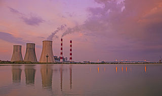
Jhajjar district is one of the 22 districts of Haryana state in northern India. Carved out of Rohtak district on 15 July 1997 and with its headquarters in Jhajjar, it lies 29 kilometres (18 mi) from Delhi and had developed into an important industrial center. Other towns in the district are Bahadurgarh and Badli and Beri. Bahadurgarh is the major city of the district and state. Bahadurgarh is known as 'The City of Destiny'. Beri used to be a village fifty years ago.
Jhajjar is a town in Jhajjar district in the Indian state of Haryana.It is a part of Delhi National Capital Region and situated on the road connecting Rewari to Rohtak (NH-352), Loharu to Meerut (NH334B), Charkhi Dadri to Delhi and Gurgaon to Bhiwani. Jhajjar is located 55 km (34 mi) west of Delhi.

The Yellow Line is a rapid transit metro line of the Delhi Metro in Delhi, India. It consists of 37 stations from Samaypur Badli in Delhi to Millennium City Centre in the neighbouring city of Gurgaon in Haryana. The 49.02 kilometers (30.46 mi) line is mostly underground and laid under one of the most congested parts of Delhi. The Yellow Line is the second line of Delhi Metro to become operational after the Red Line.
Uchana is a developing town and a municipal committee, near city of Jind in Jind district in the Indian state of Haryana.
Badli is a Village located in Rohini, North West District of Union Territory of Delhi, India. Three Metro Station are Nearly is Rohini Sector 18, 19 Metro Station, Haiderpur Badli Mor Metro Station and Samaypur Badli Metro Station.
Narela is a Suburb and a Tehsil of Delhi, located in the North Delhi district of Delhi, close to the border of Haryana. Narela is a part of North Delhi. It is 30 km away from the city centre of New Delhi.
Kundli is a town and municipal council in Sonipat, in Sonipat tehsil of Sonipat district in the Indian state of Haryana.
Samaypur is an urban village in North Delhi prominently located with NH-1 on one side and Badli Railway Station & Samaypur Badli Metro Station on the other.

Abhay Singh Chautala is an Indian politician. He was a member of the Haryana Legislative Assembly from Ellenabad. He served as Leader of the Opposition in Haryana Legislative Assembly from 2014 to 2019. He has been elected to the Haryana Legislative Assembly for four terms since 2010. He served as the 10th president of Indian Olympic Association. He also served as president of the Boxing Federation of India. He is grandson of Devi Lal, former deputy prime minister of India. He is a member of the Indian National Lok Dal.
Jai Bhagwan Aggarwal is an Indian politician from Delhi, India. He and his son, Ajay Aggarwal, are known for political intimidation and extortions from the residents of the constituency he represented. He is a member of the Bharatiya Janata Party (BJP), the ruling party in the Indian Parliament and the major party in the Legislative Assembly of Delhi. He represented the Rohini Vidhan Sabha Constituency in the Legislative Assembly of Delhi from 1993 to 2013. He lost to Rajesh Garg of Aam Aadmi Party in the 2013 Delhi legislative assembly election.
Badli Assembly constituency is one of the seventy Delhi assembly constituencies of Delhi in northern India. Badli assembly constituency is a part of North West Delhi Lok Sabha constituency.

Devender Yadav is an Indian politician belonging to the Indian National Congress (INC). He is currently the President of Delhi Pradesh Congress Committee,a permanent invitee to Congress Working Committee (CWC), INC Incharge of Punjab. He is also a founder of the Nation First Foundation, an NGO focused on providing equal opportunities for the underprivileged.
Badli is a village, nearby Jhajjar city in Jhajjar district, Haryana, India.

Nalwa Assembly constituency in Hisar district is one of the 90 Vidhan Sabha constituencies of Haryana state in northern India.

Ramvir Singh Bidhuri is the current Member of Parliament for South Delhi Lok Sabha 2024, having won by a large margin on a BJP ticket in the Lok Sabha elections 2024. He was a four-time MLA from Delhi's Badarpur seat. He served as the Leader of Opposition in the Delhi Vidhan Sabha from 2020 to 2024, and he was a member of the Badarpur Vidhan Sabha in Delhi from 1993 to 1998, 2003 to 2008, 2013 to 2015, and 2020 to 2024. In 2024, he was nominated the BJP's candidate for the South Delhi constituency in Delhi, succeeding two-time MP Ramesh Bidhuri.
Ajesh Yadav is an Indian politician and is member of the Sixth Legislative Assembly of Delhi. He is a member of the Aam Aadmi Party and represents Badli of Delhi.
Badhra is a tehsil, sub-division and assembly constituency in the Charkhi Dadri district of the Indian state of Haryana. It is located 37 kilometres (23 mi) west of district headquarters Charkhi Dadri, 44 kilometres (27 mi) south west of city of Bhiwani and 145 kilometres (90 mi) east of the national capital Delhi. As of the 2011 Census of India, the tehsil had 22,407 households with a total population of 118,084 of which 62,791 were male and 55,293 female.
Kuldeep Vats is an Indian politician from Haryana. He won from Badli Assembly constituency representing the Indian National Congress in the 2019 Haryana Legislative Assembly election. The Congress party nominated him to contest again from Badli in the 2024 Haryana Legislative Assembly election.

Haryana Orbital Rail Corridor (HORC), with target completion by 31 March 2025, is an under construction twin-track 121.7-kilometre (75.6 mi)-km long, 160 km per hour high-speed, railway project in Haryana state of India, which will run around along the Western Peripheral Expressway (WPE) on the western side of Delhi.

Badli is one of the 90 Legislative Assembly constituencies of Haryana state in India.


