This article is about the demographic features of the population of Belize, including population density, ethnicity, education level, health of the populace, economic status, religious affiliations and other aspects of the population.

Corozal Town is a town in Belize, capital of Corozal District. Corozal Town is located about 84 miles north of Belize City, and 9 miles from the border with Mexico. The population of Corozal Town, according to the main results of the 2010 census, is 9,871. Corozal was a private estate before becoming a town in the 1840s, mostly settled by Maya Mestizo refugees from the Caste War of Yucatán. Much of the town was built over an ancient Maya city, sometimes known as Santa Rita; this may have been the original Pre-Columbian town called Chetumal. Corozal Town was badly damaged by Hurricane Janet in 1955, and was substantially rebuilt afterwards.

Orange Walk Town is the fourth largest town in the nation of Belize, with a population of about 13,400. It is the capital of the Orange Walk District. Orange Walk Town is located on the left bank of the New River, 53 miles (85 km) north of Belize City and 30 miles (48 km) south of Corozal Town.

Toledo District is the southernmost district in Belize, and Punta Gorda is the District capital. It is the least developed region in the country, and it features some of the most pristine rainforests, extensive cave networks, coastal lowland plains, and offshore cays. Toledo is home to a wide range of cultures: Mopan and Kekchi Maya, Creole, the Garifuna, East Indians, Mennonites, Mestizos, and descendants of US Confederate settlers.

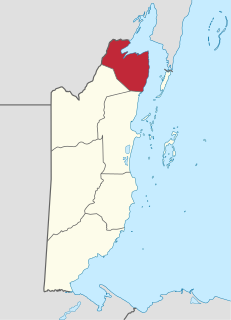
Orange Walk District is a district in the northwest of the nation of Belize, with its district capital in Orange Walk Town.

http://www.simplybelize.org/episode01.html
Xaibe is small rural settlement in the country of Belize mainly consisting of people from the Yucatec Maya ethnicity. It is located in Corozal District. The name Xaibe literally means 'crossroads'. The people of the Maya civilization often traversed across the village to reach other Maya villages. The population of the village is very small. The last available data of the population of Xaibe in 2010 revealed that it had a modest population of approximately 1,575 people. There is, however, evidence of the fact that the people belonging to the Maya civilization resided in the Xaibe village. These people then gradually shifted to Mexico, just across the border at the time of the Caste War of Yucatán. The village is known for celebrating the Maya tradition Hanal Pixan which means "food for the souls" also known as Day of the Dead.

Chetumal is a city on the east coast of the Yucatán Peninsula in Mexico. It is the capital of the state of Quintana Roo and the municipal seat of the Municipality of Othón P. Blanco. In 2010 it had a population of 151,243 people.
San José is a village in the Orange Walk District of Belize. In the 2000 census, San José had a population of 2,254 people. The village is the fourth largest in the Orange Walk district and is estimated to have almost 3,000 residents as of 2016 mainly of Yucatec Maya-Mestizo ancestry. San José is adjacent to San Pablo and is only divided from the latter by a speed bump. Combined, the two villages make up the third largest population center in the Orange Walk District with approximately 4,000 residents.
Yucatec Maya, called mayaʼ tʼàan by its speakers, is a Mayan language spoken in the Yucatán Peninsula and northern Belize. To native speakers, the proper name is Maya and it is known only as Maya. The qualifier "Yucatec" is a tag linguists use to distinguish it from other Mayan languages. Thus the use of the term Yucatec Maya to refer to the language is scientific jargon or nomenclature.

Cahal Pech is a Maya site located near the town of San Ignacio in the Cayo District of Belize. The site was a palatial, hilltop home for an elite Maya family, and though most major construction dates to the Classic period, evidence of continuous habitation has been dated to as far back as 1200 BCE during the Early Middle Formative period, making Cahal Pech one of the oldest recognizably Maya sites in Western Belize.
According to the 2010 census, the major languages spoken in Belize include English, Spanish and Kriol, all three spoken by more than 40% of the population. Mayan languages are also spoken in certain areas.
The Mopan are one of the Maya peoples in Belize and Guatemala. Their indigenous language is also called Mopan and is one of the Yucatec Maya languages.
San Jose Palmar is a village in the Orange Walk District of the nation of Belize. The official name of the village is San Jose "Nuevo" Palmar. The village has a unique and colorful history that dates back to the colonial era. The village was first settled on October 12, 1936 after the settlers were being relocated from their original village San Jose in the Yalbac Hills of Belize. The village was settled by some 200 inhabitants from the Yucatec Maya ethnicity who came originally from San Jose Viejo. Today this settlement has grown to approximately two thousand five hundred inhabitants. The village is about five minutes drive from the center of Orange Walk Town. The village is located about two miles south east from downtown Orange Walk. Its first chairperson, also known as "alcalde", was Maximo Perez. Today the newly elected chairperson is Orlando Balam, a native of the village.
Chan Chen is a village located in Corozal District, Belize. Most of the inhabitants speak Spanish or Yucatec Maya, along with some English. The name Chan Chen is Yucatec maya meaning "small well" in English. Most Chan Chen inhabitants are of Maya ancestry.
Douglas is a village situated by the Rio Hondo river in Orange Walk District, Belize, 12 miles from Orange Walk Town. According to the 2010 census, there were 122 households in Douglas with a population of 521 people, 270 males and 250 females consisting mostly from people of Maya Mestizo(Yucatec Maya) descent.
Yo Creek is a small village located in the Orange Walk District of the nation of Belize, consisting mainly of people of Yucatec Maya descent. The name Yo Creek comes from the combination of the Maya word yo which means "top" and the English word creek. Most Yo Creek residents speak Spanish and English very well, while the elders still speak their Maya language. Yo Creek is well known for cultural programs to preserve the Maya Yucatec culture. The village is also known for their Poktapok Maya ball game team Ek' Balam which means in the Yucatec Maya language Black Jaguars who won the championship in El Mundo Maya mundial de PoktaPok 2017.
Yo Chen is a small village located in the Corozal District from the nation of Belize. The name Yo Chen is in the Yucatec Maya language which means " Top of the well". Most of Yo Chen residences are from Maya Yucatec descent.
San Jose Succotz is a Maya village in Cayo District, Belize, consisting mainly of people of Yucatec Maya descent. According to the 2010 census, it has a population of 2,322 people in 472 households.