Cachardistrict is an administrative district in the state of Assam in India. After independence, the pre-existing undivided Cachar district was split into four districts: Dima Hasao, Hailakandi, Karimganj, and the current Cachar district. Silchar is Cachar district's center of government.

Karimganj district is one of the 31 districts of the Indian state of Assam. Karimganj town is both the administrative headquarters district and the biggest town of this district. It is located in southern Assam and borders Tripura and the Sylhet Division of Bangladesh. It makes up the Barak Valley alongside Hailakandi and Cachar. Karimganj was previously part of the Sylhet District before the Partition of India. It became a district in 1983.

Dima Hasao district, is an administrative district in the state of Assam, India. As of 2011, it is the least populous district of Assam.
Das is a common last name in South Asia, among adherents of Hinduism and Sikhism, as well as those who converted to Islam or Christianity. It is a derived from the Sanskrit word Dasa meaning servant, devotee, or votary. "Das" may be inferred to be one who has surrendered to God. The surname is often used by those in the Vaishnav community.
Jagiroad is a town in the state of Assam. Jagiroad located in Mayong Sub-Division, in Morigaon district. It is situated on the south bank of Kolong river.
Jiribam is a town governed by a municipal council in the Jiribam district of the state of Manipur, India. It is one of the fastest-growing towns in Manipur.
Indian Sikhs number approximately 21 million people and account for 1.7% of India's population as of 2011, forming the country's fourth-largest religious group. The majority of the nation's Sikhs live in the northern state of Punjab, which is the only Sikh-majority administrative division in the world.

The Barak Valley is the southernmost region and administrative division of the Indian state of Assam. It is named after the Barak river. The Barak valley consists of three administrative districts of Assam namely - Cachar, Karimganj, and Hailakandi. The main and largest city is Silchar, which seats the headquarter of Cachar district and also serves as administrative divisional office of Barak valley division. The valley is bordered by Mizoram and Tripura to the south, Bangladesh and Meghalaya to the west and Manipur to the east respectively. Once North Cachar Hills was a part of Cachar district which became a subdivision in 1951 and eventually a separate district. On 1 July 1983, Karimganj district was curved out from the eponymous subdivision of Cachar district. In 1989 the subdivision of Hailakandi was upgraded into Hailakandi district.

Christianity is the third largest religion in Assam, a state in the north-eastern region of India. The total population of Christians in the state is 1,165,867, which according to the 2011 census comprises about 3.74% of the state's total population. After Islam, Christianity is also the second-fastest growing religion of Assam. The largest concentration of Christians in Assam can be found in the Dima Hasao District, where Christians number approximately 30% of the population. The second largest concentration is in the Karbi Anglong district where they form approximately 16.5% of the population.

Bengali Hindus are an ethnoreligious population who make up the majority in the Indian states of West Bengal, Tripura, Andaman and Nicobar Islands, Jharkhand, and Assam's Barak Valley region. In Bangladesh, they form the largest minority. They are adherents of Hinduism and are native to the Bengal region in the eastern part of the Indian subcontinent. Comprising about one-third of the global Bengali population, they are the second-largest ethnic group among Hindus after Hindustani Hindus. Bengali Hindus speak Bengali, which belongs to the Indo-Aryan language family and adhere to Shaktism or Vaishnavism of their native religion Hinduism with some regional deities. There are significant numbers of Bengali-speaking Hindus in different Indian states. According to the census in 1881, 12.81 per cent of Bengali Hindus belonged to the three upper castes while the rest belonged to the Shudra and Dalit castes.
The Naga Hills District was a former district of the Assam province of British India. Located in the Naga Hills, it was mainly inhabited by the Naga ethnic groups. The area is now part of the state of Nagaland.

Sikhism in Bangladesh has an extensive heritage and history, although Sikhs had always been a minority community in Bengal. Their founder, Guru Nanak visited a number of places in Bengal in the early sixteenth century where he introduced Sikhism to locals and founded numerous establishments. In its early history, the Sikh gurus despatched their followers to propagate Sikh teachings in Bengal and issued hukamnamas to that region. Guru Tegh Bahadur lived in Bengal for two years, and his successor Guru Gobind Singh also visited the region. Sikhism in Bengal continued to exist during the colonial period as Sikhs found employment in the region, but it declined after the partition in 1947. Among the eighteen historical gurdwaras in Bangladesh, only five are extant. The Gurdwara Nanak Shahi of Dhaka is the principal and largest gurdwara in the country. The Sikh population in the country almost entirely consists of businessmen and government officials from the neighbouring Republic of India.

Jiribam District is a district at the western periphery state of Manipur, India. It borders the Cachar district of Assam on the west, and serves as the western gateway for Manipur. Formerly a subdivision of the Imphal East district, it was made an independent district in December 2016.
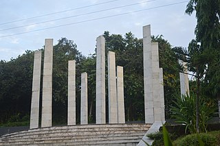
The 1869 Cachar earthquake occurred on 10 January with an estimated moment magnitude of 7.4 and a maximum EMS-98 intensity of VII (Damaging). Two people were killed and damage was considered severe. The earthquake was felt in Upper Burma, Bihar, Jharkhand, Bengal and Northeast India.

The Pratapgarh Kingdom was a medieval state in the north-east of the Indian subcontinent. Composed of the present-day Indian district of Karimganj, as well as parts of Tripura State and Sylhet, Bangladesh, the kingdom was ruled by a line of Muslim monarchs over a mixed population of Hindu and Islamic adherents. It was bordered by the larger kingdoms of Kachar, Tripura and Bengal.
Rajwars or Rajuar is a shifting cultivation community. The people of this community mainly live in Bihar, Jharkhand, Madhya Pradesh, Odisha and West Bengal. In Odisha, they are recognized as a Scheduled Tribe, while in Bihar, Jharkhand, and West Bengal, they are classified as Scheduled Caste. In other states, the community is considered part of the Other Backward Classes (OBC) or general population.
Jagara, commonly known as Jagra, is a census village in Nalbari district, Assam, India. According to the 2011 Census of India, Jagra has a total population of 6,842 people, including 3,586 males and 3,256 females.
Balikaria, also spelled as Bali Karia, is a village in Nalbari district, Assam, India. According to the 2011 Census of India, Balikaria has a population of 6,359 people including 3,305 males and 3,054 females with literacy rate of 86.54%. The 500 years old Kharzara Ashram is located on Balikaria. It's the oldest Ashram of Assam.

Haleswar Temple is an 18th-century Hindu temple, located about 10 kilometers north of Tezpur in the state of Assam.
Jagiroad Railway Station coded JID is a railway station in the town Jagiroad of Assam, India. It is an important station on the Guwahati–Lumding section of the Northeast Frontier Railway (NFR).