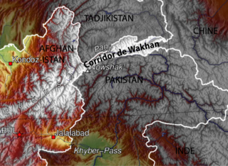
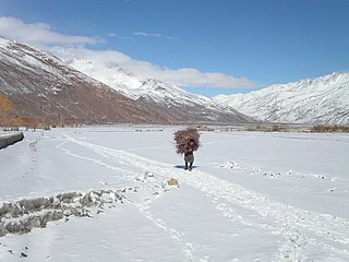
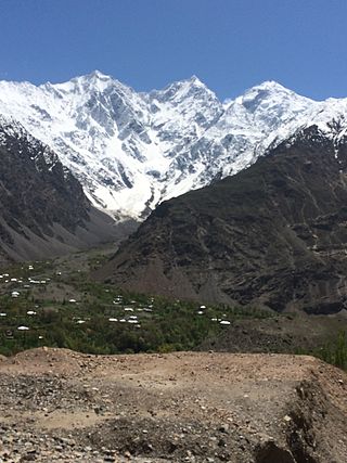
The Wakhan Corridor is a narrow strip of territory located within the Badakhshan province of Afghanistan. This corridor stretches eastward, connecting Afghanistan to Xinjiang, China. It also separates the Gorno-Badakhshan Autonomous Region of Tajikistan in the north from the northern Pakistan in the south. This high mountain valley serves as the source of both the Panj and Pamir rivers, which converge to form the larger Amu River. For countless centuries, a vital trade route has traversed this valley, facilitating the movement of travelers to and from East, South, and Central Asia.
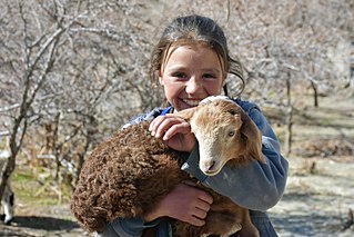
The Wakhi people, also locally referred to as the Wokhik, are an Iranian ethnic group native to Central and South Asia. They are found in Afghanistan, Tajikistan, Pakistan and China—primarily situated in and around Afghanistan's Wakhan Corridor, the northernmost part of Pakistan's Gilgit−Baltistan and Chitral, Tajikistan's Gorno−Badakhshan Autonomous Region and the southwestern areas of China's Xinjiang Uyghur Autonomous Region. The Wakhi people are native speakers of the Wakhi language, an Eastern Iranian language.

Badakhshan Province is one of the 34 provinces of Afghanistan, located in the northeastern part of the country. It is bordered by Tajikistan's Gorno-Badakhshan in the north and the Pakistani regions of Lower and Upper Chitral and Gilgit-Baltistan in the southeast. It also has a 91-kilometer (57-mile) border with China in the east.

Wakhan is one of the 28 districts of Badakhshan province in eastern Afghanistan. The district has a border with neighboring Tajikistan in the north, Xinjiang in China to the east, and Pakistan to the south.
Ab Gaj is a village in Badakhshan Province in north-eastern Afghanistan. It is on the left bank of the Ab-i-Wakhan about a mile upstream of the meeting of that river and the Amu Darya, and about ten miles southeast of Kala Panja.
Deh Gholaman is a village in Badakhshan Province in north-eastern Afghanistan on the Wakhan River, roughly 20 miles west of Baroghil.
Fotur is a village on the left bank of the Ab-i-Panj river in Badakhshan Province in north-eastern Afghanistan.
Gaz Khan or Goz Khun is a village in the Wakhan in Badakhshan Province in north-eastern Afghanistan. It is located at the confluence of the Panj River and Wakhan River, The village is the starting point for treks into the Great Pamir.
Kashkandyow is a village in Wakhan District, Badakhshan Province in north-eastern Afghanistan.
Khandud (Khandut) is a village in Badakhshan Province in north-eastern Afghanistan. It is in Wakhan District, near the left bank of the Panj River.
Langar is a village in the Wakhan District of Badakhshan Province, in north-eastern Afghanistan. It lies on the river Panj, opposite the larger village of Toqakhona in Tajikistan.
Qalʽeh-ye Panjeh, also written Qila-e Panjeh and Kala Panja, is a village in Wakhan, Badakhshan Province in north-eastern Afghanistan. It lies on the Panj River, near the confluence of the Wakhan River and the Pamir River.
Qazi Deh is a village in Badakhshan Province in north-eastern Afghanistan. It lies on the left bank of the Panj River, 20 km from Ishkashim.
Rokowt is a village in the Wakhan, Badakhshan Province in north-eastern Afghanistan. It lies on the Wakhan River between Qila-e Panja and Sarhad-e Broghil.

Sarhadd or Sarhad, also known as Sarhad-e Broghil or Sarhad-e Wakhan, is a village in the Wakhan District of Badakhshan Province, Afghanistan.
Shkhawr is a village in Badakhshan Province in north-eastern Afghanistan.
Sost is a village in Badakhshan Province in north-eastern Afghanistan.
Mastuj is a tehsil of Upper Chitral District in Khyber-Pakhtunkhwa province of Pakistan; Mastuj is the principal settlement. It is located at 36°17'0N 72°31'0E with an altitude of 2359 metres. There are ruins of old fort built originally in 18th century and reconstructed several times.
Qala Wust is a mountain village in the Wakhan region of the Badakhshan Province, north-eastern Afghanistan.
