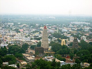
Mangalagiri is a model town in Guntur district of Andhra Pradesh. It is a major suburb of Vijayawada and also part of Vijayawada metropolitan area. It is currently the 31st most populous city of Andhra Pradesh. The town is the headquarters of Mangalagiri mandal under Tenali revenue division. It is situated on National Highway 16 between Vijayawada and Guntur. The town was known to have existed since 225 B.C.

Vijayawada is the second largest city in the Indian state of Andhra Pradesh and is a part of the state's Capital Region. It is the administrative headquarters of the NTR district. It comprises NTR and part of Krishna district. Vijayawada lies on the banks of Krishna river surrounded by the hills of Eastern Ghats, known as Indrakeeladri Hills. It geographically lies on the center spot of Andhra Pradesh. The city has been described as the commercial, political, cultural and educational capital of Andhra Pradesh, second largest city in Andhra Pradesh and is one of the fastest growing urban areas in India.

Gannavaram is a town in Krishna district of the Indian state of Andhra Pradesh. It is also the mandal headquarters of Gannavaram mandal which is administered under Gudivada revenue division.

Tadepalligudem is a City in West Godavari district of the Indian state of Andhra Pradesh. It is a Selection Grade municipality and the mandal headquarters of Tadepalligudem mandal in Bhimavaram revenue division. Tadepalligudem is second biggest city next to Bhimavaram city in west godavari District as per 2011 census in terms of population.

Narsipatnam is a census town in Anakapalle district of the Indian state of Andhra Pradesh. It was upgraded from a gram panchayat into municipality in 2012. The town is spread over an area of 42 km2 (16 sq mi) The resting place of the revolutionary Indian freedom fighter Alluri Sitarama Raju is located in Krishna Devi Peta village of Narsipatnam.

Rampachodavaram is a census town in Alluri Sitharama Raju district of the Indian state of Andhra Pradesh. It is located in Rampachodavaram mandal of Rampachodavaram revenue division. Rampachodavaram is known for its dense jungle and waterfalls which can be accessed by road transport only.
Akividu is a town in West Godavari district of the Indian state of Andhra Pradesh. It is a Nagara Panchayati(Municipality) and the Mandal Head Quarters Of Akiveedu Mandal in Bhimavaram Revenue Division. Akiveedu is a Sixth Biggest town in Westgodavari District. between the twin cities of Bhimavaram and Eluru of Andhra Pradesh.
Vuyyuru is a town in Krishna district of the Indian state of Andhra Pradesh. It is a Nagar panchayat and the headquarters of Vuyyuru Mandal. It is emerging as neighbourhood of Vijayawada, India situated 30 km away.

Vijayawada (rural) mandal is one of the 20 mandals in NTR district of the Indian state of Andhra Pradesh. It is under the administration of Vijayawada revenue division and has its headquarters at Nunna. The mandal is bounded by Ibrahimpatnam, G. Konduru, Gannavaram, Kankipadu, Penamaluru and Patamata Mandals. The mandal is also a part of the Andhra Pradesh Capital Region under the jurisdiction of APCRDA.

Cheepurupalli is a census town in Vizianagaram district of the Indian state of Andhra Pradesh. The town is located 30 km to the north of Vizianagaram.The town covers an area of 348 hectares with a population of 78,000 according to the 2011 census.
Ibrahimpatnam is a part of Vijayawada in NTR district of the Indian state of Andhra Pradesh. It is also the mandal headquarters of Ibrahimpatnam mandal. Dr Narla Tata Rao Thermal Power Station, one of the major Thermal power stations of the state is located near the town. Railway Wagon Workshop at Rayanapadu is also located very near to Ibrahimpatnam at a distance of 4 km.

Ramavarappadu is a residential hub located in the East-Central part of Vijayawada in Krishna district of the Indian state of Andhra Pradesh. It is located in Vijayawada (rural) mandal of Vijayawada revenue division. As per the G.O. No. M.S.104 (dated:23-03-2017), Municipal Administration and Urban Development Department, it became a part of Vijayawada metropolitan area.

Nakkapalle or Nakkapalli is a census town in Anakapalli district in the state of Andhra Pradesh in India.

Tadepalle is a town in Guntur district of the Indian state of Andhra Pradesh. The town is part of Mangalagiri Tadepalle Municipal Corporation part of Tenali revenue division and is a major suburb of Vijayawada. It also forms a part of Andhra Pradesh Capital Region.

Guntupalli is a suburb of Vijayawada located in the NTR district of the Indian state of Andhra Pradesh. It is located in Ibrahimpatnam mandal of Vijayawada revenue division.
China Avutapalli is a village in Krishna district of the Indian state of Andhra Pradesh. It is located in Gannavaram mandal of Nuzvid revenue division. It is located 4 km from the Vijayawada Airport.

Gannavaram mandal is one of the 25 mandals in Krishna district of the Indian state of Andhra Pradesh. It is under the administration of Gudivada revenue division and the mandal headquarters are located at Gannavaram. The mandal is bounded by Agiripalle, Bapulapadu, Unguturu, Vijayawada (rural) and Kankipadu mandals. The mandal is also a part of the Andhra Pradesh Capital Region under the jurisdiction of APCRDA.

Gampalagudem mandal is one of the 20 mandals in NTR district of the state of Andhra Pradesh in India. It is under the administration of Tiruvuru revenue division and the headquarters are located at Gampalagudem town. The mandal is bounded by Tiruvuru, A. Konduru mandals of Krishna district in Andhra Pradesh and Khammam district of Telangana state.

Bantumilli mandal is one of the 25 mandals in Krishna district of the Indian state of Andhra Pradesh. The headquarters of this mandal is located at Bantumilli town. The mandal is bordered by Kalidindi mandal to the north, Kruthivennu mandal to the east, Machilipatnam mandal to the south and Pedana mandal to the west.

Bapulapadu mandal is one of the 25 mandals in Krishna district of the Indian state of Andhra Pradesh. The headquarters of this mandal is located at Bapulapadu town. The mandal is bordered by Nuzvid mandal and Agiripalle mandal to the north, West Godavari district to the east, Nandivada mandal to the south and Unguturu mandal to the west.


