Malkajgiri is an urban area of Secunderbad city in the Medchal–Malkajgiri district of the Indian state of Telangana. It is the headquarters of Malkajgiri mandal in Malkajgiri revenue division. Malkajgiri is one of the most populated mandals in the Medchal District. It is governed by the Greater Hyderabad Municipal Corporation, and has representation in the Telangana Legislative. It was a part of Ranga Reddy district before the re-organisation of districts in the state. Now it's in Medchal-Malkajgiri district.
Mandals, taluka panchayats, block panchayats, or panchayat samiti are rural local governments (panchayats) at the intermediate level in panchayat raj institutions (PRI).

Padmanabham mandal is one of the 46 mandals in Visakhapatnam District. It is under the administration of Visakhapatnam revenue division and the headquarters is located at Padmanabham. The Mandal is bounded by Bheemunipatnam, Anandapuram mandals in Visakhapatnam District and Bhogapuram mandal in Vizianagaram District.

Saidapur is a village in Saidapur mandal of Karimnagar district in the state of Telangana in India, near Huzurabad.
Venkatapur is a village and a mandal in Mulugu district in the state of Telangana, India. It is the second-largest revenue village of the district, comprising around 12,000 people.
A tehsil is an administrative division in some countries of South Asia. It is an area of land with a city or town that serves as its administrative centre, with possible additional towns, and usually a number of villages. The terms in India have replaced earlier geographical terms, such as pargana, pergunnah and thannah.

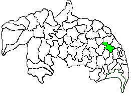
Tenali mandal is one of the 57 mandals in Guntur district of the Indian state of Andhra Pradesh. It is under the administration of Tenali revenue division and the headquarters are located at Tenali. The mandal is located in Velanadu region and is bounded by Pedakakani, Duggirala, Kollipara, Vemuru, Amruthalur, Tsundur and Chebrole mandals.

Repalle mandal is one of the 57 mandals in Guntur district of the state of Andhra Pradesh, India. It is under the administration of Tenali Revenue Division and the headquarters are located at Repalle. The mandal is situated on the banks of Krishna River of Velanadu region and is bounded by Bhattiprolu, Nagaram and Nizampatnam mandals.

Duggirala mandal is one of the 57 mandals in Guntur district of the Indian state of Andhra Pradesh. It is under the administration of Tenali revenue division and the headquarters are located at Duggirala. The mandal is bounded by Mangalagiri, Pedakakani, Tenali and Kollipara mandals. Krishna River lies to the northeast of the Duggirala mandal.

Kollur mandal is one of the 57 mandals in Guntur district of the Indian state of Andhra Pradesh. It is under the administration of Tenali revenue division and the headquarters are located at Kollur. The mandal is situated on the banks of Krishna River, bounded by Vemuru, Bhattiprolu and Kollipara mandals.

Amaravathi mandal is one of the 57 mandals in Guntur district of the Indian state of Andhra Pradesh. It is under the administration of Guntur revenue division and the headquarters are located at Amaravathi. The mandal is located on the banks of Krishna River, at a distance 27 km from the district headquarters. It is bounded by Atchampet, Krosuru, Pedakurapadu, Tadikonda and Thullur mandals.

Thullur mandal is one of the 57 mandals in Guntur district of the Indian state of Andhra Pradesh. It is under the administration of Guntur Revenue Division and the headquarters are located at Thullur. The mandal is situated on the banks of Krishna River, bounded by Amaravathi, Tadikonda, Tadepalle and Mangalagiri mandals. The mandal is also a part of the new capital city of Andhra Pradesh to be developed. 18 villages from the mandal fall under the jurisdiction of Andhra Pradesh Capital City.

Makkuva mandal is one of the 34 mandals in Vizianagaram district of the Indian state of Andhra Pradesh. It is administration under Parvathipuram revenue division and headquartered at Makkuva. The mandal is bounded by Salur mandal on South & West, Parvathipuram mandal on North, Seethanagaram mandal on east and Bobbili mandal on south east. A portion of it also borders the Narayanapatna block of the Koraput district of Odisha on north west.

Ramabhadrapuram mandal is one of the 34 mandals in Vizianagaram district of Andhra Pradesh, India. Ramabhadrapuram is the headquarters of the mandal. The mandal is bounded by Salur, Bobbili, Badangi, Merakamudidam, Dattirajeru, Mentada and Pachipenta mandals.

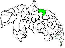
Tsundur mandal is one of the 57 mandals in Guntur district of the Indian state of Andhra Pradesh. It is under the administration of Tenali revenue division and the headquarters are located at Tsundur. The mandal is bounded by Chebrolu, Tenali, Amruthalur and Ponnur mandals. The mandal is a part of Andhra Pradesh Capital Region.

Mancherial district is a district located in the northern region of the Indian state of Telangana. It was a part of the Adilabad district prior to the re-organisation of districts in the state. Mancherial District is carved out of erstwhile Adilabad District. It is surrounded by Asifabad, Adilabad, Nirmal, Jagtial, Peddapalli and Bhupalpally districts.

Mahabubabad is a district in the Indian state of Telangana. It was a part of the Warangal district prior to the re-organisation of districts in the state in October 2016.The district shares boundaries with Suryapet, Khammam, Bhadradri Kothagudem,Jayashankar Bhupalpalle,Warangal Rural, Jangaon districts.

Jayashankar Bhupalpally is a district in the Indian state of Telangana. The district headquarters are located at Bhupalpally. It was a part of the Warangal district prior to the re-organisation of districts in the state.

Jagtial


