The Arctic Archipelago, also known as the Canadian Arctic Archipelago, is an archipelago lying to the north of the Canadian continental mainland, excluding Greenland and Iceland.

Dundee Island is an ice-covered island lying east of the northeastern tip of the Antarctic Peninsula and south of Joinville Island, Antarctica.
The Amundsen Glacier is a major Antarctic glacier, about 7 to 11 km wide and 150 km (80 nmi) long. It originates on the Antarctic Plateau where it drains the area to the south and west of Nilsen Plateau, then descends through the Queen Maud Mountains to enter the Ross Ice Shelf just west of the MacDonald Nunataks.
The Hauberg Mountains are a group of mountains of about 35 nautical miles extent, located 12 nautical miles north of Cape Zumberge and 30 nautical miles south of the Sweeney Mountains in eastern Ellsworth Land, Antarctica.

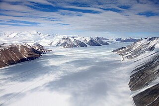
Ferrar Glacier is a glacier in Antarctica. It is about 35 nautical miles long, flowing from the plateau of Victoria Land west of the Royal Society Range to New Harbour in McMurdo Sound. The glacier makes a right (east) turn northeast of Knobhead, where it where it is apposed, i.e., joined in Siamese-twin fashion, to Taylor Glacier. From there, it continues east along the south side of Kukri Hills to New Harbor.
Kohler Range is a mountain range in Marie Byrd Land, Antarctica. The range is about 40 nautical miles long and stands between the base of Martin Peninsula and Smith Glacier. The range consists of two ice-covered plateaus punctuated by several rock peaks and bluffs. The plateaus are oriented East-West and are separated by the Kohler Glacier, a distributary which flows north from Smith Glacier.

Bear Peninsula is a peninsula about 50 nautical miles long and 25 nautical miles wide which is ice-covered except for several isolated rock bluffs and outcrops along its margins, lying 3 nautical miles east of Martin Peninsula on Walgreen Coast, Marie Byrd Land, Antarctica.

Ahlmann Glacier is the southernmost of two glaciers on the east side of Hemimont Plateau flowing east into Seligman Inlet on Bowman Coast, Graham Land in Antarctica.
The Land Glacier is a broad, heavily crevassed glacier, about 35 nautical miles long, descending into Land Bay in Marie Byrd Land, Antarctica. It was discovered by the United States Antarctic Service (1939–41) and named for Rear Admiral Emory S. Land, Chairman of the United States Maritime Commission.
The Latady Mountains are a group of mountains rising west of Gardner Inlet and between Wetmore Glacier and Ketchum Glacier, in southeastern Palmer Land, Antarctica.
On the continent of Antarctica, the Aramis Range is the third range south in the Prince Charles Mountains, situated 11 miles southeast of the Porthos Range and extending for about 30 miles in a southwest–northeast direction. It was first visited in January 1957 by Australian National Antarctic Research Expeditions (ANARE) southern party led by W.G. Bewsher, who named it for a character in Alexandre Dumas' novel The Three Musketeers, the most popular book read on the southern journey.
The Gustav Bull Mountains are a small group of bare, rugged mountain peaks and nunataks, lying 4 miles (6 km) inland from the coast and 10 nautical miles (19 km) southwest of Scullin Monolith in Mac. Robertson Land, Antarctica.

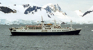
Paradise Harbour is a wide embayment behind Lemaire Island and Bryde Island, indenting the west coast of Graham Land, Antarctica, between Duthiers Point and Leniz Point. The name was first applied by whalers operating in the vicinity and was in use by 1920.
Green Glacier is a glacier on the east side of Graham Land, Antarctica, 15 nautical miles (28 km) long and 4 nautical miles (7 km) wide, flowing from the plateau northeast between Dugerjav Peak and Rugate Ridge, and then east into Vaughan Inlet next north of Pirne Peak and south of the terminus of Hektoria Glacier.
Steinemann Island is an island off the northeast coast of Adelaide Island, about 10 nautical miles (18 km) southwest of Mount Velain. Mapped from air photos taken by Ronne Antarctic Research Expedition (RARE) (1947–48) and Falkland Islands and Dependencies Aerial Survey Expedition (FIDASE) (1956–57). Named by United Kingdom Antarctic Place-Names Committee (UK-APC) for Samuel Steinemann, Swiss physicist who has made laboratory investigations on the flow of single and polycrystalline ice.
Sjögren Glacier is a glacier 15 nautical miles long in the south part of Trinity Peninsula, Antarctica. It flows southeast from Detroit Plateau to the south side of Mount Wild, where it enters Prince Gustav Channel.
Solus Island is an island off the Antarctic Peninsula, lying 3 nautical miles (6 km) south of the Guébriant Islands, tio the south-southeast of Cape Alexandra at the south end of Adelaide Island. The name appears as Islote Solitario, meaning 'solitary islet', on an Argentine government chart of 1957. The name indicates its isolated position. The name 'Solus Island' was adopted on British charts
Ryan Peak is a peak 1 nautical mile (1.9 km) east of Penitent Peak on Horseshoe Island. Surveyed by Falkland Islands Dependencies Survey (FIDS) in 1955–57. Named for Francis B. Ryan of FIDS, meteorologist at Horseshoe Island in 1956, who broke a leg in a climbing accident on this peak.
Regent Reef is an area of submerged and drying rocks forming the northeast limit of the Dion Islands, off the south end of Adelaide Island. Charted by the Royal Navy Hydrographic Survey Unit in 1963. The name given by the United Kingdom Antarctic Place-Names Committee (UK-APC) extends those in the neighboring islands associated with an emperor's court.
![]() This article incorporates public domain material from "Penitent Peak". Geographic Names Information System . United States Geological Survey.
This article incorporates public domain material from "Penitent Peak". Geographic Names Information System . United States Geological Survey. 


