Related Research Articles

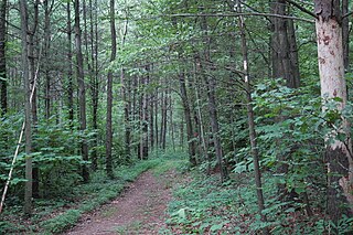
Worlds End State Park is a 780-acre (316 ha) Pennsylvania state park in Sullivan County, Pennsylvania, in the United States. The park, nearly surrounded by Loyalsock State Forest, is in the Loyalsock Creek valley on Pennsylvania Route 154, in Forks and Shrewsbury Townships southeast of the borough of Forksville. The name Worlds End has been used since at least 1872, but its origins are uncertain. Although it was founded as Worlds End State Forest Park by Governor Gifford Pinchot in 1932, the park was officially known as Whirls End State Forest Park from 1936 to 1943.

Shawnee State Park is a 3,983-acre (1,612 ha) Pennsylvania state park in Juniata and Napier Townships, Bedford County, Pennsylvania in the United States. Shawnee Lake, a 451-acre (183 ha) warm water reservoir, is at the center of the park as its main attraction. The park's main entrance is just east of Schellsburg, along U.S. Route 30 and about 10 miles (16 km) west of the county seat of Bedford. The park is also easily accessed via State Route 31 and by State Route 96.

Larrys Creek is a 22.9-mile-long (36.9 km) tributary of the West Branch Susquehanna River in Lycoming County in the U.S. state of Pennsylvania. A part of the Chesapeake Bay drainage basin, its watershed drains 89.1 square miles (231 km2) in six townships and a borough. The creek flows south from the dissected Allegheny Plateau to the Ridge-and-valley Appalachians through sandstone, limestone, and shale from the Devonian, Mississippian, and Pennsylvanian periods.

White Deer Hole Creek is a 20.5-mile (33.0 km) tributary of the West Branch Susquehanna River in Clinton, Lycoming and Union counties in the U.S. state of Pennsylvania. A part of the Chesapeake Bay drainage basin, the White Deer Hole Creek watershed drains parts of ten townships. The creek flows east in a valley of the Ridge-and-valley Appalachians, through sandstone, limestone, and shale from the Ordovician, Silurian, and Devonian periods.
Joseph E. Ibberson Conservation Area is a 783-acre (317 ha) Pennsylvania state park in Middle Paxton and Wayne Townships, Dauphin County, Pennsylvania in the United States.

Cherry Springs State Park is an 82-acre (33 ha) Pennsylvania state park in Potter County, Pennsylvania, United States. The park was created from land within the Susquehannock State Forest, and is on Pennsylvania Route 44 in West Branch Township. Cherry Springs, named for a large stand of Black Cherry trees in the park, is atop the dissected Allegheny Plateau at an elevation of 2,300 feet (701 m). It is popular with astronomers and stargazers for having "some of the darkest night skies on the east coast" of the United States, and was chosen by the Pennsylvania Department of Conservation and Natural Resources (DCNR) and its Bureau of Parks as one of "25 Must-See Pennsylvania State Parks".

Little Pine State Park is a Pennsylvania state park on 2,158 acres (873 ha) in Cummings Township, Lycoming County, Pennsylvania in the United States. Little Pine State park is along 4.2 miles (6.8 km) of Little Pine Creek, a tributary of Pine Creek, in the midst of the Tiadaghton State Forest. A dam on the creek has created a lake covering 94 acres (38 ha) for fishing, boating, and swimming. The park is on Pennsylvania Route 4001, 4 miles (6.4 km) northeast of the unincorporated village of Waterville or 8 miles (13 km) southwest of the village of English Center. The nearest borough is Jersey Shore, Pennsylvania, about 15 miles (24 km) south at the mouth of Pine Creek on the West Branch Susquehanna River.

Upper Pine Bottom State Park is a 5-acre (2.0 ha) Pennsylvania state park in Lycoming County, Pennsylvania in the United States. The park is in Cummings Township on Pennsylvania Route 44 and is surrounded by the Tiadaghton State Forest. It is on Upper Pine Bottom Run, which gave the park its name and is a tributary of Pine Creek. Upper Pine Bottom State Park is in the Pine Creek Gorge, where the streams have cut through five major rock formations from the Devonian and Carboniferous periods.

Varden Conservation Area is a Pennsylvania state park on 343 acres (139 ha) in Lake and South Canaan Townships, Wayne County, Pennsylvania in the United States. The conservation area is currently under development. The land was donated to the Commonwealth of Pennsylvania in December 2001 by Dr. Mead Shaffer a veterinarian and resident of Boothwyn, Pennsylvania in Delaware County. Dr. Shaffer stated his reason for donating the land, "Environmental education always has been a primary concern of mine. I trust this land will allow present and future generations to observe and study the diverse ecology found in the Varden Conservation Area." Varden Conservation Area is near the unincorporated village of Varden on Pennsylvania Route 296, east of the Lackawanna County line.
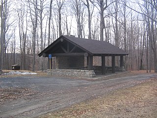
Patterson State Park is a Pennsylvania state park on 10 acres (4.0 ha) that are located in Summit Township, Potter County, Pennsylvania in the United States. The park is on Pennsylvania Route 44 near Sweden Valley. The park has two rustic roadside pavilions.
The Pennsylvania Department of Conservation and Natural Resources (DCNR), established on July 1, 1995, is the agency in the U.S. State of Pennsylvania responsible for maintaining and preserving the state's 121 state parks and 20 state forests; providing information on the state's natural resources; and working with communities to benefit local recreation and natural areas. The agency has its headquarters in the Rachel Carson State Office Building in Harrisburg.

Kooser State Park is a 250-acre (101 ha) Pennsylvania state park in Jefferson Township, Somerset County, Pennsylvania, in the United States. The park, which borders Forbes State Forest, was built in the 1930s by the Civilian Conservation Corps, who also built the 4-acre (1.6 ha) Kooser Lake by damming Kooser Run. Kooser State Park is on Pennsylvania Route 31 a one-hour drive from Pittsburgh. The park is surrounded by Forbes State Forest.

Plunketts Creek is an approximately 6.2-mile-long (10 km) tributary of Loyalsock Creek in Lycoming and Sullivan counties in the U.S. state of Pennsylvania. Two unincorporated villages and a hamlet are on the creek, and its watershed drains 23.6 square miles (61 km2) in parts of five townships. The creek is a part of the Chesapeake Bay drainage basin via Loyalsock Creek and the West Branch Susquehanna and Susquehanna Rivers.

Snyder Middleswarth Natural Area is a 500 acre (202 ha) National Natural Landmark within Bald Eagle State Forest in Spring Township, Snyder County, Pennsylvania in the United States. It is named for two Pennsylvania politicians from Snyder County: Simon Snyder and Ner Alexander Middleswarth. It was formerly a Pennsylvania state park and was the only one in Snyder County, but lost its state park status in the mid 1990s.
The Huntley Mountain Formation is a late Devonian and early Mississippian mapped bedrock unit in Pennsylvania, in the United States.

Quehanna Wild Area is a wildlife area within parts of Cameron, Clearfield and Elk counties in the U.S. state of Pennsylvania; with a total area of 48,186 acres, it covers parts of Elk and Moshannon State Forests. Founded in the 1950s as a nuclear research center, Quehanna has a legacy of radioactive and toxic waste contamination, while also being the largest state forest wild area in Pennsylvania, with herds of elk. The wild area is bisected by the Quehanna Highway and is home to second growth forest with mixed hardwoods and evergreens. Quehanna has two state forest natural areas: the 1,215-acre (492 ha) Wykoff Run Natural Area, and the 917-acre (371 ha) Marion Brooks Natural Area. The latter has the largest stand of white birch in Pennsylvania and the eastern United States.

Haycock Mountain is a locally prominent hill with the highest summit in Bucks County. It rises above Nockamixon State Park, in the Delaware River drainage of southeastern Pennsylvania. Early settlers named it simply for its "resemblance to a cock of hay."

The United States Geological Survey, abbreviated USGS and formerly simply known as the Geological Survey, is a scientific agency of the United States government. The scientists of the USGS study the landscape of the United States, its natural resources, and the natural hazards that threaten it. The organization's work spans the disciplines of biology, geography, geology, and hydrology. The USGS is a fact-finding research organization with no regulatory responsibility.

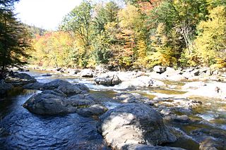
There are 24 named waterfalls in Ricketts Glen State Park in the U.S. state of Pennsylvania along Kitchen Creek as it flows in three steep, narrow valleys, or glens. They range in height from 9 feet (2.7 m) to the 94-foot (29 m) Ganoga Falls. Ricketts Glen State Park is named for R. Bruce Ricketts, a colonel in the American Civil War who owned over 80,000 acres (32,000 ha) in the area in the late 19th and early 20th centuries, but spared the old-growth forests in the glens from clearcutting. The park, which opened in 1944, is administered by the Bureau of State Parks of the Pennsylvania Department of Conservation and Natural Resources (DCNR). Nearly all of the waterfalls are visible from the Falls Trail, which Ricketts had built from 1889 to 1893 and which the state park rebuilt in the 1940s and late 1990s. The Falls Trail has been called "the most magnificent hike in the state" and one of "the top hikes in the East".