Perelik Point

Last updated
Location of Robert Island in the South Shetland Islands. Robert-Island-location-map.png
Location of Robert Island in the South Shetland Islands.
Topographic map of Livingston Island, Greenwich, Robert, Snow and Smith Islands. Livingston-Island-Map-2010.jpg
Topographic map of Livingston Island, Greenwich, Robert, Snow and Smith Islands.

Perelik Point (Bulgarian : нос Перелик, ‘Nos Perelik’ \'nos pe-re-'lik\) is a point on the north side of the entrance to Kozloduy Cove and the southeast side of the entrance to Garnya Cove on the east coast of Robert Island in the South Shetland Islands, Antarctica.

Bulgarian language South Slavic language

Bulgarian, is an Indo-European language and a member of the Southern branch of the Slavic language family.

Kozloduy Cove cove

Kozloduy Cove is a 1.4 km wide cove indenting for 1.25 km the east coast of Robert Island, South Shetland Islands between Kitchen Point and Perelik Point. Bulgarian early mapping in 2009. Named after the town of Kozloduy in northwestern Bulgaria.

Garnya Cove

Garnya Cove is a 1.2 km (0.75 mi)-wide cove on the east coast of Robert Island in the South Shetland Islands, Antarctica. It is entered southeast of Smirnenski Point and northwest of Perelik Point.

The point is projecting for 900 m into Nelson Strait, and is situated 1.4 km northwest of Kitchen Point and 1.2 km southeast of Smirnenski Point. Bulgarian early mapping in 2009.

Nelson Strait (South Shetland Islands)

Nelson Strait is the 9 km long and 9.8 km wide strait lying between Robert Island and Nelson Island in the South Shetland Islands, Antarctica. The strait was explored by early 19th century sealers and first charted by Nathaniel Palmer in 1821. While it had a variety of different names in the past, the present name — probably taken from the adjacent Nelson Island — has become well established in international usage.

Kitchen Point

Kitchen Point is a rocky point at the east end of Tirizis Island off the east coast of Robert Island in the South Shetland Islands, Antarctica. It is projecting into Bransfield Strait to form the southeast side of the entrance to Kozloduy Cove and the north side of the entrance to Kruni Cove.

Smirnenski Point

Smirnenski Point is a narrow, ice-free point on the east coast of Robert Island projecting 1.1 km into Nelson Strait in the South Shetland Islands, Antarctica, and forming the northwest side of the entrance to Garnya Cove.

The feature is named after Golyam Perelik Peak in the Rhodope Mountains, southern Bulgaria.
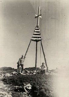
Golyam Perelik mountain

Golyam Perelik is the highest peak in the Rhodope Mountains, situated 19 km to the west of Smolyan. It makes the Rhodopes the seventh highest Bulgarian mountain range after Rila, Pirin, Stara Planina, Vitosha, Osogovo and Slavyanka. The peak is easily accessible, but currently cannot be climbed because a unit of the Bulgarian Army is stationed in its vicinity.

Rhodope Mountains mountain range in Southeastern Europe

The Rhodopes are a mountain range in Southeastern Europe, with over 83% of its area in southern Bulgaria and the remainder in Greece. Golyam Perelik is its highest peak at 2,191 meters (7,188 ft). The mountain range gives its name to the terrestrial ecoregion Rodope montane mixed forests that belongs in the Temperate broadleaf and mixed forests Biome and the Palearctic ecozone. The region is particularly notable for its karst areas with their deep river gorges, large caves and specific sculptured forms, such as the Trigrad Gorge.

Coordinates: 62°22′33″S59°21′43″W / 62.37583°S 59.36194°W / -62.37583; -59.36194

Geographic coordinate system Coordinate system

A geographic coordinate system is a coordinate system that enables every location on Earth to be specified by a set of numbers, letters or symbols. The coordinates are often chosen such that one of the numbers represents a vertical position and two or three of the numbers represent a horizontal position; alternatively, a geographic position may be expressed in a combined three-dimensional Cartesian vector. A common choice of coordinates is latitude, longitude and elevation. To specify a location on a plane requires a map projection.

Maps

International Standard Book Number Unique numeric book identifier

The International Standard Book Number (ISBN) is a numeric commercial book identifier which is intended to be unique. Publishers purchase ISBNs from an affiliate of the International ISBN Agency.

Related Research Articles

Avitohol Point

Avitohol Point is a point on the north coast of Livingston Island, Antarctica projecting 1.15 km into Hero Bay to form the west side of the entrance to Skravena Cove and the southeast side of the entrance to Prisoe Cove. The point is named after the legendary Khan Avitohol listed in the 8th Century ‘Nominalia of the Bulgarian Khans’, who laid the foundations of the Bulgarian statehood in Europe in 165 AD.

Yovkov Point

Yovkov Point is a point on the southwest coast of Greenwich Island, Antarctica projecting 150 m southwards into McFarlane Strait, forming the northwest side of the entrance to Kramolin Cove. Formed as a result of Murgash Glacier's retreat in the late 20th and early 21st century. The feature is named after the famous Bulgarian writer Yordan Yovkov (1880–1937).

Kaspichan Point

Kaspichan Point is a point on the southeast side of the entrance to Kramolin Cove on the southwest coast of Greenwich Island, Antarctica. Situated next west of Hebrizelm Hill, 1.4 km northwest of Triangle Point, 2 km south-southwest of Tile Ridge, and 2 km southeast of Yovkov Point. Shape enhanced by recent glacier retreat northwest of the point. Bulgarian topographic survey Tangra 2004/05. Named after the town of Kaspichan in northeastern Bulgaria.

Aprilov Point

Aprilov Point is a point on the north coast of Greenwich Island, Antarctica situated 6.9 km east of Duff Point, 2.1 km east-southeast of Kabile Island, 2.2 km east-northeast of Crutch Peaks, 1.8 km south of Ongley Island, 5.5 km west of Agüedo Point, and 2.3 km north-northwest of Sevtopolis Peak. Forming the east side of the entrance to Haskovo Cove and the west side of the entrance to Skaptopara Cove.

Zahari Point

Zahari Point is an ice-free point on the southwest coast of Robert Island in the South Shetland Islands, Antarctica forming the northwest side of the entrance to Micalvi Cove. Ice-free surface area 21 hectares. The feature is named after the Bulgarian writer and historiographer Zahari Stoyanov (1850–1889).

Ficheto Point

Ficheto Point is an ice-free point on the northeast coast of Varna Peninsula, Livingston Island, Antarctica forming the southeast side of the entrance to Dragon Cove. Channel Rock is lying in the adjacent northwestern part of McFarlane Strait, 1.3 km (0.81 mi) northeast of Ficheto Point and 920 m (1,010 yd) south-southwest of Meade Islands. The area was visited by 19th century sealers.

Lavrenov Point

Lavrenov Point is a point on the north coast of Robert Island, South Shetland Islands forming the east side of the entrance to Yundola Cove. Situated 2.7 km west of Newell Point and 2.6 km southeast of Catharina Point. Bulgarian early mapping in 2008. Named after the Bulgarian painter Tsanko Lavrenov (1896–1978).

Debelyanov Point

Debelyanov Point is a point forming the northwest side of the entrance to Mitchell Cove in Robert Island, South Shetland Islands. Situated 2.8 km northwest of Negra Point and 3.81 km southeast of Fort William Point. Bulgarian early mapping in 2008. Named after the Bulgarian poet Dimcho Debelyanov (1887–1916).

Miletich Point

Miletich Point is the rocky point forming the west side of the entrance to Haskovo Cove on Greenwich Island, South Shetland Islands in Antarctica. Stuated 800 m north of the summit of Crutch Peaks, 200 m southeast of Kabile Island, 1.55 km east of Pavlikeni Point, and 2.1 km west of Aprilov Point.

Batuliya Point

Batuliya Point is an ice-free tipped point forming the east extremity of Robert Island and the south side of the entrance to Tsepina Cove in the South Shetland Islands, Antarctica.

Chiprovtsi Point headland on Rugged Island

Chiprovtsi Point is a point projecting 400 m (440 yd) northwestwards from the north coast of Rugged Island off the west coast of Byers Peninsula of Livingston Island in the South Shetland Islands, Antarctica, and forming the east side of the entrance to Nishava Cove. It is extended further 400 m (440 yd) northwestwards by the group of Chiprovtsi Islets, which are centred at 62°36′52″S61°15′49″W and named in association with the point.

Herring Point

Herring Point is a point on the north coast of Rugged Island off the west coast of Byers Peninsula of Livingston Island in the South Shetland Islands, Antarctica forming the east side of the entrance to Hersilia Cove.

Pelishat Point

Pelishat Point is the point forming the south extremity of Archar Peninsula and the north side of the entrance to Berende Cove on the southwest coast of Greenwich Island in the South Shetland Islands, Antarctica. It is situated 2.4 km southeast of Duff Point and 3.9 km northeast of Pomorie Point on Livingston Island.

Spark Point

Spark Point, also Canto Point, is a rocky point forming the northwest side of the entrance to both Discovery Bay and Galápagos Cove, and the east side of the entrance to Jambelí Cove in the northeast of Greenwich Island in the South Shetland Islands, Antarctica. The point ends up in a conspicuous monolithic formation and has an adjacent ice-free area of 164 hectares. The area was visited by early 19th century sealers.

Alepu Rocks

Alepu Rocks is the group of rocks off the east coast of Robert Island in the South Shetland Islands, Antarctica, situated in an area with a diameter of 380 m (416 yd).

Razdel Point

Razdel Point is the ice-covered point on the southwest side of the entrance to Zapalnya Cove and northeast side of the entrance to Nikolov Cove on the southeast coast of Smith Island in the South Shetland Islands, Antarctica. The point is named after the settlements of Razdel in Northeastern and Southeastern Bulgaria.

Terimer Point

Terimer Point is the low, rounded and ice-free tipped east entrance point of Skaptopara Cove, forming the west extremity of Flamingo Beach on the north coast of Greenwich Island in Antarctica. It is named after the medieval settlement of Terimer in Western Bulgaria.

References

Antarctic Place-names Commission

The Antarctic Place-names Commission was established by the Bulgarian Antarctic Institute in 1994, and since 2001 has been a body affiliated with the Ministry of Foreign Affairs of Bulgaria.


This article includes information from the Antarctic Place-names Commission of Bulgaria which is used with permission.