
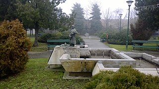
Valpovo is a town in Slavonia, Croatia. It is close to the Drava river, 25 km (16 mi) northwest of Osijek. As of 2021, the population of Valpovo is 7,406, with a total of 11,563 in the municipality.

Šenkovec is a municipality in Međimurje County, Croatia, located just outside the county seat, Čakovec.
Ruski Krstur is a village in Vojvodina, Serbia. It is located in the municipality of Kula, West Bačka District. The village has a Rusyn ethnic majority. Its population numbered 5,213 in the 2002 census. Ruski Krstur is the cultural centre of the Rusyns in Serbia. The number of Rusyns in Ruski Krstur is in constant decline as many of them have moved out to Canada concentrating in the town of North Battleford, Saskatchewan .
The village is the seat of the Greek Catholic Eparchy of Ruski Krstur, part of the wider Greek Catholic Church of Croatia and Serbia.

Vrhovine is a town and a municipality in Lika-Senj County, Croatia. The municipality is part of Lika.
Donji Andrijevci is a village and a municipality in Brod-Posavina County, Croatia.
Vajska is a village in Serbia. It is situated in the Bač municipality, in the South Bačka District, Vojvodina province. Two neighbouring settlements, Labudnjača and Živa, are also officially regarded as parts of Vajska although they are physically separated from it. The name Labudnjača is derived from Serbian labud 'swan'.
Punitovci is a municipality in Osijek-Baranja County, Croatia. There are a total of 1,803 inhabitants.
Močile is a village in Croatia. It is connected by the D3 highway.
Knezovljani is a village in the Donji Kukuruzari municipality of central Croatia. It is connected by the D30 highway. According to the 2011 census, there was a total of 81 inhabitants.
Unčani is a village in Croatia. It is connected by the D47 highway.

Ika is a small village in Croatia.It is a suburb of Opatija settled in Kvarner bay area under the Učka Mountain. It is connected by the D66 state road with Rijeka and Pula. As a part of Opatija it has been developed from fisherman‘s village to tourist destination with access to Lungomare beaches and proximity of Nature park Učka. In Ika there are 2 beaches separated by an old pier. In this small place you can find restaurants and hotels located at the beachfront.
Marija Trošt is a village in Croatia. It is connected by the D203 highway.
Gornje Komarevo is a village in Croatia. It is connected by the D224 highway.
Laslovo is a village in Croatia. It is connected by the D518 highway.
Gornja Drenova is a village in Croatia. The village has a population of around 300.
Ladvenjak is a village in Croatia.
Jaruge is a village in Croatia. The population is 738.
Hrastelnica is a village in Croatia.
Šeovica is a village in Croatia.
Gornja Oraovica is a village in central Croatia, in the municipality of Dvor, Sisak-Moslavina County.