Related Research Articles
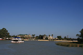
Renmark is a town in South Australia's rural Riverland area, and is located 254 km (157.83 mi) northeast of Adelaide, on the banks of the River Murray. The Sturt Highway between Adelaide and Sydney runs through the town; Renmark is the last major town encountered in South Australia when driving this route. It is a few kilometres west of the SA–Victoria and SA–NSW borders. It is 31 m (101.71 ft) above sea level.

The Riverina is an agricultural region of southwestern New South Wales, Australia. The Riverina is distinguished from other Australian regions by the combination of flat plains, warm to hot climate and an ample supply of water for irrigation. This combination has allowed the Riverina to develop into one of the most productive and agriculturally diverse areas of Australia. Bordered on the south by the state of Victoria and on the east by the Great Dividing Range, the Riverina covers those areas of New South Wales in the Murray and Murrumbidgee drainage zones to their confluence in the west.

The Riverland is a region of South Australia. It covers an area of 9,386 square kilometres (3,624 sq mi) along the River Murray from where it flows into South Australia from New South Wales and Victoria downstream to Blanchetown. The major town centres are Renmark, Berri, Loxton, Waikerie, Barmera and Monash, and many minor townships. The population is approximately 35,000 people.

Kingston On Murray is a town on the south bank of the Murray River in the Riverland region of South Australia. Its name is ultimately derived from Charles Kingston who was Premier of South Australia from 1893 to 1899. At the 2006 census, the town had a population of 257.

The Goulburn Valley is a sub-region, part of the Hume region of the Australian state of Victoria. The sub-region consists of those areas in the catchment of the Goulburn River and other nearby streams, and is part of the Murray-Darling Basin. The Goulburn Valley is bordered on the south by the Great Dividing Range and to the north by the Murray River, the state border with New South Wales. The sub-region is one of Australia's most productive and intensively farmed areas and is predominantly irrigated.
Currency Creek is a township and locality in South Australia on the western shore of Lake Alexandrina about 6 km north of Goolwa, beside a seasonal stream bearing the same name – Currency Creek – which flows into Lake Alexandrina. The locality includes the headland named Finniss Point which separates the mouths of Currency Creek and the Finniss River.

Collector is a small village on the Federal Highway in New South Wales, Australia halfway between Goulburn and the Australian Capital Territory. It is seven kilometres north of Lake George. The name is also applied to the surrounding area, for postal and statistical purposes. At the 2021 census, Collector and the surrounding district had a population of 376 people.
Murray Darling is a wine region and Australian Geographical Indication which spans the Murray River and its confluence with the Darling River in northwestern Victoria and southwestern New South Wales. It was registered as a protected name on 16 June 1997.

The South Australian wine industry is responsible for more than half the production of all Australian wine. South Australia has a vast diversity in geography and climate which allows the state to be able to produce a range of grape varieties–from the cool climate Riesling variety in the Clare Valley wine region to the big, full bodied Shiraz wines of the Barossa Valley.

New South Wales wine is Australian wine produced in New South Wales, Australia. New South Wales is Australia's most populous state and its wine consumption far outpaces the region's wine production. The Hunter Valley, located 130 km (81 mi) north of Sydney, is the most well-known wine region but the majority of the state's production takes place in the Big Rivers zone-Perricoota, Riverina and along the Darling and Murray Rivers. The wines produced from the Big Rivers zone are largely used in box wine and mass-produced wine brands such as Yellow Tail. A large variety of grapes are grown in New South Wales, including Cabernet Sauvignon, Chardonnay, Shiraz and Sémillon.

Keyneton is a locality in South Australia. The town is in the Mid Murray Council local government area, 82 kilometres (51 mi) north-east of the state capital, Adelaide.

The Hunter Valley is one of Australia's wine regions. Located in the state of New South Wales and first cultivated in the early 19th century, it was one of the first Australian wine regions. As well as Hunter Valley Sémillon, the region produces wine from a variety of grapes including Shiraz, Chardonnay, Cabernet Sauvignon and Verdelho.
The New South Wales Central Murray Forests lie on the floodplain of the Murray River in the Riverina region of south-central New South Wales, Australia. On 20 May 2003 the forests were recognised as a wetland site of international importance (RS1291) by designation under the Ramsar Convention on Wetlands.

Mount Lofty Ranges zone is a wine zone located in South Australia west of the Murray River that occupies the Adelaide metropolitan area north of Glenelg, extending as far north as Crystal Brook, and as far south as Mount Compass in the Mount Lofty Ranges. The zone which encloses the Barossa zone on three sides, includes three wine regions that have received appellation as Australian Geographical Indications (AGIs): Adelaide Hills, Adelaide Plains and Clare Valley. The zone received AGI in 1996.

Barossa zone is a wine zone located in central South Australia west of the Murray River and which occupies the Barossa Valley, the Eden Valley and some adjoining land. The zone which is enclosed by the Mount Lofty Ranges zone on three sides and by the Lower Murray zone to its east, contains two wine regions which have received appellation as Australian Geographical Indications (AGI). These are the Barossa Valley and Eden Valley regions. The Barossa zone also includes a broader area around these two defined regions. The zone received AGI in 1996.
The Jeir Creek, a perennial river that is part of the Murrumbidgee catchment within the Murray–Darling basin, is located in the South West Slopes region of New South Wales, Australia.
Big Rivers is a grape growing zone in Australia. It covers the southwestern corner of the state of New South Wales. The zone currently includes four wine regions, which cover the main areas of grape growing in the zone, but not all of them.
Riverina is an Australian Geographical Indication (AGI) registered in the Register of Protected GIs as a wine region. The Riverina AGI is centred on Griffith and is roughly circular with towns on the boundary including Mossgiel, Condobolin, Temora, Junee, Culcairn, Berrigan, Barooga, Finley, Deniliquin and Moulamein. It does not extend as far south as the Murray River. As such, the Riverina wine region is smaller than the generally known Riverina area.
Swan Hill is a wine region name protected by an Australian Geographical Indication (AGI). It is named for the town of Swan Hill on the south side of the Murray River in the Australian state of Victoria. The wine region spans the Murray and the north eastern part of the region is in the state of New South Wales. The north-eastern part of the region is in the New South Wales zone of Big Rivers. The southern and western parts are in the Victoria zone of North West Victoria. The region spans from Lake Charm and Benjeroop in the southeast through Lake Boga and Swan Hill to past Piangil and Tooleybuc in the north.
References
- 1 2 "Perricoota". Register of Protected GIs and Other Terms. Wine Australia . Retrieved 28 May 2016.
- 1 2 3 James Halliday. "Perricoota Wine Region". Australian Wine Companion. Retrieved 28 May 2016.
- ↑ "Perricoota Wine Region". Vinodiversity. Retrieved 28 May 2016.