
Samuel Pepys was an English diarist and naval administrator. He served as administrator of the Royal Navy and Member of Parliament, but is most remembered today for the diary he kept for almost a decade. Though he had no maritime experience, Pepys rose to be the Chief Secretary to the Admiralty under both King Charles II and King James II through patronage, diligence, and his talent for administration. His influence and reforms at the Admiralty were important in the early professionalisation of the Royal Navy.

Magdalene College is a constituent college of the University of Cambridge. The college was founded in 1428 as a Benedictine hostel, in time coming to be known as Buckingham College, before being refounded in 1542 as the College of St Mary Magdalene.
Samuel Hartlib or Hartlieb was a Polish born, English educational and agricultural reformer of German-Polish origin who settled, married and died in England. He was a son of George Hartlib, a Pole, and Elizabeth Langthon, a daughter of a rich English merchant. Hartlib was a noted promoter and writer in fields that included science, medicine, agriculture, politics and education. He was a contemporary of Robert Boyle, whom he knew well, and a neighbour of Samuel Pepys in Axe Yard, London, in the early 1660s. He studied briefly at the University of Cambridge upon arriving in England.

Pall Mall is a street in the St James's area of the City of Westminster, Central London. It connects St James's Street to Trafalgar Square and is a section of the regional A4 road. The street's name is derived from pall-mall, a ball game played there during the 17th century, which in turn is derived from the Italian pallamaglio, literally "ball-mallet".

Pall-mall, paille-maille, palle-maille, pell-mell, or palle-malle is a lawn game that was mostly played in the 16th and 17th centuries. It is considered a precursor to croquet.

The Pepys Library of Magdalene College, Cambridge, is the personal library collected by Samuel Pepys which he bequeathed to the college following his death in 1703.

Hicks Hall, or Hickes' Hall, was a courthouse at the southern end of St John Street, Clerkenwell, London. It opened in 1612, and was closed and demolished in 1782. It was the first purpose-built sessions house for justices of the peace of the county of Middlesex, and became the main court of petty sessions and arraignment for more serious offences, including cases involving plots, attacks and minor transgressions against the state.
Gibbon's Tennis Court was a building off Vere Street and Clare Market, near Lincoln's Inn Fields in London, England. Originally built as a real tennis court, it was used as a playhouse from 1660 to 1663, shortly after the English Restoration. As a theatre, it has been variously called the "Theatre Royal, Vere Street", the "Vere Street Theatre", or simply "The Theatre". It was the first permanent home for Thomas Killigrew's King's Company and was the stage for some of the earliest appearances by professional actresses.

Hungerford Market was a produce market in London, at Charing Cross on the Strand. It existed in two different buildings on the same site, the first built in 1682, the second in 1832. The market was first built on the site of Hungerford House, next to Durham Yard, the town house of the Hungerford family. The house had burned down in 1669 as is recorded in the Diary of Samuel Pepys. It was replaced by a new Italianate market building by Charles Fowler, which opened in 1833. The new market was unsuccessful. It was damaged when the adjoining Hungerford Hall burned down in 1854, and was sold to the South Eastern Railway in 1862. Charing Cross railway station was built on the site and opened in 1864.

New Palace Yard is a yard northwest of the Palace of Westminster in Westminster, London, England. It is part of the grounds not open to the public. However, it can be viewed from the two adjoining streets, as a result of Edward Middleton Barry, who also assisted with its landscaping, having used railings rather than walls or fencing in its design. The yard has existed since about the year 1100, but was greatly reduced in the 18th century to allow for the construction of new streets and buildings, the most notable of which is the wing taking up the eastern end and having the most prominent tower of the current palace. Speaker's Green fronts the Thames. An underground car park used by Members of Parliament is beneath. Before latest incarnations of the palace, the yard was an open public space used diversely such as for speeches, tournaments, pilloryings, and executions. It has twice been the scene of terrorist attacks.

The Lion Yard shopping centre is a covered shopping centre in the city centre of Cambridge, England. Construction work on the centre, which is bounded by St Andrew's Street, Corn Exchange Street, and Petty Cury, commenced in 1970 and the development contained a library, multi-storey car park and magistrates' court.

Sidney Street is a major street in central Cambridge, England. It runs between Bridge Street at the junction with Jesus Lane to the northwest and St Andrew's Street at the junction with Hobson Street to the southeast.

Corn Exchange Street is a street in central Cambridge, England. It runs between Wheeler Street to the northwest and Downing Street to the southeast. To the northeast, Guildhall Place, a cul-de-sac, runs parallel with Corn Exchange Street at the northern end, an extension of Guildhall Street.

Market Hill is the location of the marketplace in central Cambridge, England. Operating as a marketplace since Saxon times, a daily outdoor market with stalls continues to run there.

Market Street is a shopping street in central Cambridge, England. It runs between Market Hill, location of the city's central Market Square to the west and Sidney Street to the east. On the other side of the market square, the street continues west as St Mary's Street, north of Great St Mary's, the University church. On the other side of Sidney Street is Hobson's Passage leading east to Hobson Street. To the north is Market Passage and to the south is Petty Cury, a pedestrianised shopping street.

Guildhall Street is a street in central Cambridge, England. To the north is the southeast corner of Market Hill at the junction with the pedestrianised shopping street Petty Cury. To the south it continues as Guildhall Place, a cul-de-sac, at the junction with Wheeler Street, close to the northern end of Corn Exchange Street.
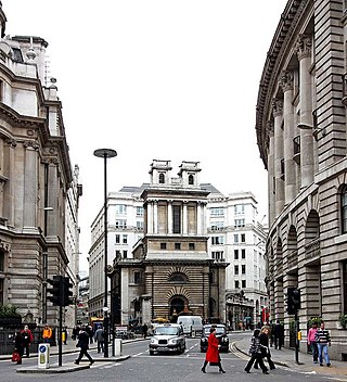
Lombard Street is a street notable for its connections with the City of London's merchant, banking and insurance industries, stretching back to medieval times.

Stocks Market was a market in central London operating between 1282 and 1737 and for centuries was London's main retail meat and produce market.

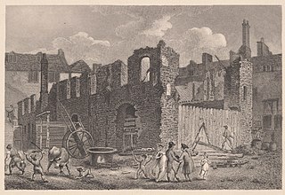
Seething Lane is a street in the City of London. It connects All Hallows-by-the-Tower, Byward Street, with St Olave's Church, Hart Street. The street is named after an Old English expression meaning "full of chaff", which was derived from the nearby corn market in Fenchurch Street. Samuel Pepys lived there and is buried in St Olave's Church at the junction with Hart Street. A bust of Pepys, created by Karin Jonzen, sits in the public garden at the south end of the street.
Cury is a surname derived from the Latin word curia. It may refer to:
