Howard County is one of 92 counties in the U.S. state of Indiana. As of the 2020 census, the population was 83,658. The county seat is Kokomo. Originally named Richardville County, it was renamed in 1844 to commemorate General Tilghman Ashurst Howard.
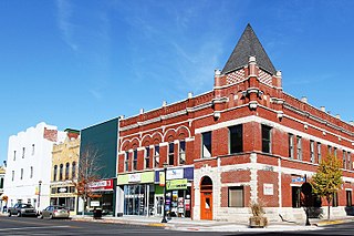
Kokomo is a city in Indiana and the county seat of Howard County, Indiana, United States. Its population increased from 45,468 at the 2010 census to 59,604 in the 2020 census. It is the principal city of the Kokomo, Indiana Metropolitan Statistical Area, which includes all of Howard County, the Kokomo-Peru CSA, which includes Howard and Miami counties, as well as the North Central Indiana region consisting of six counties anchored by the city of Kokomo.
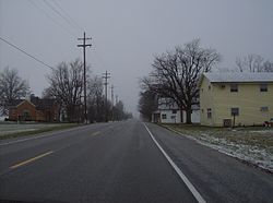
West Middleton is an unincorporated community between Russiaville and Kokomo in western Howard County, Indiana, United States. It is part of the Kokomo, Indiana Metropolitan Statistical Area.
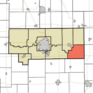
Union Township is one of eleven townships in Howard County, Indiana, United States. As of the 2020 census, its population was 1,012, down from 1,029 in 2010.

Oakford is an unincorporated community in southwestern Taylor Township, Howard County, Indiana, United States.

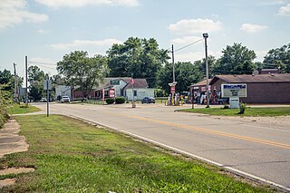
Hemlock is an unincorporated community in southern Taylor Township, Howard County, Indiana, United States. It lies at the intersection of State Road 26 with County Road 450E.

Point Isabel is an unincorporated community and census-designated place (CDP) in central Green Township, Grant County, Indiana, United States. It lies at the intersection of State Roads 13 and 26. As of the 2010 census it had a population of 91.

Hackleman is a small unincorporated community in central Liberty Township, Grant County, Indiana.

Velpen is an census-designated place in southeastern Marion Township, Pike County, in the U.S. state of Indiana. It lies along State Road 257 southeast of the city of Petersburg, the county seat of Pike County. Although Velpen is unincorporated, it has a post office, with the ZIP code of 47590.

St. Croix is an unincorporated community in northern Oil Township, Perry County, in the U.S. state of Indiana.
Richland is an unincorporated community in western Richland Township, Rush County, Indiana, United States. It lies along State Road 244, south of the city of Rushville, the county seat of Rush County.
Reelsville is an unincorporated community in central Washington Township, Putnam County, in the U.S. state of Indiana. It lies along local roads just north of U.S. Route 40, southwest of the city of Greencastle, the county seat of Putnam County. Its elevation is 676 feet (206 m), and it is located at 39°33′27″N86°58′1″W. Although Reelsville is unincorporated, it has a post office, with the ZIP code of 46171.
Prairie Creek is an unincorporated community in southeastern Prairie Creek Township, Vigo County, in the U.S. state of Indiana. Its elevation is 528 feet (161 m), and it is located at 39°16′30″N87°29′50″W. Because the community has had multiple names, the Board on Geographic Names officially decided in favor of "Prairie Creek" in 1959. Although Prairie Creek is unincorporated, it has a post office, with the ZIP code of 47869.

Wadesville is a census designated place in northern Center Township, Posey County, in the U.S. state of Indiana. It lies along State Road 66 northeast of the city of Mt. Vernon, the county seat of Posey County. Although Wadesville is unincorporated, it has a post office, with the ZIP code of 47638.

Derby is an unincorporated community along the Ohio River in far southern Union Township, Perry County, in the U.S. state of Indiana. It lies at the intersection of State Roads 66 and 70 above the city of Tell City, the county seat of Perry County. Its elevation is 453 feet (138 m), and it is located at 38°1′49″N86°31′38″W. Although Derby is unincorporated, it has a post office, with the ZIP code of 47525.
Homer is an unincorporated community in central Walker Township, Rush County, in the U.S. state of Indiana. Although Homer is unincorporated, it has a post office, with the ZIP code of 46146.

Ray is an unincorporated community in both Steuben County, Indiana and Branch County, Michigan in the United States. Located along the local "State Line Road," the small community straddles the border between the two states. The Indiana Northeastern Railroad travels southwest-northeast through Ray. Its elevation is 1,079 feet (329 m), making it the highest populated place in northern Indiana.

U.S. Route 31 (US 31) is a part of the United States Numbered Highway System that runs from Spanish Fort, Alabama, to Mackinaw City, Michigan. It enters the U.S. state of Indiana via the George Rogers Clark Memorial Bridge between Louisville, Kentucky, and Clarksville, Indiana. The 266.02 miles (428.12 km) of US 31 that lie within Indiana serve as a major conduit. Some of the highway is listed on the National Highway System. Various sections are rural two-lane highway and urbanized four- or six-lane divided expressway. The northernmost community along the highway is South Bend near the Michigan state line.
Pearl Elliott was a notorious madam of Kokomo, Indiana, United States. She was best known as an early associate of the Prohibition era gangster Harry Pierpont and later of the bank robber John Dillinger. Along with the gun moll Mary Kinder, she was one of two women listed on the Chicago Police Department's Public Enemies list in 1933.
Sylvia Clevenger was an American prostitute who worked with madam Pearl Elliott and was a minor associate of the John Dillinger gang. Her brother William was the former husband of Elliott. She was married three times, reverting to her maiden name of Hughes after her divorce from her second husband, John Clevenger, in 1930. She lived for much of her life in Kokomo, Indiana, and died in 1951 in Michigan City, Indiana.