Hemlock, Indiana

Last updated

Hemlock, Indiana
Hemlock, Indiana.jpg
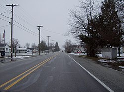
Along State Road 26 in Hemlock
USA Indiana location map.svg
Red pog.svg
Hemlock
Usa edcp location map.svg
Red pog.svg
Hemlock
Coordinates: 40°25′09″N86°02′31″W / 40.41917°N 86.04194°W / 40.41917; -86.04194
Country United States
State Indiana
County Howard
Township Taylor
Elevation
[1]
860 ft (260 m)
ZIP code
46937
Area code 765
GNIS feature ID2830413 [1]

Hemlock (originally called Terre Hall) is an unincorporated community in southern Taylor Township, Howard County, Indiana, United States. It lies at the intersection of State Road 26 with County Road 450E. [2]

Hemlock is part of the Kokomo, Indiana Metropolitan Statistical Area.

History

Hemlock was laid out in 1852. [3] It was originally known as Terre Halle, but was renamed Hemlock before 1881. [4]

Related Research Articles

<span class="mw-page-title-main">Howard County, Indiana</span> County in Indiana, United States

Howard County is one of 92 counties in the U.S. state of Indiana. As of the 2020 census, the population was 83,658. The county seat is Kokomo. Originally named Richardville County, it was renamed in 1844 to commemorate General Tilghman Ashurst Howard.

<span class="mw-page-title-main">Greentown, Indiana</span> Town in Indiana, United States

Greentown is a town in Liberty Township, Howard County, Indiana, United States. Located approximately 9 miles east of Kokomo on State Road 22 / US 35; it is home to the Howard County Fair Grounds. The town was platted in 1848, and incorporated as a town in 1873. Known for its collectible glassware made for only a few years by a local factory destroyed in 1903, it is home to the Greentown Glass Museum. As of the 2010 census, the town's population was 2,415.

Center is an unincorporated community in Taylor Township, Howard County, Indiana, United States. Center is a suburb of Kokomo and is a part of the Kokomo, Indiana Metropolitan Statistical Area.

West Middleton is an unincorporated community between Russiaville and Kokomo in western Howard County, Indiana, United States. It is part of the Kokomo, Indiana Metropolitan Statistical Area.

Alto was an unincorporated town which is now a neighborhood of Kokomo in Harrison Township, Howard County, Indiana, United States. It is part of the Kokomo, Indiana Metropolitan Statistical Area. Alto was annexed into the city of Kokomo January 1, 2012.

<span class="mw-page-title-main">Cassville, Indiana</span> Unincorporated community and Census-designated place in Indiana, United States

Cassville is an unincorporated community in Howard Township, Howard County, Indiana, United States. It is part of the Kokomo, Indiana Metropolitan Statistical Area and located approximately 5.9 miles from downtown Kokomo.

<span class="mw-page-title-main">Center Township, Howard County, Indiana</span> Township in Indiana, United States

Center Township is one of eleven townships in Howard County, Indiana, United States. As of the 2020 census, its population was 45,776, up from 45,275 in 2010.

<span class="mw-page-title-main">Harrison Township, Howard County, Indiana</span> Township in Indiana, United States

Harrison Township is one of 11 townships in Howard County, Indiana, United States. As of the 2020 census, its population was 9,848, upfrom 9,489 in 2010.

<span class="mw-page-title-main">Howard Township, Howard County, Indiana</span> Township in Indiana, United States

Howard Township is one of eleven townships in Howard County, Indiana, United States. As of the 2020 census, its population was 2,436, down from 2,579 in 2010.

<span class="mw-page-title-main">Liberty Township, Howard County, Indiana</span> Township in Indiana, United States

Liberty Township is one of eleven townships in Howard County, Indiana, United States. As of the 2020 census, its population was 4,737, down from 4,862 in 2010. Liberty Township hosts the Howard County fair each year in July in Greentown, which is the second biggest town in Howard County, and third biggest in the Kokomo Metropolitan Area after only Kokomo, and Tipton.

<span class="mw-page-title-main">Taylor Township, Howard County, Indiana</span> Township in Indiana, United States

Taylor Township is one of eleven townships in Howard County, Indiana, United States. As of the 2020 census, its population was 9,396, up from 9,294 in 2010.

<span class="mw-page-title-main">Oakford, Indiana</span> Unincorporated community in Indiana, United States

Oakford is an unincorporated community in southwestern Taylor Township, Howard County, Indiana, United States.

<span class="mw-page-title-main">Phlox, Indiana</span> Unincorporated community in Indiana, United States

Phlox is an unincorporated community in southern Union Township, Howard County, Indiana, United States. It lies at the intersection of State Road 26 with County Road 1100 East.

<span class="mw-page-title-main">Point Isabel, Indiana</span> Census-designated place in Indiana, United States

Point Isabel is an unincorporated community and census-designated place (CDP) in central Green Township, Grant County, Indiana, United States. It lies at the intersection of State Roads 13 and 26. As of the 2010 census it had a population of 91.

Jerome is an unincorporated community in Union Township, Howard County, Indiana, United States. It is part of the Kokomo, Indiana Metropolitan Statistical Area.

<span class="mw-page-title-main">Prairie Creek, Indiana</span> Unincorporated community in Indiana, United States

Prairie Creek is an unincorporated community in southeastern Prairie Creek Township, Vigo County, in the U.S. state of Indiana. Its elevation is 528 feet (161 m), and it is located at 39°16′30″N87°29′50″W. Because the community has had multiple names, the Board on Geographic Names officially decided in favor of "Prairie Creek" in 1959. Although Prairie Creek is unincorporated, it has a post office, with the ZIP code of 47869.

<span class="mw-page-title-main">Fontanet, Indiana</span> Census-designated place in Indiana, United States

Fontanet is an unincorporated census-designated place in central Nevins Township, Vigo County, in the U.S. state of Indiana. It lies along Baldwin St., northeast of the city of Terre Haute, the county seat of Vigo County. Its elevation is 614 feet (187 m), and it is located at 39°34′34″N87°14′37″W. Although Fontanet is unincorporated, it has a post office, with the ZIP Code of 47851.

Pearl Elliott was a notorious madam of Kokomo, Indiana, United States. She was best known as an early associate of the Prohibition era gangster Harry Pierpont and later of the bank robber John Dillinger. Along with the gun moll Mary Kinder, she was one of two women listed on the Chicago Police Department's Public Enemies list in 1933.

Sylvia Clevenger was an American prostitute who worked with madam Pearl Elliott and was a minor associate of the John Dillinger gang. Her brother William was the former husband of Elliott. She was married three times, reverting to her maiden name of Hughes after her divorce from her second husband, John Clevenger, in 1930. She lived for much of her life in Kokomo, Indiana, and died in 1951 in Michigan City, Indiana.

<span class="mw-page-title-main">Poplar Grove, Howard County, Indiana</span> Unincorporated community in Indiana, U.S.

Poplar Grove is an unincorporated community in Howard County, Indiana, in the United States.

References

  1. 1 2 U.S. Geological Survey Geographic Names Information System: Hemlock, Indiana
  2. DeLorme. Indiana Atlas & Gazetteer. 3rd ed. Yarmouth: DeLorme, 2004, p. 33. ISBN   0-89933-319-2.
  3. "Howard County's Townships and Their Early Settlements and Towns". Kokomo-Howard County Public Library. Archived from the original on December 22, 2013. Retrieved June 2, 2014.
  4. "A Look Back as We Move Forward". The Kokomo Tribune. March 28, 1999. p. 58. Retrieved August 16, 2014 via Newspapers.com. Open Access logo PLoS transparent.svg