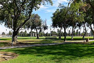
Santa Fe Springs is a city in Los Angeles County, California, United States. It is one of the Gateway Cities of southeast Los Angeles County. The population was 16,223 at the 2010 census, down from 17,438 at the 2000 census.

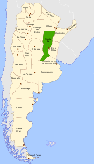
Rosario is the largest city in the central Argentina province of Santa Fe. The city is located 300 km (186 mi) northwest of Buenos Aires, on the west bank of the Paraná River. Rosario is the third most populous city in the country, and is also the most populous city in Argentina that is not a provincial capital. With a growing and important metropolitan area, Greater Rosario has an estimated population of 1,276,000 as of 2012. One of its main attractions includes the neoclassical architecture that has been retained over the centuries in hundreds of residences, houses and public buildings.

Santa Fe de la Vera Cruz is the capital city of the province of Santa Fe, Argentina. It is situated in north-eastern Argentina, near the junction of the Paraná and Salado rivers. It lies 15 kilometres (9.3 mi) from the Hernandarias Subfluvial Tunnel that connects it to the city of Paraná. The city is also connected by canal with the port of Colastiné on the Paraná River. Santa Fe de la Vera Cruz has about 391,164 inhabitants as per the 2010 census [INDEC]. The metropolitan area has a population of 653,073, making it the eighth largest in Argentina. The third largest city in Argentina is Rosario, also located in Santa Fe Province. Rosario has a population of 1.24 million and it is the largest city in Argentina not to be a provincial capital.
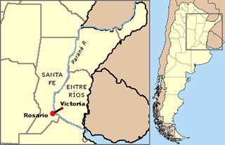
Rosario-Victoria Bridge is the informal name of the physical connection between the Argentine cities of Rosario and Victoria.
Autonomous city is a type of autonomous administrative division.

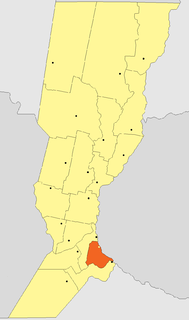
Villa Constitución is a city in the province of Santa Fe, Argentina, and the head town of the Constitución Department. It is located on the south-western banks of the Paraná River between the courses of the Arroyo Pavón and the Arroyo del Medio, about 214 km south from the provincial capital, the city of Santa Fe, and 50 km from Rosario. It has a population of more than 47,374 inhabitants as per the 2010 census [INDEC].

San Lorenzo is a city in the south of the province of Santa Fe, Argentina, located 23 km north of Rosario, on the western shore of the Paraná River, and forming one end of the Greater Rosario metropolitan area. It is the head town of the San Lorenzo Department, and it has about 46,000 inhabitants according to the 2010 census [INDEC].
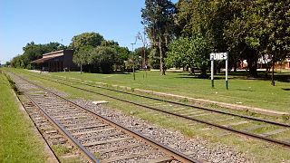
Funes is a small city in the province of Santa Fe, Argentina, located within the metropolitan area of Greater Rosario, about 15 km west from downtown Rosario. It has a population of about 23,500 inhabitants.
Roldán is a small city in the province of Santa Fe, Argentina, located within the metropolitan area of Greater Rosario. According to the 2001 census, it had a population of 11,470 inhabitants. Its area is 114 km².
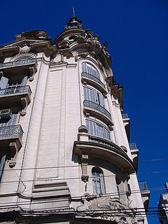
The Sala Lavardén is an important theater in Rosario, province of Santa Fe, Argentina. It is formally called Teatro Provincial Manuel José de Lavardén and is part of the culture center of the same name, in turn administered by the provincial state.

Carlos Pellegrini is a town in the center-west of Santa Fe Province, Argentina.

Armstrong is a city in the southwest of the province of Santa Fe, Argentina. It has 11,181 inhabitants as per the 2010 census [INDEC]. It is located 214 km (133 mi) from the provincial capital Santa Fe, 80 km (50 mi) west of Rosario and 20 km (12 mi) from Cañada de Gómez, on National Route 9 near the intersection with National Route 178.
The Litoral region of Argentina underwent heavy rainstorms in the early autumn season of 2007. Starting in late March and ending in mid-April, the rains caused several major rivers to rise and/or overflow their banks, partly or completely flooded many towns and large cities, ruined a significant part of the crops in a wide region, and severely damaged the physical infrastructure. At least 15 people were killed as a result of the flooding.
Watertable control is the practice of controlling the height of the water table by drainage. Its main applications are in agricultural land and in cities to manage the extensive underground infrastructure that includes the foundations of large buildings, underground transit systems, and extensive utilities.

Soil salinity control relates to controlling the problem of soil salinity and reclaiming salinized agricultural land.
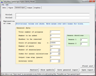
SahysMod is a computer program for the prediction of the salinity of soil moisture, groundwater and drainage water, the depth of the watertable, and the drain discharge in irrigated agricultural lands, using different hydrogeologic and aquifer conditions, varying water management options, including the use of ground water for irrigation, and several crop rotation schedules, whereby the spatial variations are accounted for through a network of polygons.
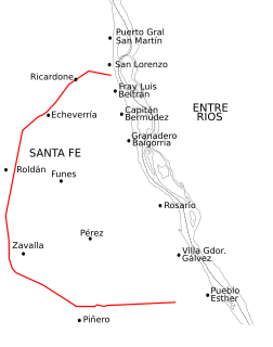
National Route A012 is a road in the southeast of Santa Fe Province, Argentina. It has a semi-circular length centered on the city of Rosario, running as a long-length beltway. From the National Route 9 junction on km marker 278, in the town of Pueblo Esther, to the junction with National Route 11 on km marker 326 in the city of San Lorenzo it runs for 67 km (41.6 mi) all paved.

SaltMod is computer program for the prediction of the salinity of soil moisture, groundwater and drainage water, the depth of the watertable, and the drain discharge (hydrology) in irrigated agricultural lands, using different (geo)hydrologic conditions, varying water management options, including the use of ground water for irrigation, and several cropping rotation schedules. The water management options include irrigation, drainage, and the use of subsurface drainage water from pipe drains, ditches or wells for irrigation.

The Rosario Rugby Union is the organisational body that controls the game of rugby union in Rosario, in the province of Santa Fe, Argentina. The rest of Santa Fe province teams are organised under the Unión Santafesina de Rugby.
