Pichl-Kainisch | |
|---|---|
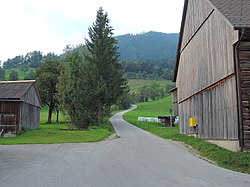 Street in Pichl-Kainisch | |
 Coat of arms | |
 Pichl-Kainisch Location within Austria | |
| Coordinates: 47°34′10″N13°51′14″E / 47.56944°N 13.85389°E | |
| Country | Austria |
| State | Styria |
| District | Liezen |
| Area | |
• Total | 29.84 km2 (11.52 sq mi) |
| Elevation | 803 m (2,635 ft) |
| Population (1 January 2016) [1] | |
• Total | 743 |
| • Density | 25/km2 (64/sq mi) |
| Time zone | UTC+1 (CET) |
| • Summer (DST) | UTC+2 (CEST) |
| Postal code | 8984 |
| Area code | 03624 |
| Vehicle registration | LI |
| Website | www.pichl-kainisch.at |
Pichl-Kainisch is a former municipality in the Salzkammergut in the Liezen (district) Austrian state of Styria. Since the 2015 Styria municipal structural reform, it is part of the municipality Bad Mitterndorf. [2]