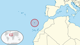
The Azores, officially the Autonomous Region of the Azores, is one of the two autonomous regions of Portugal. It is an archipelago composed of nine volcanic islands in the North Atlantic Ocean about 1,360 km (850 mi) west of continental Portugal, about 1,643 km (1,021 mi) west of Lisbon, in continental Portugal, about 1,507 km (936 mi) northwest of Morocco, and about 1,925 km (1,196 mi) southeast of Newfoundland, Canada.

Pico Island, is an island in the Central Group of the Portuguese Azores. The landscape features an eponymous volcano, Ponta do Pico, which is the highest mountain in Portugal, the Azores, and the highest elevation of the Mid-Atlantic Ridge. In the tradition of the Portuguese poet, Raul Brandão, Pico is referred to as the Ilha Preta, for its black volcanic earth, responsible for its UNESCO-designated historical vineyards that allowed the development of the island.

Porto Santo Island is a Portuguese island 43 kilometres (27 mi) northeast of Madeira Island in the North Atlantic Ocean; it is the northernmost and easternmost island of the archipelago of Madeira, located in the Atlantic Ocean west of Europe and Africa.

Verdelho is a white wine grape grown throughout Portugal, though most associated with the island of Madeira, and also gives its name to one of the four main types of Madeira wine. At the turn of the 20th century it was the most widely planted white grape in Madeira.
Calheta may refer to the following places:

Câmara de Lobos is a municipality, parish and town in the south-central coast of the island of Madeira. Technically a suburb of the much larger capital city of Funchal, it is one of the larger population centres and an extension of the Funchal economy.
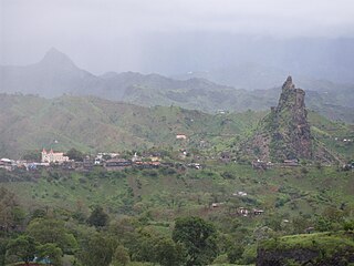
Picos, also known as Achada Igreja, is a city in the central part of the island of Santiago, Cape Verde. It is the seat of São Salvador do Mundo municipality. Picos is located 4 km southeast of Assomada and 23 km northwest of the capital city of Praia, near the national road from Praia to Tarrafal via Assomada (EN1-ST01).

Mount Pico is a stratovolcano located on Pico Island, in the mid-Atlantic archipelago of the Azores. It is the highest mountain of Portugal, at 2,351 metres (7,713 ft) above sea level, and is one of the highest Atlantic mountains; it is more than twice the elevation of any other peak in the Azores.

Pico do Arieiro, at 1,818 m (5,965 ft) high, is Madeira Island's third highest peak. Most days, visitors can stand and look down on the clouds. The air is fresh and clear and the sun is very bright. On a clear day it is possible to see the neighbouring island of Porto Santo, 30 miles to the northeast.

The topographic isolation of a summit is the minimum great-circle distance to a point of equal elevation, representing a radius of dominance in which the peak is the highest point. It can be calculated for small hills and islands as well as for major mountain peaks, and can even be calculated for submarine summits.
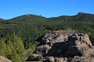
Pico de las Nieves is the highest peak of Gran Canaria Canary Islands, Spain. Its height is 1,949 metres (6,394 ft) above sea level. The origin is volcanic (stratovolcano). On its slopes, Canary Islands Pine was reintroduced in the 1950s.

Paul da Serra in the municipal county of Ponta do Sol, Madeira, it is the largest and most extensive plateau of Madeira about 24 square kilometres (9.3 sq mi), with an altitude average of about 1,500 metres (4,900 ft). Its highest point is the peak pico do Paul at 1,640 metres (5,380 ft) from where you can admire the length of the entire plateau. On days with good visibility, both the south and north coasts are visible.