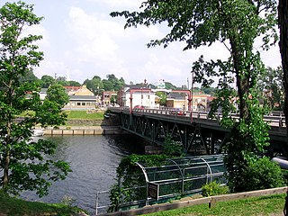
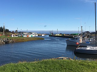
Pictou Landing (Gaelic Eilean Phiogto) is a community in the Canadian province of Nova Scotia, located in Pictou County. [1]
Pictou Landing (Gaelic Eilean Phiogto) is a community in the Canadian province of Nova Scotia, located in Pictou County. [1]
It is situated on the south shore of Pictou Harbour across from the town of Pictou.
Its name is probably derived from the fact that it is the landing place for ferries crossing the harbour. An earlier name for the area was Fishers Grant after a grant of land made to John Fisher in 1765. [2] The only populated reserve of the Pictou Landing First Nation is named Fisher's Grant 24 and is located 3 km north-east of Pictou Landing.
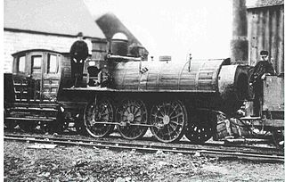
The Nova Scotia Railway reached here in 1867. It was the main route for travelers to Upper Canada in the ice-free months until the opening of the Intercolonial Railway in 1876. The steamship Mayflower carried passengers and freight across the harbour. [3] A map published in 1879 shows four piers at Pictou Landing, three of them carrying track of the Intercolonial rail road and two of these piers belonging to coal companies. [4]

Pictou County is a county in the province of Nova Scotia, Canada. It was established in 1835, and was formerly a part of Halifax County from 1759 to 1835. It had a population of 43,657 people in 2021, a decline of 0.2 percent from 2016. Furthermore, its 2016 population is only 88.11% of the census population in 1991. It is the sixth most populous county in Nova Scotia.

New Glasgow is a town in Pictou County, in the province of Nova Scotia, Canada. It is situated on the banks of the East River of Pictou, which flows into Pictou Harbour, a sub-basin of the Northumberland Strait.

Pictou is a town in Pictou County, in the Canadian province of Nova Scotia. Located on the north shore of Pictou Harbour, the town is approximately 10 km north of the larger town of New Glasgow.

The Intercolonial Railway of Canada, also referred to as the Intercolonial Railway (ICR), was a historic Canadian railway that operated from 1872 to 1918, when it became part of Canadian National Railways. As the railway was also completely owned and controlled by the Government of Canada, the Intercolonial was also one of Canada's first Crown corporations.

The Sydney and Louisburg Railway (S&L) was a Canadian railway. Built to transport coal from various mines to the ports of Sydney and Louisbourg, the S&L operated in the eastern part of Cape Breton County, Nova Scotia. The railway uses a slightly different spelling for the town of "Louisbourg".

The Nova Scotia Railway is a historic Canadian railway. It was composed of two lines, one connecting Richmond with Windsor, the other connecting Richmond with Pictou Landing via Truro.
Caribou is a small rural community in Pictou County, Nova Scotia, Canada.
Peter Crerar was a Scottish-Nova Scotian civil engineer. He designed the first railway in British North America, and the first standard gauge railroad in North America, at Stellarton, near Pictou, Nova Scotia.

Hector was a ship that was part of the first significant migration of Scottish settlers to Nova Scotia in 1773. A replica of the original ship is located at the Hector Heritage Quay, a heritage centre run by local volunteers, in Pictou, Nova Scotia.

Pictou Landing First Nations is a Mi'kmaq First Nation band government in Nova Scotia, Canada. Their territory spans five reserves that have a combined area of 527.6 hectares. As of September 2017, the Mi'kmaq population is 485 on their own reserve, 23 on other reserves and 157 living off-reserve.

The Samson is an English-built railroad steam locomotive made in 1838 that ran on the Albion Mines Railway in Nova Scotia, Canada. It is preserved at the Nova Scotia Museum of Industry in Stellarton, Nova Scotia and is the oldest locomotive in Canada.

Toney River is a community in the Canadian province of Nova Scotia, located at the mouth of the Toney River in Pictou County. The river has a deep, narrow estuary which has been improved seaward of the Sunrise Trail bridge as a harbour including moorings for about a dozen fishing boats. The community is named after a Mi'kmaq chief who is reported to have signed the Halifax Treaties in 1761.
Boat Harbour West 37 is a Mi'kmaq reserve located in Pictou County, Nova Scotia.

Boat Harbour is a body of water on the Northumberland Strait in Pictou County, Nova Scotia. Originally a tidal estuary, construction of a pulp and paper waste effluent treatment facility in the 1960s led to the pollution of the harbour and the source of ongoing environmental concern. Treated water takes about 30 days to reach the Northumberland Strait. Since the treatment system began operation in 1967, Boat Harbour has become polluted with dioxins, furans, chloride, mercury and other toxic heavy metals. It is considered to be one of Nova Scotia's worst cases of environmental racism. In 2015, the Boat Harbour Act wrote into law that the pulp and paper mill cease effluent treatment no later than January 31, 2020; soon after this took effect, the mill closed indefinitely. The Boat Harbour Remediation Project aims to return Boat Harbour to its original state as a tidal estuary. Pilot scale testing has been completed and the project is undergoing a federal environmental assessment and cleanup is expected to begin in 2021.
Fisher's Grant 24 is a Mi'kmaq reserve located in Pictou County, Nova Scotia.
Fisher's Grant 24G is a Mi'kmaq reserve located in Pictou County, Nova Scotia.

The Pictou Shipyard is a Canadian shipbuilding site located in Pictou County, Nova Scotia, and made famous by its use as an emergency shipbuilding facility in World War II, during which it constructed twenty-four 4,700-ton Scandinavian class freighters.

Pictou Harbour is a natural harbour in Nova Scotia on the Northumberland Strait.

The East River of Pictou is a Canadian river located in Pictou County, Nova Scotia.
The Middle River of Pictou is a Canadian river located in Pictou County, Nova Scotia.
45°39′58″N62°41′0″W / 45.66611°N 62.68333°W