Related Research Articles
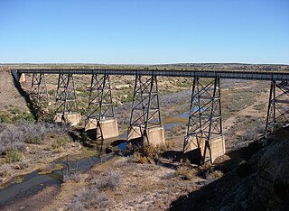
The Canadian River is the longest tributary of the Arkansas River in the United States. It is about 1,026 miles (1,651 km) long, starting in Colorado and traveling through New Mexico, the Texas Panhandle, and Oklahoma. The drainage area is about 47,700 square miles (124,000 km2).

The Santa Fe Trail was a 19th-century route through central North America that connected Franklin, Missouri, with Santa Fe, New Mexico. Pioneered in 1821 by William Becknell, who departed from the Boonslick region along the Missouri River, the trail served as a vital commercial highway until 1880, when the railroad arrived in Santa Fe. Santa Fe was near the end of El Camino Real de Tierra Adentro which carried trade from Mexico City. The trail was later incorporated into parts of the National Old Trails Road and U.S. Route 66.
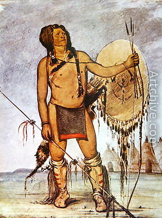
Comanche history is the story of the Native American (Indian) tribe which lived on the Great Plains of the present-day United States. In the 17th century the Eastern Shoshone people who became known as the Comanche migrated southward from Wyoming. In the 18th and 19th centuries the Comanche became the dominant tribe on the southern Great Plains. The Comanche are often characterized as "Lords of the Plains." They presided over a large area called Comancheria which they shared with allied tribes, the Kiowa, Kiowa-Apache, Wichita, and after 1840 the southern Cheyenne and Arapaho. Comanche power and their substantial wealth depended on horses, trading, and raiding. Adroit diplomacy was also a factor in maintaining their dominance and fending off enemies for more than a century. They subsisted on the bison herds of the Plains which they hunted for food and skins.

The Villasur expedition of 1720 was a Spanish military expedition intended to check New France's growing influence on the North American Great Plains, led by Lieutenant-General Pedro de Villasur. Pawnee and Otoe Indians attacked the expedition in Nebraska, killing 36 of the 40 Spaniards, 10 of their Indian allies, and a French guide. The survivors retreated to their base in New Mexico.

Dohäsan, Dohosan, Tauhawsin, Tohausen, or Touhason was a prominent Native American. He was War Chief of the Kata or Arikara band of the Kiowa Indians, and then Principal Chief of the entire Kiowa Tribe, a position he held for an extraordinary 33 years. He is best remembered as the last undisputed Principal Chief of the Kiowa people before the Reservation Era, and the battlefield leader of the Plains Tribes in the largest battle ever fought between the Plains tribes and the United States.
In the history of the American frontier, pioneers built overland trails throughout the 19th century, especially between 1829 and 1870, as an alternative to sea and railroad transport. These immigrants began to settle much of North America west of the Great Plains as part of the mass overland migrations of the mid-19th century. Settlers emigrating from the eastern United States did so with various motives, among them religious persecution and economic incentives, to move from their homes to destinations further west via routes such as the Oregon, California, and Mormon Trails. After the end of the Mexican–American War in 1849, vast new American conquests again encouraged mass immigration. Legislation like the Donation Land Claim Act and significant events like the California Gold Rush further encouraged settlers to travel overland to the west.
Claude Charles du Tisné led the first official French expedition to visit the Osage and the Wichita Indians in 1719 in what became known as Kansas in the present-day United States.
Antonio Valverde y Cosío was the architect behind the disastrous Villasur expedition wherein the famous Spanish colonial scout José Naranjo perished.
The Glenn–Fowler expedition to Santa Fe, New Mexico was led by Hugh Glenn and Jacob Fowler to see whether trade with the Spanish in the region would be feasible. The expedition was made up of 21 men. They left their establishment on the Verdigris River in present-day Oklahoma on September 25, 1821, and arrived in Santa Fe in January 1822, and found that the Spanish authority in the region had been ended by the Mexican War of Independence.

Tomás Vélez Cachupín was a colonial judge, and the Spanish colonial governor of Santa Fe de Nuevo México province, located in the northern Viceroyalty of New Spain, from 1749 to 1754 and 1762 to 1767. During his rule, Cachupín achieved the peace between Spaniards and the Amerindian peoples of New Mexico, especially the Comanches. He also protected the right to the possession of lands by the people of New Mexico, including the Amerindians, fining and imprisoning those who occupied the lands of others under the idea that these lands were property of their inhabitants.

The early history of the Arkansas Valley in Colorado began in the 1600s and to the early 1800s when explorers, hunters, trappers, and traders of European descent came to the region. Prior to that, Colorado was home to prehistoric people, including Paleo-Indians, Ancestral Puebloans, and Late prehistoric Native Americans.
The Dismal River culture refers to a set of cultural attributes first seen in the Dismal River area of Nebraska in the 1930s by archaeologists William Duncan Strong, Waldo Rudolph Wedel and A. T. Hill. Also known as Dismal River aspect and Dismal River complex, dated between 1650 and 1750 A.D., is different from other prehistoric Central Plains and Woodland traditions of the western Plains. The Dismal River people are believed to have spoken an Athabascan language and to have been part of the people later known to Europeans as the Apache.

French people have been present in the U.S. state of Nebraska since before it achieved statehood in 1867. The area was originally claimed by France in 1682 as part of La Louisiane, the extent of which was largely defined by the watershed of the Mississippi River and its tributaries. Over the following centuries, explorers of French ethnicity, many of them French-Canadian, trapped, hunted, and established settlements and trading posts across much of the northern Great Plains, including the territory that would eventually become Nebraska, even in the period after France formally ceded its North American claims to Spain. During the 19th century, fur trading gave way to settlements and farming across the state, and French colonists and French-American migrants continued to operate businesses and build towns in Nebraska. Many of their descendants continue to live in the state.
The Vérendrye brothers were the first Europeans to cross the northern Great Plains and see the Rocky Mountains, during an expedition in 1742–1743. What little is known about their journey comes from a journal found in the French archives in 1851 and an inscribed lead plate commemorating the journey which was found buried near Pierre, South Dakota in 1913. Both the journal and plate are difficult to interpret. The journal states the trip may have been made by the "Chevalier Vérendrye and one of his brothers", who are otherwise unidentified. Most likely the Chevalier was Louis-Joseph Gaultier de La Vérendrye and the brother was François de La Vérendrye, but this remains uncertain. The mountains they saw during the expedition may have been the Big Horn Mountains of Wyoming, but could also have been the Black Hills or the Laramie Mountains.
A Spanish military fort was constructed and occupied in 1819 near Sangre de Cristo Pass in the present U.S. State of Colorado to protect the Spanish colony of Santa Fe de Nuevo México from a possible invasion from the United States. The fort was the only Spanish settlement in present-day Colorado. The site of this fort is known today as the Spanish Fort.
The history of Cleveland County, Oklahoma refers to the history of a county in the U.S. state of Oklahoma, and the land on which it developed prior to 1907 statehood. Prior to European colonization, the land represented the edge of the domain of the Plains Indians. France and Spain both colonized and explored the area before it became part of the United States via the Louisiana Purchase. It became part of the territory of the United States and tribal land and eventually part of the U.S. state of Oklahoma.
Pedro Vial, or Pierre Vial, was a French explorer and frontiersman who lived among the Comanche and Wichita Indians for many years. He later worked for the Spanish government as a peacemaker, guide, and interpreter. He blazed trails across the Great Plains to connect the Spanish and French settlements in Texas, New Mexico, Missouri, and Louisiana. He led three Spanish expeditions that attempted unsuccessfully to intercept and halt the Lewis and Clark Expedition.

Bent's New Fort was a historic fort and trading post along the banks of the Arkansas River in what is now Bent County, Colorado, about nine miles west of Lamar, on the Mountain Route branch of the Santa Fe Trail. William Bent operated a trading post with limited success at the site and in 1860 leased the fort to the United States government, which operated it as a military outpost until 1867. In 1862, it was named Fort Lyon. The fort was abandoned after a flood of the Arkansas River in 1867.
Alexander Barclay was an American frontiersman. After working in St. Louis as a bookkeeper and clerk, he worked at Bent's Old Fort. He then ventured westward where he was a trapper, hunter, and trader. Barclay entered into a common-law relationship with Teresita Sandoval, one of the founders of the settlement and trading post El Pueblo. He helped settle Hardscrabble, Colorado and built Fort Barclay in New Mexico.
James Purcell, also known by Zebulon Pike as James Pursley, was a hunter, trapper, and trader in the Louisiana Territory beginning in 1802. He traded with Native Americans in what is now Colorado and New Mexico until 1805 when he went to Santa Fe. Purcell was then a carpenter there until 1824.
References
- ↑ “Mallet Brothers.” Encyclopedia of the Great Plains. http://plainshumanities.unl.edu/encyclopedia/doc/egp.ea.026, accessed 1 Dec 2011
- ↑ “Extract of the Journal of the Expedition of the Mallet Brothers to Santa Fe, 1739-1740.” www.americanjourneys.org/aj-092/summary/index.asp, accessed 1 Dec 2011
- ↑ Blaine, Martha Royce. “French Efforts to Reach Santa Fe: Andre Fabry do la Bruyere’s Voyage up the Canadian River in 1741-1742.” Louisiana History: The Journal of the Louisiana Historical Association. Vol. 20, No. 2, Spring 1979, pp. 133-157
- ↑ “Mallet Brothers.” Encyclopedia of the Great Plains. http://plainshumanities.unl.edu/encyclopedia/doc/egp.ea.026, accessed 1 Dec 2011
- ↑ Blaine, p. 156
- ↑ Blaine, p. 156
- ↑ ”Mallet, Paul” The Handbook of Texas Online. www.tshaonline.org/handbook/online/articles/upm01, accessed 1 Dec 2011
- ↑ “Mallet Brothers.” Encyclopedia of the Great Plains. http://plainshumanities.unl.edu/encyclopedia/doc/egp.ea.026, accessed 1 Dec 2011