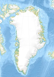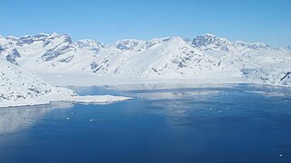
Kaiser Franz Joseph Fjord is a major fjord system in the NE Greenland National Park area, East Greenland.

Foster Bay is a large bay of the Greenland Sea in King Christian X Land, Eastern Greenland. Administratively it belongs to the NE Greenland National Park area.

Søren Norby Islands, named after Søren Norby, is an uninhabited archipelago close to the shores of Eastern Greenland. Administratively it is part of the Sermersooq municipality.

Myggbukta, meaning "Mosquito Bay" in Norwegian, was a Norwegian whaling, meteorological and radio station located on the coast of Eastern Greenland in present-day King Christian X Land.

Crown Prince Christian Land is a large peninsula in northern Greenland. It is a part of King Frederick VIII Land and administratively it belongs to the Northeast Greenland National Park.

Upernattivik – also known as Upernarsuak – is an uninhabited island in King Frederick VI Coast, southeastern Greenland. Administratively it is part of the Sermersooq municipality.

Bernstorff Fjord is a fjord in King Frederick VI Coast, eastern Greenland.

Cape Nansen is a headland in the Greenland Sea, east Greenland, Sermersooq municipality. This cape is named after Fridtjof Nansen. Cape Nansen is an important geographical landmark.

Sermilik is a fjord in eastern Greenland. It is part of the Sermersooq municipality.

Umivik Bay, also known as Umiivik and Umerik, is a bay in King Frederick VI Coast, southeastern Greenland. It is part of the Sermersooq municipality.

Nanuuseq, also known as Nanûseq or Nanusek is an uninhabited island in the Kujalleq municipality in southern Greenland.

Lindenow Fjord or Kangerlussuatsiaq, is a fjord in the King Frederick VI Coast, Kujalleq municipality, southern Greenland.

King Frederick VI Coast is a major geographic division of Greenland. It comprises the coastal area of Southeastern Greenland in Sermersooq and Kujalleq municipalities fronting the Irminger Sea of the North Atlantic Ocean. It is bordered by King Christian IX Land on the north and the Greenland Ice Sheet to the west.

Dannebrog Island is an uninhabited island of the King Christian IX Land coast, Sermersooq municipality, southern Greenland.

Ingolf Fjord, also known as Ingolf Sound, is a fjord of Greenland's northeastern coast in northern King Frederick VIII Land.

Griffenfeld Island, Griffenfeldt Island, or Umanaq, after the name of the highest peak. is an uninhabited island in the Sermersooq municipality in southern Greenland.

Igtip Kangertiva, also known as Comanche Bay. is a fjord in Eastern Greenland. It is part of the Sermersooq municipality.

Dusen Fjord or Dusén Fjord is a fjord in the NE Greenland National Park area, East Greenland.

Jens Munk Island, uninhabited coastal island in eastern Greenland in the Sermersooq municipality. It is named after the Dano-Norwegian navigator and explorer Jens Munk. The island is the largest in the Søren Norby Islands archipelago.

Fridtjof Nansen Peninsula is a peninsula in the King Frederick VI Coast, southeastern Greenland. It is a part of the Sermersooq municipality.


