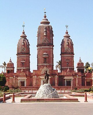
Ghaziabad is a city in the Indian state of Uttar Pradesh and a part of Delhi NCR. It is the administrative headquarters of Ghaziabad district and is the largest city in western Uttar Pradesh, with a population of 1,729,000. Ghaziabad Municipal Corporation is divided into 5 zones - City Zone, Kavi Nagar Zone, Vijay Nagar Zone, Mohan Nagar Zone and Vasundhara Zone. The Municipal Corporation comprises 100 wards. Well connected by roads and railways, it is a major rail junction for North India. It is part of the Meerut Division of Uttar Pradesh.

The National Capital Region (NCR) is a planning region centred upon the National Capital Territory (NCT) of Delhi in India. It encompasses Delhi and several districts surrounding it from the states of Haryana, Uttar Pradesh and Rajasthan. The NCR and the associated National Capital Region Planning Board (NCRPB) were created in 1985 to plan the development of the region and to evolve harmonized policies for the control of land-uses and development of infrastructure in the region. Prominent cities of NCR include Delhi, Faridabad, Ghaziabad, Gurugram, Noida and Meerut.

Bagpat district, also spelled as Baghpat district, is one of the 75 districts of the Indian state of Uttar Pradesh, with headquarters at the town of Baghpat. It is within the National Capital Region. Created in 1997, the district has an area of 1,321 square kilometres (510 sq mi). Bhagpat has a population of 1,303,048 as of 2011 census.

Modinagar is a town and a municipal board in Ghaziabad district in the Indian state of Uttar Pradesh. It's just 24 km from Ghaziabad city, 48 km from New Delhi. It is a part of National Capital Region.

Ghaziabad district is a largely suburban district of Uttar Pradesh state in northern India. It is also a core part of the National Capital Region. The city of Ghaziabad is the administrative headquarters of the district. This district is part of Meerut Division. It has become a major bedroom community for Delhi.
Begumabad Budhana is a census town in Ghaziabad district in the state of Uttar Pradesh, India.
Behta Hajipur is a census town in the Loni block of Ghaziabad district in the Indian state of Uttar Pradesh. It is a part of the National Capital Region (NCR). At one end (southwest), the town's boundary terminates at National Highway 709B, which connects Delhi to Saharanpur, and at the other end (northeast), the boundary ends at Loni-Ghaziabad Road. It also share its territories with the neighboring census town, Mandoli.
Bisokhar is a census town in Ghaziabad district in the state of Uttar Pradesh, India. Bisokhar is a village in District Ghaziabad in state of Uttar Pradesh, India. Geographically it is located on Delhi - Meerut Highway in the town of Modinagar which is an Industrial town of western UP. More than half land belonging to the village is in modinagar while other is still used as agriculture land. Modinagar railway station is 3 km away. It has an elected village panchayat. People living here belong to primarily Religion Hindu and Muslim.

Dadri is a town and a municipal board in Gautam Buddha Nagar District in the state of Uttar Pradesh, India. Noida, Dadri and Jewar are the 3 sub-divisions of GB Nagar district, each headed by a SDM.
Dasna is a town, near Ghaziabad city and a nagar panchayat in Ghaziabad district in the state of Uttar Pradesh, India.
Dharoti Khurd is a census town in Ghaziabad district in the state of Uttar Pradesh, India.Khurd and Kalan Persian language word which means small and Big respectively when two villages have same name then it is distinguished as Kalan means Big and Khurd means Small with Village Name.

Garhmukteshwar is a town, just outside of Hapur city, and tehsil in Hapur district of Uttar Pradesh, India. According to Census 2011 information the sub-district code of Garhmukteshwar block is 00741. Total area of Garhmukteshwar is 272 km2 including 237.38 km2 rural area and 34.13 km2 urban area. Garhmukteshwar has a population of 46,077. There are 64,688 houses in the sub-district. There are about 137 villages in Garhmukteshwar block.
Muradnagar is a city and a municipal board in Ghaziabad district, Uttar Pradesh, India. It lies about 22 km (14 mi) from Ghaziabad, the district headquarters, and 55 km (34 mi) from Delhi.

North East Delhi is one of the eleven administrative district of Delhi, India. The district was established in 1997. North East Delhi borders the Yamuna River on the west, Ghaziabad District to the north and east, East Delhi to the south, and North Delhi to the west across the Yamuna. Karawal Nagar, Seelampur and Yamuna Vihar are 3 sub-divisions of this district.
Loni is a town, near Ghaziabad city in Ghaziabad district in the state of Uttar Pradesh, India and Loni town is governed by Loni Municipal Council which comes under Ghaziabad Metropolitan Region.
Niwari is a town, near city of Ghaziabad in Ghaziabad district in the Indian state of Uttar Pradesh.

Sambhal district is a district of Uttar Pradesh state in India. The district headquarter is Bahjoi town. 993 Villages and 16 Police stations fall under Sambhal district.

Hapur district is a recently formed district in the Indian state of Uttar Pradesh with a population of 1,338,211 at the 2011 Census. It arose as an area leading in the trade of grains and jaggery. This district on the Ganges river is 60 kilometres (37 mi) from New Delhi. Being located on the river could be a reason for its prosperity in trade.It is the smallest district of Uttar Pradesh.


