
Cassiar is a ghost town in British Columbia, Canada. It was a small company-owned asbestos mining town located in the Cassiar Mountains of Northern British Columbia north of Dease Lake. After forty years of operation, starting in 1952, the mine was unexpectedly forced to close in 1992. The closure was driven by a combination of factors including diminished demand for asbestos and expensive complications faced after converting from an open-pit mine to an underground mine. Most of the contents of the town, including a few houses, were sold off and trucked away. Most of the remaining dwellings were bull-dozed and burned to the ground. The mill was briefly reactivated in 1999 by Cassiar Chrysotile Inc which had a reclamation permit to clean up the site. 11,000 tons of asbestos were exported before the mill burned down on Christmas Day of 2000, effectively halting all production. Today the streets are bare and flowers bloom where the houses once stood. Residents living between the townsite and the Stewart-Cassiar Highway, and on the highway itself, who originally obtained phone service from the Cassiar exchange, were moved to the nearby Good Hope Lake exchange in fall 2006 and the Cassiar exchange shut down.
The Nakusp and Slocan Railway (N&S) is a historic Canadian railway that operated in southeastern British Columbia.

The Quesnel River is a major tributary of the Fraser River in the Cariboo District of central British Columbia. It begins at the outflow of Quesnel Lake, at the town of Likely and flows for about 100 kilometres (60 mi) northwest to its confluence with the Fraser at the city of Quesnel.
Sandon is a ghost town in the Kootenay region of British Columbia, Canada. Once the unofficial capital of the mining region known as the "Silvery Slocan", only some of it remains standing.
Gold Bridge is an unincorporated community in the Bridge River Country of British Columbia, Canada. Although numbering only around 40 inhabitants, Gold Bridge is the service and supply centre for the upper basin of the Bridge River Valley, which includes recreation-residential areas at the Gun Lakes, Tyaughton Lake, Marshall Creek, and Bralorne; and the nearby ghost towns of Brexton and Pioneer Mine.
Robert Allan Brown was a well-known and flamboyant prospector and speculator in 19th and early 20th Century in the Canadian province of British Columbia. He was known generally as Volcanic Brown, especially in the province's Kootenay and Boundary districts and in adjoining Eastern Washington, and also as Sunset Brown in the Similkameen District and still also to others as Crazy Brown. His enthusiastic nature contributed to his nickname, and as result of that and his flamboyant personality he was a fixture in mining industry news in a wide region which spanned the British Columbia-United States border.

Ainsworth or Ainsworth Hot Springs is a historic village on Kootenay Lake in British Columbia, Canada and has a population of 20.

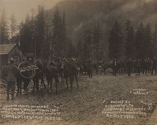
Moyie is an unincorporated community in the East Kootenay region of British Columbia, Canada. It is located on Highway 3, 19 miles (30 km) south of Cranbrook on the eastern shore of Moyie Lake.

Phoenix is a ghost town in the Boundary Country of British Columbia, Canada, 11 km east of Greenwood. Once called the “highest city in Canada” by its citizens it was a booming copper mining community from the late 1890s until 1919. In its heyday it was home to 1,000 citizens and had an opera house, twenty hotels, a brewery and its own city hall. Phoenix’s magistrate, Judge Willie Williams, who served there from 1897 until 1913, became famous for his booming declaration, “I am the highest judge, in the highest court, in the highest city in Canada.” In 1911, Phoenix’s hockey team won the provincial championship and asked for the right to compete for the Stanley Cup, but it was too late to qualify. The Granby Consolidated Mining, Smelting and Power Company operated the Phoenix Mine, a copper mine that produced 13,678,901 tons of ore before operations ceased on June 14, 1919.
Lardeau, originally spelled Lardo, is an unincorporated community and former mining town near the north end of Kootenay Lake in the West Kootenay region of southeastern British Columbia, Canada. The centre of a district known as the Lardeau mines, and as the Lardeau Country, Lardeau once had ambitions of becoming much larger, like Trout Lake City nearby on the lake of the same name, which forms a pass through to Galena Bay on Upper Arrow Lake, through which planned railways were to have turned Trout Lake and Lardeau into the great cities they were dreamed of becoming. Lardeau today is a mixed farming and logging community.
The Cadwallader Range, originally named the Cadwallader Mountains, is a sub-range of the Pacific Ranges of the Coast Mountains in the Bridge River-Lillooet Country of the South-Central Interior of British Columbia, Canada, located between the south end of Anderson Lake (E) and the Hurley River. According to the provincial basemap, the precise alpine boundaries of the range are McGilliray Pass, at its eastern extremity and beyond which is the Bendor Range, and the pass between Noel and Sockeye Creeks on its west, which is immediately north of the lower end of Birkenhead Lake. The officially unnamed range west of that has been called the Noel Range, after its main peak Mount Noel. At the foot of the range along its northeast flank is Cadwallader Creek, scene of the historic and once-rich Bralorne and Pioneer Mines and the ghost town of Bralorne.
Comaplix is the name of former mining town on the Incomappleux River in the northern Arrow Lakes region of British Columbia's Kootenay Country in Canada. The name of the town and an adjacent mountain and creek are derived from that of the river, which is an Okanagan word meaning "point at the head of the lake". The location, now flooded, is on the northeast side of Beaton Arm of Upper Arrow Lake, near the sites of Beaton and Camborne.
Camborne is a locality and former galena-mining town on the east side of the Incomappleux River, northeast of the head of Beaton Arm of Upper Arrow Lake in the Kootenay Country region of British Columbia.
Carmi is a ghost town in the Boundary Country region of British Columbia, Canada.The town is located on the west side of West Kettle River, east of Penticton, on Hwy 33. Carmi emerged as a silver mining camp just after the turn of the 20th century, named after the nearby mine. The mine in turn was named after the home town of James Dale, Carmi, Illinois.
Nashwito Creek is located in the Okanagan region of British Columbia. The creek flows into Okanagan Lake from the west. Nashwito Creek is located a few miles south of Vernon, British Columbia. The creek is also called Siwash Creek which should not be confused with Siwash Creek near Princeton, British Columbia. Nashwito Creek has been mined for gold.
Brexton, formerly known as Fish Lake, is a ghost town located in the Bridge River Country region of British Columbia. Although the provincial Gazetteer still lists the "settlement" of Brexton, which was situated between the southeast end of Gun Lake and Gold Bridge, and three and a half miles north of Bralorne, this once busy town has mostly vanished though a few buildings remain. The old town site now sits mainly on private property.
Walter Edwin Gilbert was a Canadian bush pilot and one of the founders of Pacific Western Airlines.


